

[Map of the Monterey Peninsula.]
A lovely example of Jo Mora's Del Monte Properties Company' California's Fun' playground tourist map of the Monterey Peninsular, published in San Francisco in 1927. The rare first state and among the rarest maps by Jo Mora.A lively map full of interesting, fun illustrations of the region. The map borders are surrounded by many small illustrations of modern and historical Monterey. These include animals, historical figures, native Indians, missionaries, cowboys, singing & dancing, the 'gold rush'...
€900
Maker : ROBERTSON, A.M.
Place : San Francisco
Date : 1927
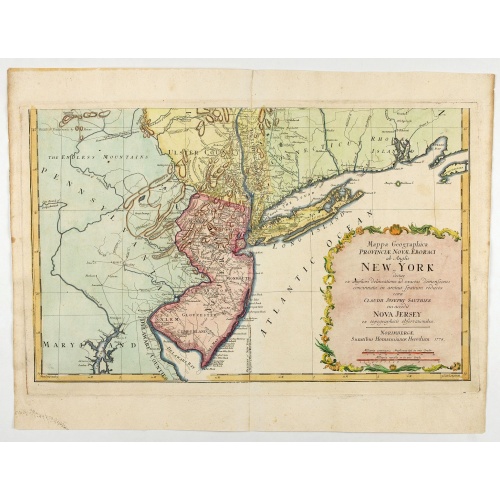
Mappa geographica Provinciæ Nova Eboraci ab Anglis New-York . . .
Lower part of the two sheets map of Homann Heirs' edition of Sauthier's celebrated map of New York and New Jersey, made during the Revolutionary War. Appears in Homann's Atlas geographicvs maior. 1759-[1784].
€750
Maker : HOMANN HEIRS.
Place : Nuremburg
Date : 1778
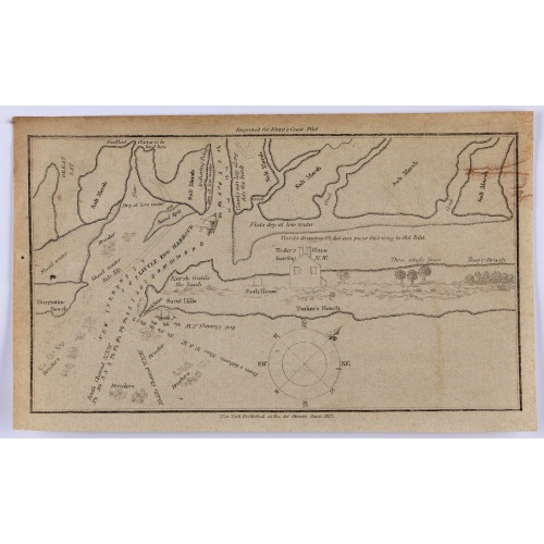
Little Egg Harbour.
A small sea chart showing Little Egg Harbour east of Tucker's Island. This map was published in the “American Coast Pilot”, a detailed guide to harbors, capes and headlands on the east coasts of North and South America. It includes information on winds, currents, tides as well as latitudes and longitudes. The American Coast Pilot was published between 1796 and 1861, until it was replaced by the US Coast Survey.Edmund March Blunt (1770–1862) was an American navigator, author, and publisher ...
$50
Maker : BLUNT, E.
Place : New York, 1817
Date : 1817
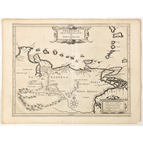
Venezuela, atque Occidentalis Pars Novæ Andalusiae.
Coastline of Venezuela with little interior development. Including Aruba, Bonaire, Curaçao, etc. Scarce map prepared by Hessel Gerritsz (1581-1632), former apprentice of Willem Blaeu, and Blaeu’s predecessor as chief cartographer of the Dutch East India Company. Gerritsz enjoys a very high reputation for his critical approach towards his sources.Most of Gerritsz’ work exists only in manuscript, and these maps published by de Laet, are among the only printed Gerritsz maps available to the co...
$600
Maker : LAET, DE J. / GERITSZ, H.
Place : Leiden, Elzevier
Date : 1630
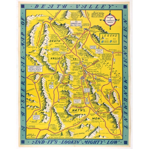
A Hysterical Map Of Death Valley National Monument -- And It's Looking Mighty Low
First edition Humorous map of Death Valley. "Drawn In Broken English by Jolly Lindgren," this comic pictorial map is full of puns and comic vignettes related to Death Valley. The Lindgren Brothers issued a number of other silly whimsical maps of national parks and other parts of the West.
$500
Maker : LINDGREN, J.
Place : Spokane, Wash., Lindgren Brothers,
Date : 1948
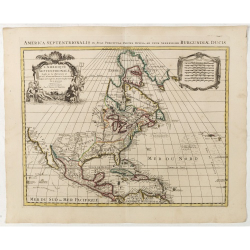
L'Amerique septentrionale, Dressée sur les memoires les plus recens. . .
A very detailed map extending from Hudsons Bay to Panama, and including the West Indies. The map is a later copy of Guillaume de L'Isle's foundation map of North America, originally prepared in 1700.The de L'Isle was one of the earliest maps to restore the peninsula form for California, and has a much improved outline for the Great Lakes and Mississippi valley.The map shows select towns and cities, forts, Indian villages and tribal territory and relief.
$900
Maker : COVENS, J. / MORTIER, C.
Place : Amsterdam
Date : 1739
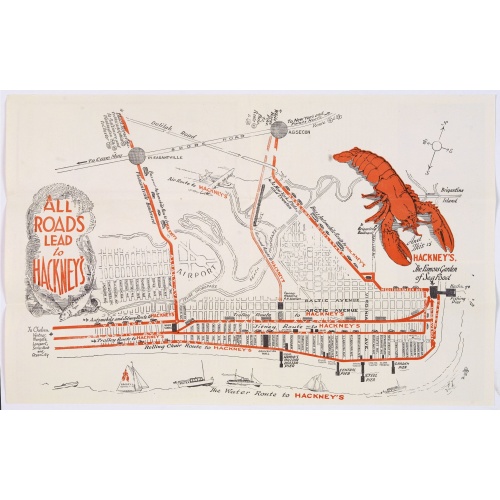
Map of Atlantic City to Hackney's Famous Garden of Sea Food . . .
A mid 1950s brochure for the famous Atlantic City Seafood Restaurant - 'Hackneys'. One side proclaims that "All Roads lead to Hackney's". It shows a nice plan of Atlantic City in NJ. Highlighted in red are the famous Boardwalk, Pacific, Atlantic, Albany and Mediterranean Avenues plus Absecon Boulevard, and all roads that lead off them.Other major thoroughfares and roads are shown, together with the Airport and bus and car route. Famous piers are in bold, plus there are small illustrations of sea...
€50
Maker : ANONYMOUS.
Place : New Jersey
Date : 1954

[Murder of Dominican monks in Cumana or Cubagua Island].
Murder of Dominican monks in Cumana or Cubagua Island in what is now Venezuela. Scarce print (150x177mm.) on a German text sheet taken from a first edition of Johann Ludwig Gottfried's "Newe Welt Vnd Americanische Historien/ Jnhaltende Warhafftige vnd volkommene Beschreibungen Aller West-Indianischen Landschafften…" published by M.Merian in 1631.
$80
Maker : GOTTFRIED, J.L. / DE BRY, T.
Place : Frankfurt, M.Merian
Date : 1633
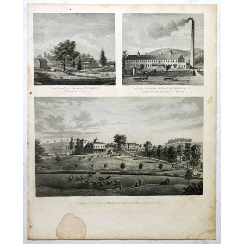
Mount Vernon Valley Residence of S.J. Powers / Borden condensed milk factory brewsters N.Y / Residence of Dan D. Chamberlain South East Putman Co. N.Y.
Three heliographic prints on one sheet : "Mount Vernon Valley Residence of S.J. Powers (135 x 155mm.) / Borden condensed milk factory brewsters N.Y (135 x 155mm.) / Residence of Dan D. Chamberlain South East Putman Co. N.Y. (190 x 155mm.) " after design by R.K.Sneden.From Beer's famous county atlas "Atlas of New York and vicinity", "a documentary record of nineteenth century life and delightful specimens of American folk art". F. W. Beers, along with other members of his family, were among the l...
$90
Maker : DE BEERS, F.W.
Place : New York
Date : 1867
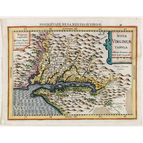
Virginiae item et Floridae . . .
Map of Virginia from the rare Cloppenburg edition slightly larger format and more scarce edition of the Mercator/Hondius "Atlas Minor". Engraved by Pieter Van Den Keere.The Cloppenburg edition "Atlas Sive Cosmographicae Meditationes De Fabrica Mundi Et Fabricati Figura", was continued for a couple of years but seems to have been suppressed after 1636 ... (Koeman Atlantes Neerlandici).Based on the 1595 Abraham Ortelius map, but with added decoration.
€750
Maker : MERCATOR, G. / CLOPPENBURGH, J.E.
Place : Amsterdam
Date : 1630
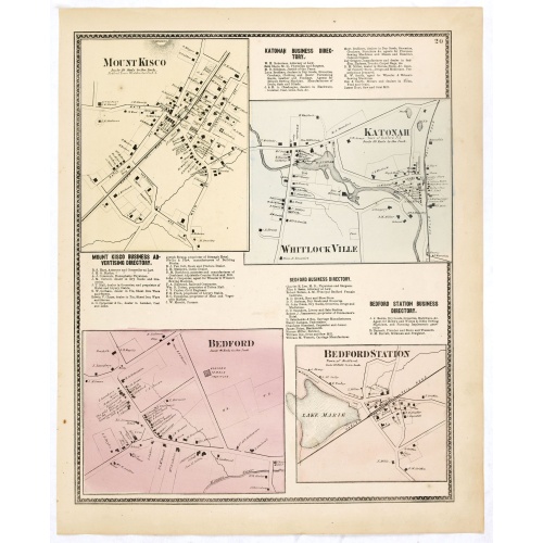
Mount Kisco / Bedford / Katonah / Bedford Station.
Fine lithographed map of Mount Kisco / Bedford / Katonah / Bedford Station. The map provides the names of specific homeowners, as well as information about the occupations and physical locations of the various tradesmen in each village from Beer's famous county atlas "Atlas of New York and vicinity, a documentary record of nineteenth-century life and delightful specimens of American folk art." F. W. Beers, along with other members of his family, were among the leading county atlas publishers in ...
$90
Maker : DE BEERS, F.W.
Place : New York
Date : 1867
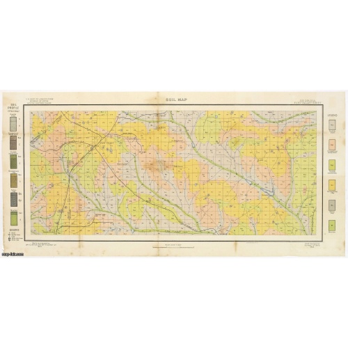
Soil map - Georgia, Fort Valley sheet.
Early color lithographed soil map by Julius Bien & Co. in New York for Department of Agriculture. Legends at side give detail on soil type, etc. They also include interesting details of the cities, roads, railroads, rivers, canals, etc. Scale of 1" = 1 mile. The map is giving great detail of the area in the year 1903. Soils are surveyed by Wm. G. Smith and Wm. T. Carter Jr. in the same year. To the left and right color keys to the different types of soil.Upper left: U.S.Department of Agricult...
$50
Maker : U.S. DEPT. OF ARGICULTURE
Place : New York, 1903
Date : 1903
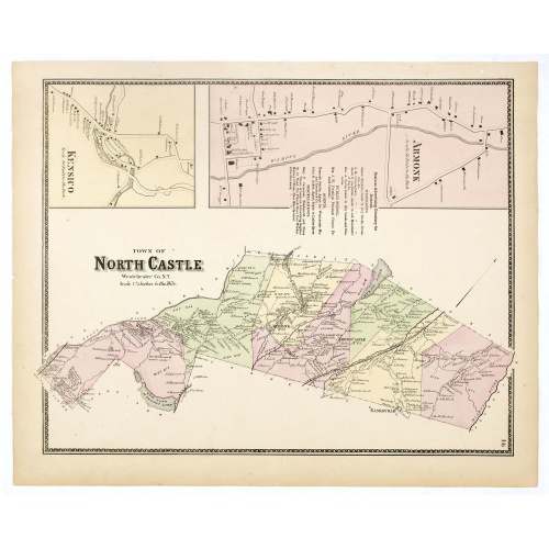
Town of North Castle.
Fine lithographed map of the town of North Castle. The map provides the names of specific homeowners, as well as information about the occupations and physical locations of the various tradesmen in each village from Beer's famous county atlas "Atlas of New York and vicinity, a documentary record of nineteenth-century life and delightful specimens of American folk art." F. W. Beers, along with other members of his family, were among the leading county atlas publishers in the period immediately fo...
$90
Maker : DE BEERS, F.W.
Place : New York
Date : 1867
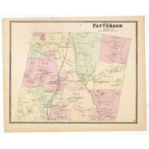
Town of Patterson.
Fine lithographed map of the town of Patterson. From : "Atlas of New York and vicinity" published by Beers, Ellis & Soule, 95 Maiden Lane, New York.The map provides the names of specific homeowners, as well as information about the occupations and physical locations of the various tradesmen in each village from Beer's famous county atlas "Atlas of New York and vicinity," "a documentary record of nineteenth-century life and delightful specimens of American folk art." F. W. Beers, along with othe...
€90
Maker : DE BEERS, F.W.
Place : New York
Date : 1867
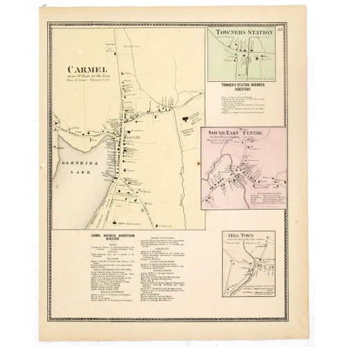
Town of Carmel / Towners Station / South East Centre / Mill Town.
Fine lithographed map of the town of Carmel / Towners Station / South East Centre / Mill Town. From "Atlas of New York and vicinity" published by Beers, Ellis & Soule, 95 Maiden Lane, New York.The map provides the names of specific homeowners, as well as information about the occupations and physical locations of the various tradesmen in each village from Beer's famous county atlas "Atlas of New York and vicinity," "a documentary record of nineteenth-century life and delightful specimens of Ame...
€80
Maker : DE BEERS, F. W.
Place : New York
Date : 1867
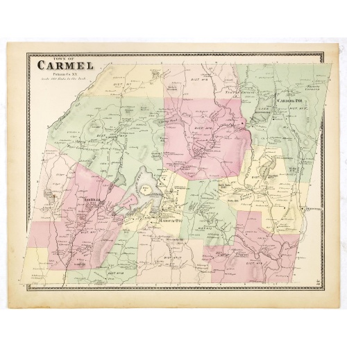
Town of Carmel.
Fine lithographed map of the town of Carmel. From : "Atlas of New York and vicinity" published by Beers, Ellis & Soule, 95 Maiden Lane, New York. The map provides the names of specific homeowners, as well as information about the occupations and physical locations of the various tradesmen in each village from Beer's famous county atlas "Atlas of New York and vicinity," "a documentary record of nineteenth-century life and delightful specimens of American folk art." F. W. Beers, along with other ...
€80
Maker : DE BEERS, F.W.
Place : New York
Date : 1867
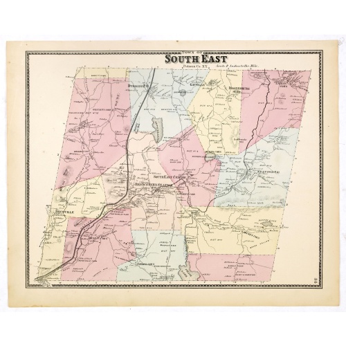
Town of South East.
Fine lithographed map of the town of South East. From : "Atlas of New York and vicinity" published by Beers, Ellis & Soule, 95 Maiden Lane, New York.The map provides the names of specific homeowners, as well as information about the occupations and physical locations of the various tradesmen in each village from Beer's famous county atlas "Atlas of New York and vicinity, a documentary record of nineteenth-century life and delightful specimens of American folk art."F. W. Beers, along with other m...
€90
Maker : DE BEERS, F.W.
Place : New York, 1867
Date : 1867
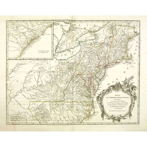
Partie De L'Amerique Septentrionale... Le Cours De L'Ohio, La N.lle Angleterre, a Nlle York, le New Jersey , La Pensyvanie, Le Maryland, Le Virginie, La Carolina...1755
From the Atlas Universel , a detailed map extending the length of the east coast from Penobscot Bay to Cape Fear and, in an inset, from Cape Fear to Fort St.Georges.This state with a dotted border of Treaty of Paris, 1763, with Virginie and Caroline Sept. Et Merid. Extended west to Mississippi. New-Hemp-Shire" and Prov. De Sagadahock" now added.The Atlas Universel of Gilles and Didier Robert de Vaugondy was first published in 1755. The maps were detailed, precisely engraved and not given to the ...
€800
Maker : DE VAUGONDY, R. de
Place : Paris
Date : 1768
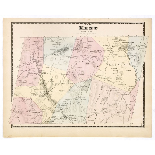
Town of Kent.
Fine lithographed map of the town of Kent. From :"Atlas of New York and vicinity" published by Beers, Ellis & Soule, 95 Maiden Lane, New York.The map provides the names of specific homeowners, as well as information about the occupations and physical locations of the various tradesmen in each village from Beer's famous county atlas "Atlas of New York and vicinity", a documentary record of nineteenth-century life and delightful specimens of American folk art.F. W. Beers, along with other members ...
€90
Maker : DE BEERS, F. W.
Place : New York
Date : 1867
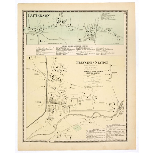
Town of Patterson / Brewsters Station.
Fine lithographed map of the town of Patterson / Brewsters Station. From : "Atlas of New York and vicinity" published by Beers, Ellis & Soule, 95 Maiden Lane, New York. The map provides the names of specific homeowners, as well as information about the occupations and physical locations of the various tradesmen in each village from Beer's famous county atlas "Atlas of New York and vicinity, a documentary record of nineteenth-century life and delightful specimens of American folk art." F. W. Beer...
€80
Maker : DE BEERS, F. W.
Place : New York
Date : 1867