

Belchrijuinghe vande zee custen van Engelandt. . .
A rare Dutch text edition of this detailed early chart of the northern coast of England. West to the top. The mileage cartouche has no Latin captures. Decorated by a colorful title cartouche and scale cartouche, one compass rose, and several vessels. An early Dutch text edition of this landmark contribution to the science of navigation. Waghenaer's own experiences as a pilot along European coasts were used to compile the Spiegel der Zeevaerdt, the first edition of which was published in Dutch at...
$3.000
Maker : WAGHENAER, L. J.
Place : Leiden, Plantijn
Date : 1585
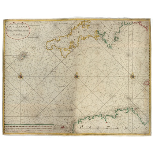
Nieuwe Paskaart van het Westerlykste Gedeelte van HET KANAAL strekkende aan de ENGELSCHE KUST van Poortland tot de Sorlinges. . .
Nieuwe Paskaart van het Westerlykste Gedeelte van HET KANAAL strekkende aan de ENGELSCHE KUST van Poortland tot de Sorlinges en aan de Fransche kust van het Eylandt Guernsey tot Heysandt. Ioannes van Keulen A RARE and decorative chart of the Channel between England and France. Decorated with a fine title cartouche: Nieuwe Paskaart van het Westerlykste Gedeelte van HET KANAAL strekkende aan de ENGELSCHE KUST van Poortland tot de Sorlinges en aan de Fransche Kust van het Eylandt Guernsey tot He...
€900
Maker : VAN KEULEN, J.
Place : Amsterdam
Date : 1760
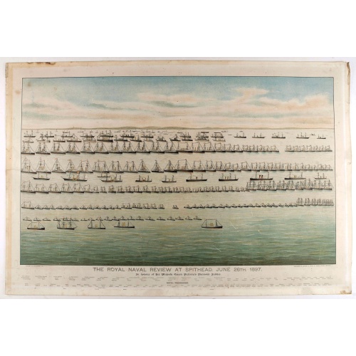
The Royal Naval review at Spithead, June 26th, 1897. In Honour of Her Majesty Queen Victoria's Diamond Jubilee.
A very decorative and large chromolithographed plate showing a line up of international vessels at Spithead, June 26th, 1897 In Honour of her Majesty Queen Victoria'a Diamond Jubilee. Below names of all International and British vessels giving presence on that day.
$750
Maker : JOGHNSON & LOGAN
Place : Portsea
Date : ca. 1897