Vertoog van het regt, Dat de Vereenigde Nederlandsche Oost-Indische maatschappye Heeft op de Vaart en Koophandel naar Oost-Indiën, Tegen de inwooners van de Spaanse, nu de Oostenrykse Nederlanden.
Dutch translation of the Latin edition, published in 1723. Westerveen was the secretary of the Dutch East India Company and writes on the right of the VOC to trade as well as on VOC maritime trade with the East Indies. Westerveen also addresses these matters with regard to the Dutch West India Company and deals with Dutch trade in the light of the interests of both Spain and Portugal in the Americas and in Asia.Also contains an interesting Extract uyt de Resolutien door den Gouverneur Generaal e...
$1.200
Maker : WESTERVEEN, A.
Place : Amsterdam
Date : 1724
Zee caerte vande Sondt tvermaerste van Danemarcke . . .
A detailed chart of the coast of Denmark and its islands, Copenhagen in the center of the chart. West to the top. It is decorated by a title, scale and descriptive cartouche, a compass rose, several vessels and sea monsters, and depictions of mountains, fields, trees, small villages and animals.The chart shows soundings, sandbanks, landmarks and coastal profiles.Chart from an early Dutch text edition of this landmark contribution to the science of navigation. Waghenaer's own experiences as a pil...
$3.000
Maker : WAGHENAER, L. J.
Place : Leiden, Plantijn
Date : 1585
A Map of the most Inhabited part of New England containing the Provinces of Massachusetts Bay and New Hampshire, with the Colonies of Connecticut and Rhode Island.
A copper engraving in four sheets, published in Georges Louis Le Rouge, in his "Atlas Ameriqua in Septentrional Contenant les details des differentes provinces, de ce vaste continent, traduit des cartes levées par ordre du Gouvernement Britannique". This is a very close copy of the second edition, the second issue of the Jefferys-Green map, even down to the spelling, in the statement of sources, of Connecticut with 'k's (but translated into French). The title cartouche is also a straight copy, ...
€4.000
Maker : LE ROUGE, G. L.
Place : Paris, 1777
Date : Paris, 1777
[Lot of 3 maps] Carte de la Souveraineté de NEUCHATEL et VALLANGIN. Plus Mercator's and Blaeu's maps of the Wiflispurgergou]
Map of the lake of Neuchatel by Covens & Mortier. After the death of the widow of Pieter Mortier in 1719, the firm continued till 1778 as Covens & Mortier. They published numerous atlases and pocket atlases, using maps after de l' Isle and Map of the lake of Neuchatel.Plus Mercator's and Blaeu's maps of the Wiflispurgergou. [Lot of 3 maps]- Carte de la Souveraineté de NEUCHATEL et VALLANGIN- das WIFLISPUR-Gergow- Das WIFLISPUR-Gergow Blaeu 1610
€350
Maker : COVENS, J. / MORTIER, C.
Place : Amsterdam
Date : c. 1745
[Lot of 3] Celestial chart depicting astronomical division of the earth.
A chart depicting the astronomical division of the earth. With on both sides a descriptionary text. All within an elaborate and very decorative border. A very fine item.Claude Buy de Mornas (d. 1783), géographe du roi (1764). Atlas Méthodique et Elémentaire de Géographie et d' Histoire, 1761, Atlas Historique et Géographique, 1762. A chart depicting the astronomical division of the earth. With on both sides a descriptionary text. All within an elaborate and very decorative border. A very fi...
€250
Maker : BUY DE MORNAS, C.
Place : Paris, L.C. Desnos
Date : 1761.
[Lot of 2 prints of Globes] La Sphere Terrestre / La Sphere Celeste.
La Sphere Terrestre / La Sphere CelesteA set of two very fine prints of a Terrestrial Sphere and a celestial Sphere. With an description on both sides. All within an elaborate and very decorative border. Claude Buy de Mornas (d. 1783), géographe du roi (1764). Atlas Méthodique et Elémentaire de Géographie et d' Histoire, 1761, Atlas Historique et Géographique, 1762.[Lot of 2 prints]
€450
Maker : DE MORNAS, C.
Place : Paris, L.C. Desnos
Date : 1761
Kaerte en Afbeeldinge vande Geheele Jurisdictie van Stantdarbuyten Gelegen in de Generaliteit onder Marquisaet van Bergen op den Zoom
With a large title cartouche with signature of the maker Adriaan van der Ende, : Kaerte en Afbeeldinge vande Geheele Jurisdictie van Stantdarbuyten Gelegen in de Generaliteit onder Marquisaet van Bergen op den Zoom, gemaekt, en in den Jare van 1733, 1734, 1735 gemeten by my ondergetz… Willemstadt den 8 Julij 1737 Adr: van Enden.Adriaan van de Ende was a surveyor, appointed by the Council of Brabant in 1720, then living in Heyningen. Was later living and active in Willemstad.Other manuscript m...
$2.500
Maker : VAN DE ENDEN, A.
Place : Willemstadt
Date : 1737
L'Europe en Sept 1939. Ille terrarum mihi angulus ridet.
A rare oversized serio-comic map of Europe at the start of the Second World War depicting stereotypes of 31 countries, as listed in the key lower right, including Britain as a woman with battleships on leads; France as Marianne, leading her troops into battle; Germany, with a swastika sash, stabbing a female Poland; and Russia as a Cossack holding a hammer and sickle, his arm around a large brown bear. Very scarce, although as mentioned on the map 150 were printed, only three, nos. 8, 9, 10, 13...
€9.000
Maker : VLAANDEREN, Cornelis André
Place : Bruges, Leon Burghgraeve
Date : 1939
Gelriae, Cliviae, Finitimorumque Locorum Verissima..
East to the top. Fine map of Geldria and Limburg, prepared by Christian s'Grooten. Very fine title cartouche lower right with painter's utensils around the cartouche.Dare to go in Black. All early maps were printed in black and white, and many were kept that way for a long time. A black and white map in an early and strong impression is a rarity nowadays, being so many examples recently colored up!
$250
Maker : ORTELIUS, A.
Place : Antwerp
Date : 1598
A new mape of Ye XVII Provinces of Low Germanie.
Showing all 17 Provinces of the Netherlands before the split between Spain and the Protestant Provinces under the House of Orange.The map was first published. At the same time, the war of independence was still being fought against Philip II. With columns of figures on either side and surmounted by eight city prospects. A famous and most decorative item.A fourth state published by Thomas Basset and Richard Chiswell. The date has been removed and Speed's name has been added to the title cartouche...
$2.300
Maker : SPEED, J.
Place : London, 1676
Date : 1626
Inventio Maris Magallanici.
Allegorical scene allegorical image celebrating the circumnavigation of the earth by Ferdinand Magellan. The image shows Magellan on board of his ship, surrounded by mythological figures including Apollo with sun and lyre, Zeus on his throne of clouds, Adam and Eve. A bird carrying an elephant and a depiction of the Tierra del Fuego.The image also includes cannon, banner with the double-headed Hapsburg eagle, anchor, broken mast, navigational instruments such as armillary sphere and dividers, se...
$750
Maker : DE BRY, Th.
Place : Frankfurt
Date : 1594
Brabantiae Descriptio.
In an inset Mechelen and surroundings. Decorative scale and title cartouche with dedicational initials, which may refer to Laurentius Michaelis, who may be connected with the Mechelen inset map.Dare to go in Black. All early maps were printed in black and white, and many were kept that way for a long time. A black and white map in an early and strong impression is a rarity nowadays, being so many examples recently colored up!
$350
Maker : ORTELIUS, A.
Place : Antwerp, 1598
Date : 1598
Osservazioni meteorologiche e punti neri all'orizzonte
€450
Maker : Gioannetti Leonida diresse
Place : Italy
Date : 1896
Leti, Amsterdam
54x42,5 cm. Amstelodami Celeberrimi Hollandiae emporii Delineato Nova. Colored Copper engraving. G. Leti. Amsterdam 1690
€2.250
Maker : LETI, G.
Place : Amsterdam
Date : 1690
Hollandt: Hollandia quae olim Catthorum
One of the Earliest Printed Maps of Holland Produced in the Low Countries
$19.500
Maker : Cornelis de Hooghe
Place : Antwerp?
Date : 1565
A pair of extremely rare Valk table globes [GLOBES – TERRESTRIAL & CELESTIAL].
A pair of extremely rare Valk table globes [GLOBES – TERRESTRIAL & CELESTIAL].VALK, Gerard and Leonard. [Terrestrial globe:] Cosmotheore, caelesti nostro globo, par, et plane novus, hic terrestris ut existeret, certo scias, errore veterum sublato, non tantum utriusque orbis, longitudines ac latitudines, par reiterates neotericorum observationes, hicce esse restitutas, sed et nullum typis emendatiorem prodiisse, hoc igitur novissimô tam diu fruere, donec sub majori forma, meô aere alios excud...
€275.000
Maker : VALK, L and G.
Place : Amsterdam
Date : 1700/1750
Celestial table globe. URANOGRAPHIA / SYDERUM ET STELLARUM / in Singulis Syderibus conspicuarum / exhibens Delineationem accuratissimam...
An extraordinary, eye-catching set of these rare globes.
€207.000
Maker : Valk Leonard, Valk, Gerard
Place : Amsterdam
Date : 1750
Painting made by a sailor, signed W. Welman.
Painting made by a sailor, signed W.Welman.
€250
Maker : WELMAN, W.
Place : Unknown
Date : c.1960
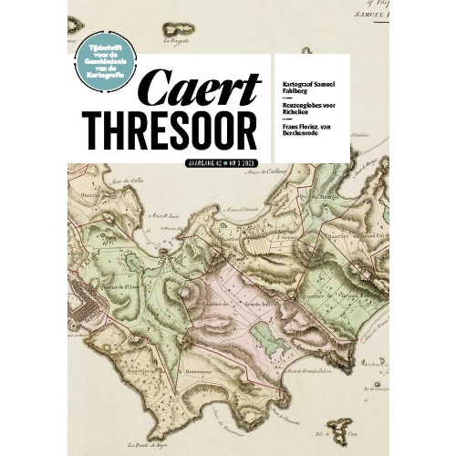
Caert-Thresoor verschijnt 4 keer per jaar op papier
Caert-Thresoor verschijnt 4 keer per jaar op papier. Een jaarabonnement kost in Nederland € 37,50, in België € 40,00, en in overige Europese landen en buiten Europa € 47,50.
Voor overige vragen, zoals advertenties en losse nummers, schrijf naar:
Caert-Thresoor Abonnementen en administratie
administratie@caert-thresoor.nl
€38
Maker : Cart thresoor
Place : Delft
Date : 2024
Caert-Thresoor verschijnt 4 keer per jaar op papier
Caert-Thresoor verschijnt 4 keer per jaar op papier. Een jaarabonnement kost in Nederland € 37,50, in België € 40,00, en in overige Europese landen en buiten Europa € 47,50.Voor overige vragen, zoals advertenties en losse nummers, schrijf naar: Caert-Thresoor Abonnementen en administratie administratie@caert-thresoor.nl
€38
Maker : Canaletto
Place : 2024
Date : Delft