ID: 90
Open
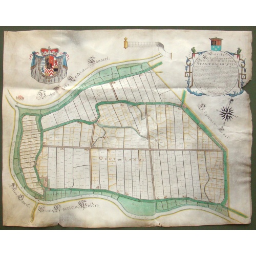
Kaerte en Afbeeldinge vande Geheele Jurisdictie van Stantdarbuyten Gelegen in de Generaliteit onder Marquisaet van Bergen op den Zoom
BuyNow for $2.500
- Maker :
- VAN DE ENDEN, A.
- Place :
- Willemstadt
- Date :
- 1737
- Color :
- In original color
- Height mm.:
- 810
- Width mm.:
- 1020
- Condition :
- Manuscript map on vellum in brown ink with gouache colors and coat of arms heightened with gold. Small hole below the coat of arms, generally in very good condition.
- Bibliography :
- Donkersloot-de Vrij 574; Teeling-Landmeters NB 119
- Seller's ref. :
- 48783
This item is offered by Paulus_Swaen_Old_Maps
See other Items from this seller- Postage
-
Standard Shipping
$0 to France
- Select Country
- Zip/Post Code
- Quantity
$2.500
Description
With a large title cartouche with signature of the maker Adriaan van der Ende, : Kaerte en Afbeeldinge vande Geheele Jurisdictie van Stantdarbuyten Gelegen in de Generaliteit onder Marquisaet van Bergen op den Zoom, gemaekt, en in den Jare van 1733, 1734, 1735 gemeten by my ondergetz… Willemstadt den 8 Julij 1737 Adr: van Enden.Adriaan van de Ende was a surveyor, appointed by the Council of Brabant in 1720, then living in Heyningen. Was later living and active in Willemstad.
Other manuscript maps by van der Ende are recorded ; Kaart figuratief van de eilanden, waarin gelegen zijn de steden Willemstad en Klundert met de onderhorige forten en landen, Standaardbuiten, een gedeelte van Zevenbergen en Prinsenland; and in Repertorium kaartmakers, Donkersloot-de Vrij/Van der Krogt, Versie 2.6 (6-8-2023) ; Standdaarbuiten, 1734; Polder Ruygenhil, 1738; Heerlijkheid Willemstad en Ruygenhil, 1745.
Standdaarbuiten is a village in the Dutch province of North Brabant located in the municipality of Moerdijk, about 9 km northeast of Roosendaal.
Around the 13th century, the northwest of the current province of North Brabant was an extensive water area with an inland sea in the middle, called Barleaq. In the southeast, Barleaq bordered on a large forest, heathland and swamp area, the Barlebosch. Oudenbosch would later be created here.
The current Standdaarbuiten used to be part of the former Marquisate of Bergen op Zoom, just like Hoeven, Oudenbosch, Oud en Nieuw-Gastel and Fijnaart.
After the St. Elisabeth Flood of 1421, new land began to emerge in the water outside the dike to the north of the land of Gastel and Barlebosch. This was literally a large sandbank and was referred to as “'t sant er buyten” or “'t sant daer buyten”.
The title cartouche is topped with a coat of arms of the town of Standdaarbuiten. The main colors of the municipal flag are red and green, the personal colors of Jan III van Glymes, lord of Bergen op Zoom.
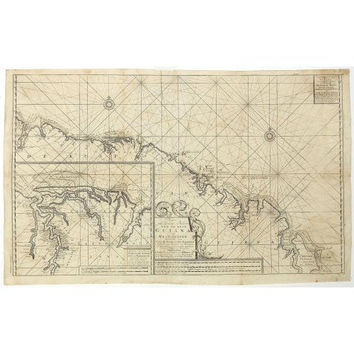
Nieuwe gelyk Graadige Paskaart van de Kust van Guiana in West-Indien.
Detailed chart of Guiana in South America. Two scales are given in both maps: Dutch, French and English nautical miles.The inset chart provide detailed view of the Camopi and Maroni or Marowijne Rivers that forms the border between French Guiana and Suriname. The charts are prepared by Johannes Loots and H.Mooy.
$650
Maker : VAN KEULEN, G.
Place : Amsterdam
Date : 1684 - 1704
Peru.
FIRST EDITION, FIRST ISSUE OF THIS MAP. Decorated with ships and monsters in the sea. Orientated with east at the top. With the signature of G. Blaeuw lower right corner. Shows the Pacific coast of South America from Ecuador (at the left-hand side) as far south as the Atacama desert in the northern reaches of Chile. "As early as 1520, Spanish settlers in Panama had heard tales of a powerful civilization rich in gold that lay to the south, and in 1522 an expedition was organized to find this land...
$900
Maker : BLAEU, W.
Place : Amsterdam
Date : 1644
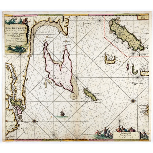
Pas kaart Van Rio Oronoque Golfo De Paria met d'Eylanden Trinidad, Tabago, Granada, Granadillos, en Bequia . . .
A highly detailed and rare sea chart of the mouth of the Orinoco River, Trinidad, Tabago, St.Vincent and neighboring islands. Oriented with north to the right by two compass roses.A large inset shows Tobago on a larger scale. Taken from De Nieuwe Groote Lichtende Zee-Fakkel, Part IV.Decorative scale cartouche features Neptune with his entourage and natives with trade goods. The chart is further adorned with a monkey atop the title cartouche and a sailing ship.
$900
Maker : VAN KEULEN, J.
Place : Amsterdam
Date : 1684
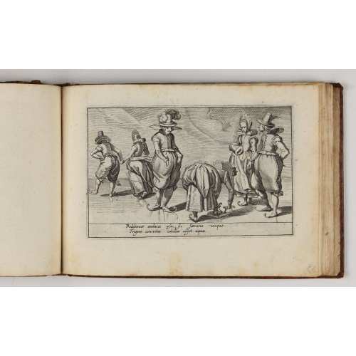
Deliciae Batavicae.
It is a charming book illustrated with portraits of Willem of Orange and Prince Maurits and eight engraved armorial plates. Followed by thirthy engraved views or scenes of Dutch cities, most with Latin text at the foot.The plates include views of Amsterdam, Leiden, a skating scene, and Prince Maurits sailing wagon. The Anatomy Theatre of the University of Leiden with a finely attired man looking at the dissected body of a man lying on the central table, surrounded by concentric benches with hum...
$5.000
Maker : MARCUS, J.
Place : Amsterdam, Johannes Janssonius
Date : 1618
Postage & Shipping
-
Item Location
Terms and conditions - Item Location
- Amsterdam, Alabama, United States
- Ships To
- United States, United Kingdom, Albania, Argentina, Armenia, Australia, Azerbaijan, Bahamas, Belgium, Bermuda, Cambodia, Canada, Chile, China, Croatia, Cyprus, Czech Republic, Denmark, Estonia, Finland, France, Germany, Gibraltar, Greece, Greenland, Guatemala, Hong Kong, Iceland, India, Indonesia, Israel, Italy, Japan, Latvia, Lithuania, Luxembourg, Malta, Mexico, Monaco, Netherlands, Norway, Singapore, Spain, Sweden, Switzerland, Turkey
- Pick-ups
- No pick-ups
This item is owned and offered by the seller Paulus_Swaen_Old_Maps - All items are available for immediate sale, offered subject to prior sale.
Invoices are created by the seller by using our shopping cart or be prepared by the seller the day following the order and are emailed to you.
Items offeres by different sellers are invoiced separately.
Shipping fees are extra. The buyer is responsible for all applicable taxes, including any VAT, customs clearance, import duties, or equivalent costs arriving at the customer's home border. Payment is due on receipt of the invoice. The item(s) are shipped as soon as possible after receipt of your payment.
Before buying please read the complete Terms Conditions of Sale.
- Payment Methods
- Visa, Mastercard, Bank Transfer, American Express, iDEAL, PayPal, Google Pay
- Returns Accepted
- No
Post Message
Feel free to ask the seller a question. Please note that the seller could be located in an area with a different time zone. Our seller will do their best to respond within 24 hours.Post your message below.
Sign in to ask the seller a question.


-500x500.jpg)


