
ID: 299
Open
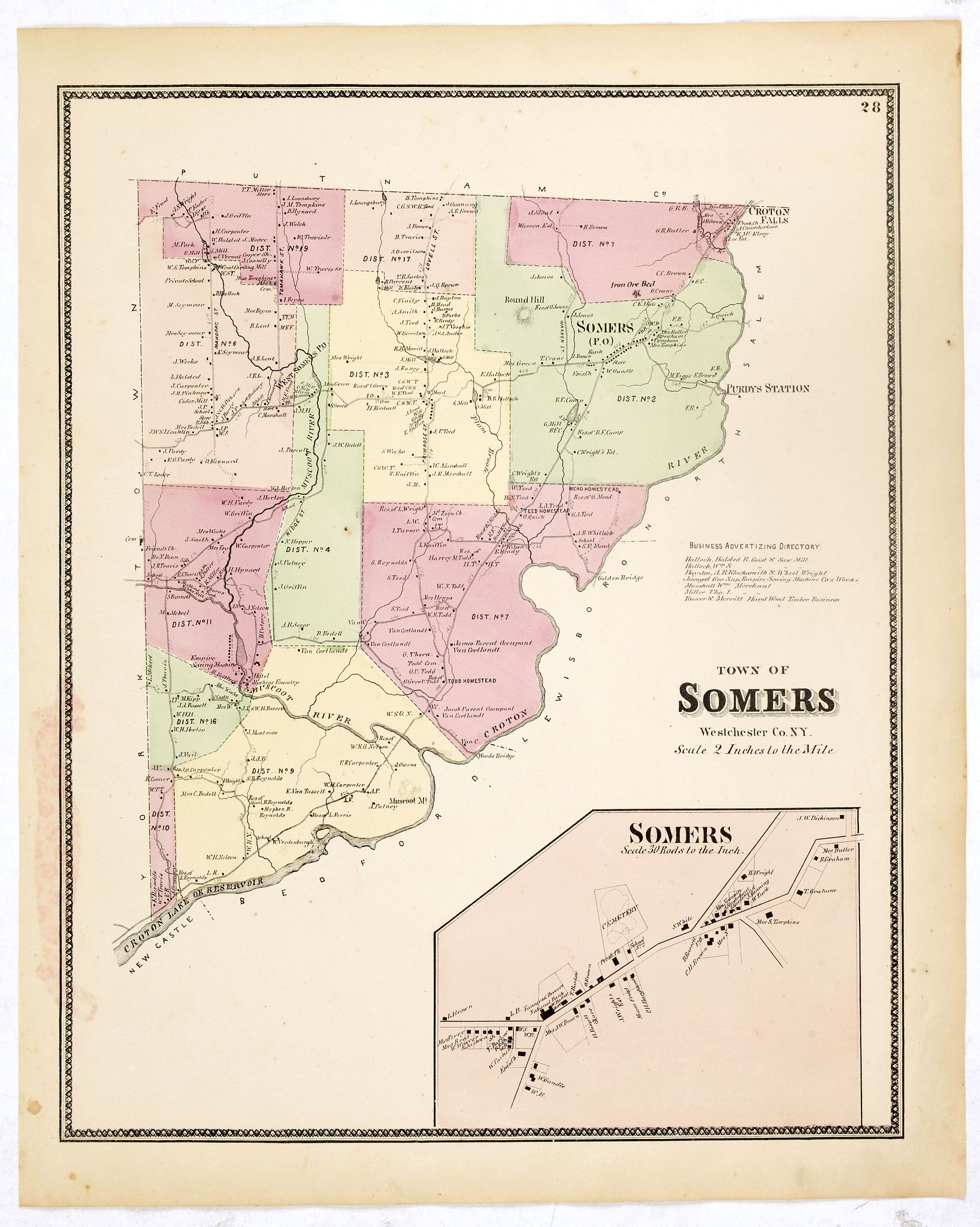
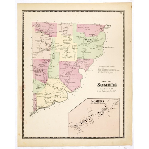
Town of Somers.
BuyNow for $90
- Maker :
- DE BEERS, F.W.
- Place :
- New York
- Date :
- 1867
- Color :
- Original colors
- Height mm.:
- 415
- Width mm.:
- 320
- Condition :
- Some very light spotting but generally in very good condition.
- Bibliography :
- Barbara B. McCorkle 'The Strange Case of F.W. Beers and The Atlas of New York and Vicinity' in Meridian 5, pp.39-43. cf. Phillips 2290; cf. Rumsey 4631. Ristow, American Maps and Mapmakers, chapter 25.
- Seller's ref. :
- 37660
This item is offered by Paulus_Swaen_Old_Maps
See other Items from this seller- Postage
-
Europe
$34 to France
- Select Country
- Zip/Post Code
- Quantity
$90
Description
Fine lithographed map of the town of Somers. The map provides the names of specific homeowners, as well as information about the occupations and physical locations of the various tradesmen in each village from Beer's famous county atlas "Atlas of New York and vicinity," "a documentary record of nineteenth-century life and delightful specimens of American folk art."
F. W. Beers, along with other members of his family, were among the leading county atlas publishers in the period immediately following the Civil War. Their atlases provide "a detailed cartographical, biographical, and pictorial record of a large segment of rural America in the Victorian age" (Ristow).
Beers first published his Atlas of New York & Vicinity in 1867.
Shows townships, roads, railroads, radial distances. "Atlas of New York and vicinity" published by Beers, Ellis & Soule, 95 Maiden Lane, New York.
Partie septentrionale des Pays-Bas comprenant .. des provinces unies. . .
Finely and crisply engraved map of Netherlands.Venetian edition of Giles Didier Robert De Vaugondy's map from Atlas Universel printed in 1776-84.Ornamental title cartouche in the upper right corner, including a large vessel in the North Sea.
$450
Maker : SANTINI, P. / REMONDINI, M.
Place : Venice, 1776 - 1784
Date : 1784
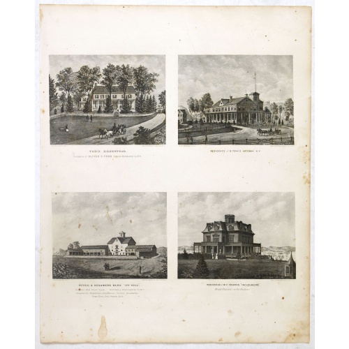
Todd Homestead / Résidence of B. Travis Katonah N.Y / Reisig & HexamersBarn Ivy Hill / Résidence of W.F Bearns
Four heliographic prints on one sheet : "Todd Homestead / Résidence of B. Travis Katonah N.Y / Reisig & HexamersBarn Ivy Hill / Résidence of W.F Bearns "Ingleuberg". After design by R.K.Sneden.From Beer's famous county atlas "Atlas of New York and vicinity", "a documentary record of nineteenth century life and delightful specimens of American folk art".F. W. Beers, along with other members of his family, were among the leading county atlas publishers in period immediately following the Civil W...
$90
Maker : DE BEERS, F.W.
Place : New York
Date : 1867
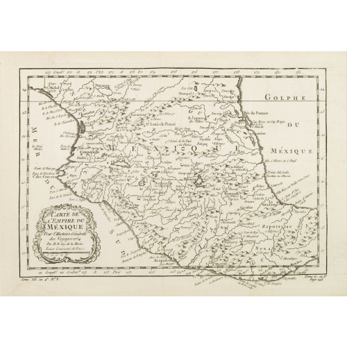
Carte de L'Empire du Mexico.
A good engraved map of Mexico, with rococo title cartouche lower left. From l'Histoire générale des voyages .
$80
Maker : BELLIN, J.N.
Place : Paris
Date : 1754
-500x500.jpg)
Kaart van de Gaspar Straaten volgens opnemingen van J.Stolze, D.Ross, enz.
Very large and rare chart centered on the strait between Bangka's southeastern seacoast and Belitung's western shores.Short front views of the coastal relief are shown in the lower-left corner of the map.The chart is prepared by H.L.Osthoff in 1840 and published in 1844 by Jacob Swart. When Gerard Hulst van Keulen died in 1801, his widow ran the firm until her death in 1810, at which time Johannes Hulst van Keulen became the last van Keulen to run the firm.In 1823, Jacob Swart entered the servic...
$900
Maker : HULST VAN KEULEN, Wed.G.
Place : Amsterdam
Date : 1843
Postage & Shipping
-
Item Location
Terms and conditions - Item Location
- Amsterdam, , Netherlands
- Ships To
- United States, United Kingdom, Albania, Argentina, Armenia, Australia, Azerbaijan, Bahamas, Belgium, Bermuda, Cambodia, Canada, Chile, China, Croatia, Cyprus, Czech Republic, Denmark, Estonia, Finland, France, Germany, Gibraltar, Greece, Greenland, Guatemala, Hong Kong, Iceland, India, Indonesia, Israel, Italy, Japan, Latvia, Lithuania, Luxembourg, Malta, Mexico, Monaco, Netherlands, Norway, Singapore, Spain, Sweden, Switzerland, Turkey
- Pick-ups
- No pick-ups
This item is owned and offered by the seller Paulus_Swaen_Old_Maps - All items are available for immediate sale, offered subject to prior sale.
Invoices are created by the seller by using our shopping cart or be prepared by the seller the day following the order and are emailed to you.
Items offeres by different sellers are invoiced separately.
Shipping fees are extra. The buyer is responsible for all applicable taxes, including any VAT, customs clearance, import duties, or equivalent costs arriving at the customer's home border. Payment is due on receipt of the invoice. The item(s) are shipped as soon as possible after receipt of your payment.
Before buying please read the complete Terms Conditions of Sale.
- Payment Methods
- Visa, Mastercard, Bank Transfer, American Express, iDEAL, PayPal, Google Pay
- Returns Accepted
- No
Post Message
Feel free to ask the seller a question. Please note that the seller could be located in an area with a different time zone. Our seller will do their best to respond within 24 hours.Post your message below.
Sign in to ask the seller a question.
![[Map of the Monterey Peninsula.]](/uploads/cache/48349-500x500.jpg)