Novus de Leone Belgico eiusq topographia atq. Historica descriptione liber (…). Rerumque in Belgio maxime gestarum, inde ab anno Christi M.D.LIX. Usque ad annum M.D.LXXXVII perpetua narratione continatus.
ENLARGED EDITION, with 207 (of 208) engravings of a famous eyewitness account of the Dutch Revolt, with the famous "Leo Belgicus" map, here in its second state. One of the major sources for the history of the Low Countries during the beginning of their struggle for independence. This history of the religious wars in Belgium and Holland from 1559-87 is illustrated with Hogenberg's engravings (from his "Geschichtsblättern"), whereby the engravings for this edition were printed without the lower ...
$39.000
Maker : AITSINGER (EYZINGER), Michael von.
Place : Cologne, Gerardus Campensis for Frans Hogenberg
Date : 1588
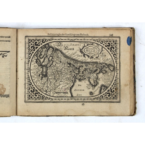
Nieuw Nederlandtsch Caertboeck. Waer in volkomentlijcker als oyt te voren vertoont werden de XVII. Nederlanden.
Rare first edition of this atlas of the provinces of the Netherlands, Belgium and Luxemburg. Engraved title page, with : "Gedruckt t' Amsterdam by Abraham Goos Plaetsnyder wonende op den Dam in 't vergulde Caertboeck.Our atlas is conform to the copy described in Koeman/Krogt : "One copy is known of the B-edition without text (Brussel KB IV). All maps in this copy are in the second variant".A. Goos published on his own a single atlas, the " Nieuw Nederlandtsch Caertboeck" with 23 maps. He receive...
$3.000
Maker : GOOS, A.
Place : Amsterdam
Date : 1616
Deliciae Batavicae.
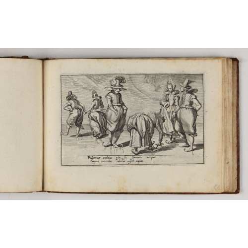
It is a charming book illustrated with portraits of Willem of Orange and Prince Maurits and eight engraved armorial plates. Followed by thirthy engraved views or scenes of Dutch cities, most with Latin text at the foot.The plates include views of Amsterdam, Leiden, a skating scene, and Prince Maurits sailing wagon. The Anatomy Theatre of the University of Leiden with a finely attired man looking at the dissected body of a man lying on the central table, surrounded by concentric benches with hum...
$5.000
Maker : MARCUS, J.
Place : Amsterdam, Johannes Janssonius
Date : 1618
De Bello Belgico, Decas Prima / Decas Secunda.
With 2 engraved titles of the 'Leo Belgicus', with one paw resting on a shield bearing the title, large woodcut printer's device on the colophons, and 30 richly engraved views and plans of battles and sieges, 28 double-page and 2 full-page, by Johanness W.Bauer, J.Miele, Jacomo Cortese, a.o. Two examples of the famous Leo Belgicus map are included. Among the greatest decorative works of early cartography is a series of arresting maps showing The Netherlands and Belgium in the shape of a lion.Thi...
€6.900
Maker : STRADA, Famiano.
Place : Rome, Franciscus Corbelletus
Date : 1632-1647
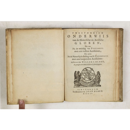
Tweevoudigh onderwiis van de Hemelsche en Aerdsche Globen; Het een Na de meyning van Ptolemeus met een vasten Aerdkloot...
Tweevoudigh onderwiis van de Hemelsche en Aerdsche Globen; Het een Na de meyning van Ptolemeus met een vasten Aerdkloot; Het ander Na de Natuerlijcke stelling van N. Copernicus met een loopenden Aerdkloot:Willem Blaeu's guide to the making of globes, first published in 1620, here reprinted by his son, Joan.The book consists of two parts; volume I : Astronomical principles of celestial and terrestrial globes based on the inadequate hypothesis of Ptolemy.Volume II : Astronomical principles of glob...
$2.250
Maker : BLAEU, W.
Place : Amsterdam
Date : 1655
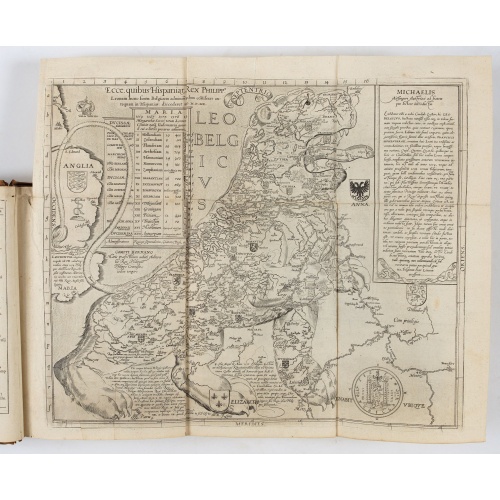
De Bello Belgico decades duae ab excessu... [including lion map]
Included in Famiani Stradae Romani è Societate Jesu de Bello Belgico Decas duae... .Published by Johann Godfried Martin Schönwetter. The book was first published in 1651 and re-published in 1699. The binding is a fine German blind-tooled pigskin, clamps wanting. Fair amount of pages has the usual browning. Copy is somewhat used but altogether very fine. Specially the folding historical engravings are of a high standard.The Bello Belgico , written by Famianus Strada (1572-1649), Jesuit and teac...
$3.500
Maker : STRADA
Place : Frankfurt am Main, Schönwetter
Date : 1699
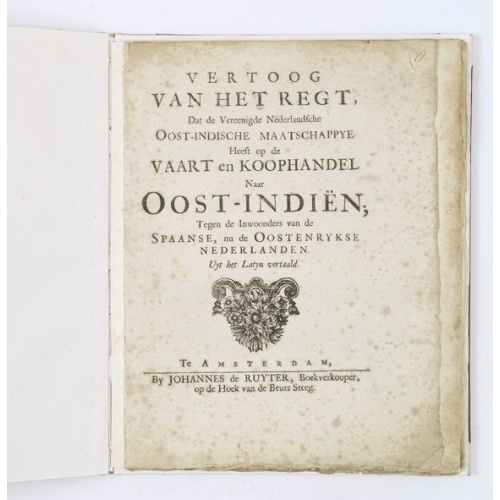
Vertoog van het regt, Dat de Vereenigde Nederlandsche Oost-Indische maatschappye Heeft op de Vaart en Koophandel naar Oost-Indiën, Tegen de inwooners van de Spaanse, nu de Oostenrykse Nederlanden.
Dutch translation of the Latin edition, published in 1723. Westerveen was the secretary of the Dutch East India Company and writes on the right of the VOC to trade as well as on VOC maritime trade with the East Indies. Westerveen also addresses these matters with regard to the Dutch West India Company and deals with Dutch trade in the light of the interests of both Spain and Portugal in the Americas and in Asia.Also contains an interesting Extract uyt de Resolutien door den Gouverneur Generaal e...
$1.200
Maker : WESTERVEEN, A.
Place : Amsterdam
Date : 1724
(Chatelain "Atlas Historique" in 7 volumes.]
Henri Abraham Chatelain, whose Atlas Historique was one of the most expansive encyclopedias of the age. First published in 1705, Chatelain's Atlas Historique was part of an immense seven-volume encyclopedia. Although the main focus of the text was geography, the work also included a wealth of historical, political, and genealogical information. The text was compiled by Nicholas Gueudeville and Garillon with a supplement by H.P. de Limiers and the maps were engraved by Chatelain, primarily after...
€40.000
Maker : CHATELAIN, H.
Place : Amsterdam: Chez Zacharie Châtelain
Date : 1732 - 1739
't Hooge Heemraedschap van Delfland met alle de Steden, Dorpen, Ambachten, Litmaten, Polders, (etc.).
The so-called Kruquius map is a wall-map of the Delfland water board district. The map consists of 25 engraved map sheets. Several maps flanked by fine large armorial cartouches. All sheets together cover a wall map with a total area of 230 x 280 cm. The map was often bound in a rich gilted calf binding and presented as gifts to important persons. The atlas than included also the overview map. According to Prof. Koeman "Thanks to the quality of the cartography (a “sensitive” scale of 1:10,00...
€3.750
Maker : KRUIKIUS, N. / J.
Place : Delft
Date : 1712-1750
Boertige reis door Europa. . . [with] Europa volgens de nieuwste verdeeling. . .
Rare illustrated publication including a rare map of Europe as a regal queen with the title "Geheimzinnige toebereidselen tot eene boertige reis door Europa. [...] voorgeleezen in [...] de maatschappij der verdiensten, onder de spreuk: Felix Meritis. / By A. Fokke Simonsz".The book contains a map of Europe (168x2369mm.) engraved by H.Klockhoff and a cartographical curiosity, "Europa volgens de nieuwste verdeeling...", Europe as a regal queen but with an interesting twist and political commentary...
€1.900
Maker : BOHN, F.
Place : Haarlem
Date : 1794
Geographie Universelle dite de Crozat.
A nice geographical dictionair with maps of the world and the continents and maps of European countries. Lacks the maps of France and of the Turkish empire.
€280
Maker : Crozat.
Place : Paris
Date : 1823


![De Bello Belgico decades duae ab excessu... [including lion map]](/uploads/cache/07603-500x500.jpg)
-500x500.jpg)