ID: 97
Open
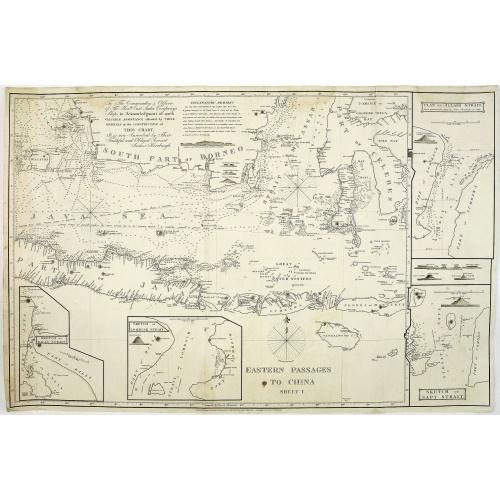
Eastern passage to China. sheet 1.
BuyNow for $3.000
- Maker :
- HORSBURGH, JAMES, F.R.S
- Place :
- London
- Date :
- 1824
- Color :
- Uncoloured
- Height mm.:
- 635
- Width mm.:
- 955
- Condition :
- Very good condition, printed on heavy paper. Paper slightly age toned.
- Bibliography :
- -
- Seller's ref. :
- 30310
This item is offered by Paulus_Swaen_Old_Maps
See other Items from this seller- Postage
-
Standard Shipping
$0 to Netherlands
- Select Country
- Zip/Post Code
- Quantity
$3.000
Description
James Horsburgh early chart of the coasts of Java, Bali, Lombok, with part of Sulawesi, and Borneo. Insets of "Sketch of Bally Strait", Sketch of Lombock Strait", Plan of Allas Strait", "Sketch of Sappy Strait".
In top Horsburgh thanks for the aid he has gotten for preparing this chart : "To the commanders and officers of the hon. East India Companys ships, in acknowledgment of much valuable assistance afforded by teir journals, in the construction of this chart, It is now inscribed by their faithful and obliged servant James Horsburgh".
As mentioned in his nine-lines EXPLANATION REMARKS, he mentions the areas which are well surveyed, as usual for that time the south coast of Java shows little information.
James Horsburgh was a distinguished hydrographer and was born at Elie, Fifeshire, September 23, 1762. At the age of sixteen, having acquired the elements of mathematical science, bookkeeping, and the theoretical parts of navigation, he sailed in various vessels, chiefly in the coal trade, from Newcastle and the Firth of Forth to Hamburg, Holland, and Ostend. In 1784 he bound for Bombay. In May 1786, when proceeding from Batavia towards Ceylon, he was wrecked upon the island of Diego Garcia, owing to the incorrectness of the charts then in use. On his return to Bombay, he joined, the Gunjava, and bound to China. On the vessel’s arrival at Canton, he became first mate, in which capacity he continued to sail, in that and other ships, between China, Bombay, and Calcutta, for several years.
In 1805 Horsburgh returned to England, and soon after he published various charts. In 1810, on the death of Dalrymple, he was appointed hydrographer to the East India Company. In 1835 he published a Chart of the East Coast of China, having the names in the Chinese character and in English, translated by himself, which was his last work. He died May 14, 1836.
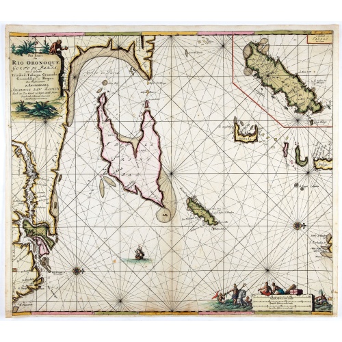
Pas kaart Van Rio Oronoque Golfo De Paria met d'Eylanden Trinidad, Tabago, Granada, Granadillos, en Bequia . . .
A highly detailed and rare sea chart of the mouth of the Orinoco River, Trinidad, Tabago, St.Vincent and neighboring islands. Oriented with north to the right by two compass roses.A large inset shows Tobago on a larger scale. Taken from De Nieuwe Groote Lichtende Zee-Fakkel, Part IV.Decorative scale cartouche features Neptune with his entourage and natives with trade goods. The chart is further adorned with a monkey atop the title cartouche and a sailing ship.
$900
Maker : VAN KEULEN, J.
Place : Amsterdam
Date : 1684
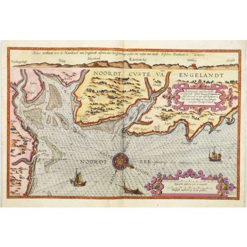
Belchrijuinghe vande zee custen van Engelandt. . .
A rare Dutch text edition of this detailed early chart of the northern coast of England. West to the top. The mileage cartouche has no Latin captures. Decorated by a colorful title cartouche and scale cartouche, one compass rose, and several vessels. An early Dutch text edition of this landmark contribution to the science of navigation. Waghenaer's own experiences as a pilot along European coasts were used to compile the Spiegel der Zeevaerdt, the first edition of which was published in Dutch at...
$3.000
Maker : WAGHENAER, L. J.
Place : Leiden, Plantijn
Date : 1585
View of Brewsters' Putnam Co.N.Y.
Heliographic print of Brewsters' Putnam Co.N.Y." after a design by R.K.Sneden.From Beer's famous county atlas "Atlas of New York and vicinity, a documentary record of nineteenth-century life and delightful specimens of American folk art". F. W. Beers, along with other members of his family, were among the leading county atlas publishers in period immediately following the Civil War. Their atlases provide "a detailed cartographical, biographical, and pictorial record of a large segment of rural A...
$90
Maker : DE BEERS, F.W.
Place : New York
Date : 1867
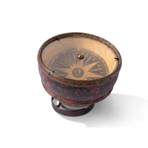
Mariner’s compass
Inverted compass called "snitch" in wood painted in imitation of tortoiseshell and brass, signed "Ing MANN Maker Water Street Liverpool".
$3.000
Maker : MANN
Place : Liverpool
Date : ca. 1785
Postage & Shipping
-
Item Location
Terms and conditions - Item Location
- Amsterdam, , Netherlands
- Ships To
- United States, United Kingdom, Albania, Argentina, Armenia, Australia, Azerbaijan, Bahamas, Belgium, Bermuda, Cambodia, Canada, Chile, China, Croatia, Cyprus, Czech Republic, Denmark, Estonia, Finland, France, Germany, Gibraltar, Greece, Greenland, Guatemala, Hong Kong, Iceland, India, Indonesia, Israel, Italy, Japan, Latvia, Lithuania, Luxembourg, Malta, Mexico, Monaco, Netherlands, Norway, Singapore, Spain, Sweden, Switzerland, Turkey
- Pick-ups
- No pick-ups
This item is owned and offered by the seller Paulus_Swaen_Old_Maps - All items are available for immediate sale, offered subject to prior sale.
Invoices are created by the seller by using our shopping cart or be prepared by the seller the day following the order and are emailed to you.
Items offeres by different sellers are invoiced separately.
Shipping fees are extra. The buyer is responsible for all applicable taxes, including any VAT, customs clearance, import duties, or equivalent costs arriving at the customer's home border. Payment is due on receipt of the invoice. The item(s) are shipped as soon as possible after receipt of your payment.
Before buying please read the complete Terms Conditions of Sale.
- Payment Methods
- Visa, Mastercard, Bank Transfer, American Express, iDEAL, PayPal, Google Pay
- Returns Accepted
- No
Post Message
Feel free to ask the seller a question. Please note that the seller could be located in an area with a different time zone. Our seller will do their best to respond within 24 hours.Post your message below.
Sign in to ask the seller a question.


-500x500.jpg)

