ID: 326
Open
Listing ID: #326 has been added to your wishlist.
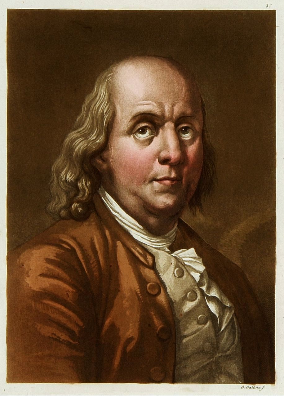
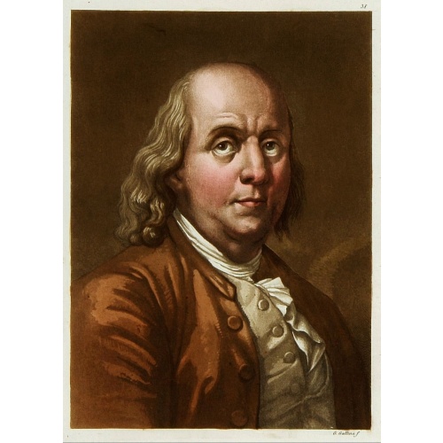
Portrait de Benjamin Franklin.
BuyNow for $75
- Maker :
- FERRARIO, G.
- Place :
- Milan, 1827
- Date :
- 1827
- Color :
- Original colors
- Height mm.:
- 180
- Width mm.:
- 130
- Condition :
- color aquatint. In mintcondition. Nice margins for framing.
- Bibliography :
- -
- Seller's ref. :
- 16286
This item is offered by Paulus_Swaen_Old_Maps
See other Items from this seller- Postage
-
Europe
$34 to France
- Select Country
- Zip/Post Code
- Quantity
$75
Description
Portrait de Benjamin Franklin. From Giulio Ferrario's work Le Costume ancien et moderne ou histoire du gouvernement, de la milice, de la religion, des arts, etc. published in Milan by the author between 1816 and 1827.
This aquatint engraved plate was color printed on fine wove paper of a soft aged white color, bearing the embossed seal of authenticity impressed at the time of publication with the legend “Il Costume Antico E Moderno” surrounding the initials GF.
A beautifully hand colored aquatint with additional hand-coloring.
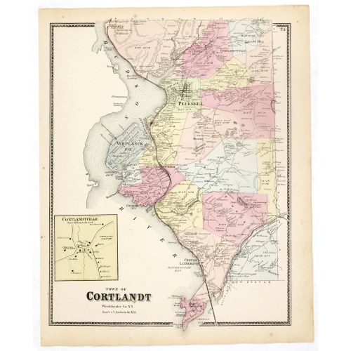
Town of Cortlandt.
Fine lithographed map of the town of Cortlandt. The map provides the names of specific homeowners, as well as information about the occupations and physical locations of the various tradesmen in each village from Beer's famous county atlas "Atlas of New York and vicinity", "a documentary record of nineteenth-century life and delightful specimens of American folk art." F. W. Beers, along with other members of his family, were among the leading county atlas publishers in the period immediately fol...
$90
Maker : DE BEERS, F.W.
Place : New York
Date : 1867
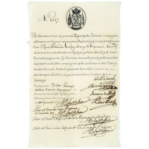
Very rare share in the Ostend Company. (4527)
Upper left hand corner share number 4527 in manuscript. In top emblem of the Ostend Company in copper engraving. Text: De Directeurs van de generale Keijserlijche- Indische compagnie, ordoneren aen hunnen cassier 'joan Baptist Cogels junior, te ontvangen van D'Heer Ferdinand Anthoin Baron de Veecquemans, Antwerp. de somme van tweehondert en vijftigh guldens wisselgeldt, voor het eerste payement sijnder actie van een duijsent guldens in het Capitael van de Selve compagnie, op de conditien in het ...
$2.000
Maker : OSTEND COMPANY
Place : Antwerp / Ostend
Date : 1723
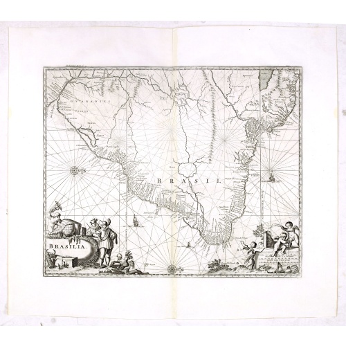
Brasilia.
Very fine decorative map od Brazil with west to the top. From the book "A Collection of Voyages and Travels" by Churchill and the map came from the part containing a description Nieuhoff's travels in Brazil.
$550
Maker : CHURCHIL, J.
Place : London, Printed for A. and J. Churchill
Date : 1703
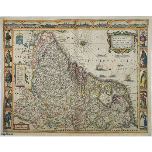
A new mape of Ye XVII Provinces of Low Germanie.
Showing all 17 Provinces of the Netherlands before the split between Spain and the Protestant Provinces under the House of Orange.The map was first published. At the same time, the war of independence was still being fought against Philip II. With columns of figures on either side and surmounted by eight city prospects. A famous and most decorative item.A fourth state published by Thomas Basset and Richard Chiswell. The date has been removed and Speed's name has been added to the title cartouche...
$2.300
Maker : SPEED, J.
Place : London, 1676
Date : 1626
Postage & Shipping
-
Item Location
Terms and conditions - Item Location
- 75013, Ile-de-France, France
- Ships To
- United States, United Kingdom, Albania, Argentina, Armenia, Australia, Azerbaijan, Bahamas, Belgium, Bermuda, Cambodia, Canada, Chile, China, Croatia, Cyprus, Czech Republic, Denmark, Estonia, Finland, France, Germany, Gibraltar, Greece, Greenland, Guatemala, Hong Kong, Iceland, India, Indonesia, Israel, Italy, Japan, Latvia, Lithuania, Luxembourg, Malta, Mexico, Monaco, Netherlands, Norway, Singapore, Spain, Sweden, Switzerland, Turkey
- Pick-ups
- No pick-ups
This item is owned and offered by the seller Paulus_Swaen_Old_Maps - All items are available for immediate sale, offered subject to prior sale.
Invoices are created by the seller by using our shopping cart or be prepared by the seller the day following the order and are emailed to you.
Items offeres by different sellers are invoiced separately.
Shipping fees are extra. The buyer is responsible for all applicable taxes, including any VAT, customs clearance, import duties, or equivalent costs arriving at the customer's home border. Payment is due on receipt of the invoice. The item(s) are shipped as soon as possible after receipt of your payment.
Before buying please read the complete Terms Conditions of Sale.
- Payment Methods
- Visa, Mastercard, Bank Transfer, American Express, iDEAL, PayPal, Google Pay
- Returns Accepted
- No
Post Message
Feel free to ask the seller a question. Please note that the seller could be located in an area with a different time zone. Our seller will do their best to respond within 24 hours.Post your message below.
Sign in to ask the seller a question.