ID: 480
Open
France.
BuyNow for €50
- Maker :
- DURY, A. / SAYER, R. / KITCHIN, T.
- Place :
- London
- Date :
- 1761-1763
- Color :
- In original outline colors
- Height mm.:
- 103
- Width mm.:
- 120
- Condition :
- Paper very slightly age toned and some very light offsetting due to oxidation of ink.
- Bibliography :
- -
- Seller's ref. :
- 38637
This item is offered by Librairie_Loeb-Larocque
See other Items from this seller- Postage
-
France
€15 to France
- Select Country
- Zip/Post Code
- Quantity
€50
Description
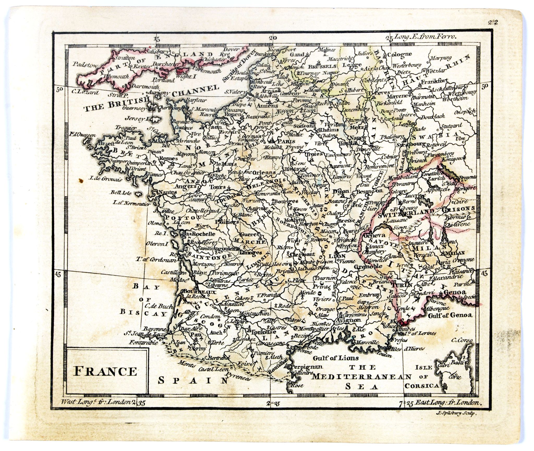
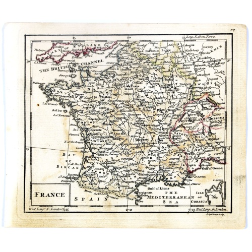
Uncommon miniature map of France, engraved by J.Spilbury for "A New General and Universal Atlas Containing Forty five Maps by Andrew Dury".This miniature atlas published during the Seven Years' War.
The maps are typical for the period and well executed with great clarity. The plates are engraved in 1761 and in 1763 a second edition was presumably produced for the French market having all but nine with a French titles added above the top.
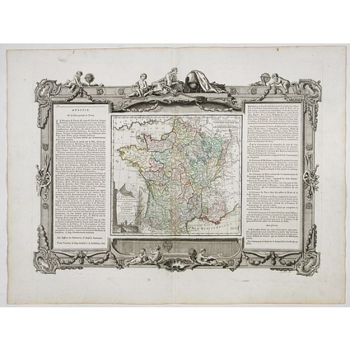
La France Divisée en ses quarante gouvernemens . . .
Map of France surrounded by a decorative frame.
€80
Maker : DESNOS, S.
Place : Paris, 1770
Date : 1770
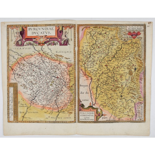
Burgundiae Ducatus. Burgundiae Comitatus.
Separately issued map of Burgundy area. Two maps of Burgundy region on a plate. Separately published map, without text on the verso. Second state with the date 1597 removed from the title cartouche. This is the rarest Burgundy map of the four that Ortelius made.
€500
Maker : ORTELIUS, A.
Place : Antwerp
Date : after 1612
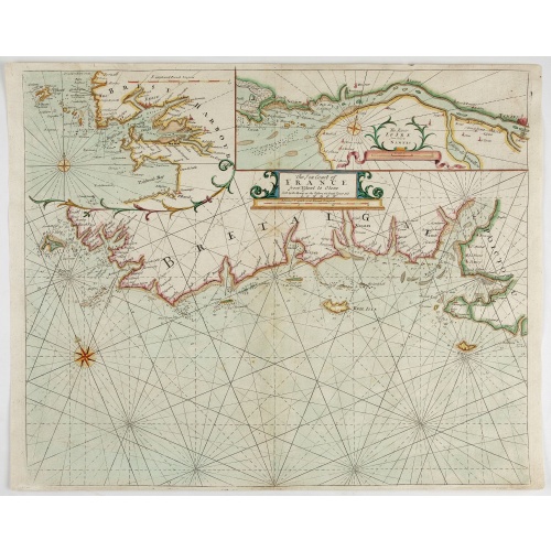
The Sea Coast of France from Ushent to Olone.
Chart showing the Brittany coast from Ushent to Ollone, with Belle-Ile. In insets : Rade de Brest and Mouth of the Loire between St. Nazaire and Nantes.Originally engraved by John Seller, here with the address "Sold by Ri. Mount at the Postern on Great Tower Hill LONDON". Mount and Page was a firm of religious and maritime publishers that flourished in the 18th century. The name became well-known worldwide as an imprint of nautical charts.The firm was founded in 1701 by Richard Mount (1654–172...
€550
Maker : MOUNT, R.. / PAGE, T.
Place : London, ca. 1680
Date : 1680
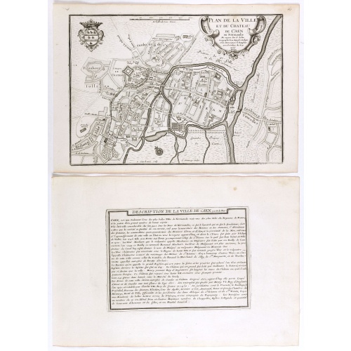
Plan de la ville et du château de Caën en Normandie.
Plan of the city of Caen, from Nicolas de Fer's "L'Atlas curieux ou le Monde réprésente dans des cartes. "The "Atlas Curieux" is a geographic encyclopedia of images and a celebration of the French Empire under the Sun King, with maps of French possessions in the western hemisphere, maps of France, with detailed views of the grand waterworks at Marly, views of the great palaces and chateaux, views and plans of the Paris Observatory, and samples of military architecture. Issued in six annual par...
€60
Maker : DE FER, N.
Place : Paris, 1705
Date : 1705
Postage & Shipping
-
Item Location
Terms and conditions - Item Location
- 75013, Ile-de-France, France
- Ships To
- United States, United Kingdom, Albania, Argentina, Armenia, Australia, Austria, Bahamas, Belgium, Bermuda, Bosnia and Herzegowina, Brazil, Bulgaria, Canada, Chile, China, Costa Rica, Denmark, Dominica, Egypt, El Salvador, Finland, France, Germany, Greece, Guatemala, Hong Kong, Hungary, Iceland, India, Italy, Japan, Korea (South), Kuwait, Liechtenstein, Lithuania, Luxembourg, Madagascar, Mexico, Monaco, Morocco, Netherlands, Netherlands Antilles, New Zealand, Norway, Paraguay, Peru, Philippines, Poland, Portugal, Qatar, Reunion, Romania, San Marino, Saudi Arabia, Seychelles, Singapore, Slovenia, South Africa, Spain, Sri Lanka, Suriname, Sweden, Switzerland, Taiwan, Thailand, Tunisia, Turkey, United Arab Emirates, Uruguay, Vietnam
- Pick-ups
- Buyer can pick-up
This item is owned and offered by the seller Librairie_Loeb-Larocque - All items are available for immediate sale, offered subject to prior sale.
Invoices are created by the seller by using our shopping cart or be prepared by the seller the day following the order and are emailed to you.
Items offeres by different sellers are invoiced separately.
Shipping fees are extra. The buyer is responsible for all applicable taxes, including any VAT, customs clearance, import duties, or equivalent costs arriving at the customer's home border. Payment is due on receipt of the invoice. The item(s) are shipped as soon as possible after receipt of your payment.
Before buying please read the complete Terms Conditions of Sale.
- Payment Methods
- Visa, Mastercard, Bank Transfer, American Express, iDEAL, PayPal, Google Pay
- Returns Accepted
- No
Post Message
Feel free to ask the seller a question. Please note that the seller could be located in an area with a different time zone. Our seller will do their best to respond within 24 hours.Post your message below.
Sign in to ask the seller a question.
![[Cavendish reaches Morro Moreno.]](/uploads/cache/39910-500x500.jpg)