ID: 310
Open
Nouvelle carte de l'Amérique Septentrionale et des iles qui en dépendent dressée par H. Brué. . .
BuyNow for $500
- Maker :
- LOGEROT, A.
- Place :
- Paris
- Date :
- 1875
- Color :
- In original colors
- Height mm.:
- 658
- Width mm.:
- 878
- Condition :
- In very good condition. Repair of a center fold split, 3cm. into engraved area. Printed on heavy paper. Wide margins, paper size: 71x102cm. !
- Bibliography :
- -
- Seller's ref. :
- 30072
This item is offered by Paulus_Swaen_Old_Maps
See other Items from this seller- Postage
-
Europe
$36 to France
- Select Country
- Zip/Post Code
- Quantity
$500
Description
Very large, highly detailed, and uncommon issue of the map of North and Central America (ca. 1:13,888,000) prepared by H. Brué and improved by A.Vuillemin. Showing main interregional routes, rivers, and canals.The map was published in the year of The Texas Constitution of 1876. Texas still operates under the 1876 constitution today.
Between the years of 1824 and 1876, Texas was at times a part of the United States of Mexico, an independent republic, a state within the Confederate States of America, and a state within the United States of America.
The Texas Constitution of 1876 remains the foundation of state government. This constitution has enjoyed remarkable staying power, despite having been written as an extreme reaction to the deficiencies of the Constitution of 1869 and to the real and perceived abuses of brief but deeply despised Radical Republican rule.
This issue was published by Auguste Logerot, with his name added to the title and dated 1876.
Logerot was a French publisher active from c. 1839 until 1880. Logerot made use of the works of the well-known cartographers Fremin, Dufour, Dyonnet, and Vuillemin. He published maps, atlases, folding case maps and jigsaw puzzle maps. He was active at Quai des Augustins 55, Paris. Little else is known of Logerot's life and work.
Prepared by Alexandre Vuillemin (1812-1880) a french cartographer who studied under the prominent Auguste Henri Dufour (1798-1865).
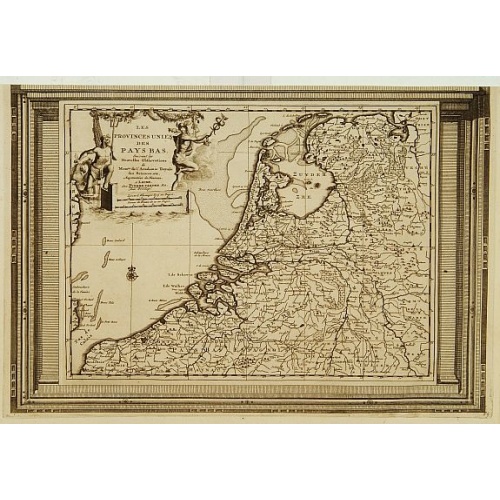
Les Provinces Unies des Pays Bas, suivant les nouvelles observations. . .
With decorative title cartouche upper left corner.This example is unusual in having the additional separately engraved decorative framework border around the map, the resultant visual effect being particularly striking. The frame border was prepared with a blank center so that the map could be over-printed on that area.These separately engraved border frames appear much more uncommon than the standard edition without border frames. From Le Nouveau Theatre du Monde, ou la Geographie Royale.
$250
Maker : AA, P. van der
Place : Amsterdam
Date : 1728
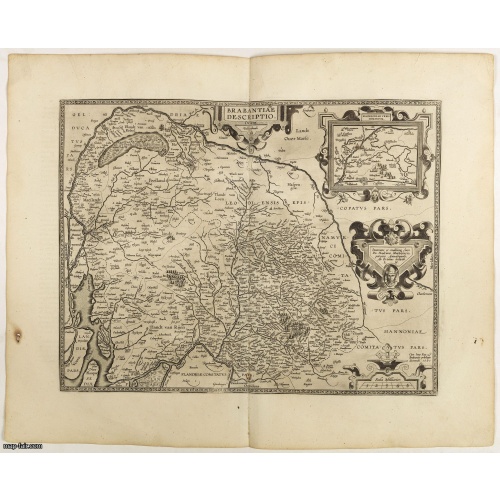
Brabantiae Descriptio.
In an inset Mechelen and surroundings. Decorative scale and title cartouche with dedicational initials, which may refer to Laurentius Michaelis, who may be connected with the Mechelen inset map.Dare to go in Black. All early maps were printed in black and white, and many were kept that way for a long time. A black and white map in an early and strong impression is a rarity nowadays, being so many examples recently colored up!
$350
Maker : ORTELIUS, A.
Place : Antwerp, 1598
Date : 1598
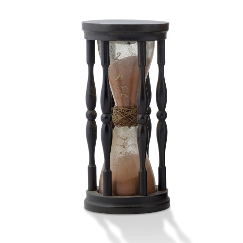
A ship's hour glass.
Maritime hourglass with blown glass bulbs, orange sand, junction ring covered with cord, the circular ebony frame with six turned baluster columns. The invention of the hourglass is attributed to an 8th-century monk in Chartres, France, with the marine sandglass appearing as early as the 14th century. In earlier examples, the bulbs were connected with a material such as putty or hardened wax, bound in leather, linen or string. From about 1720, the two bulbs were welded together over a brass bead...
$2.000
Maker : ANONYMOUS
Place : Germany
Date : ca. 1750
View of Brewsters' Putnam Co.N.Y.
Heliographic print of Brewsters' Putnam Co.N.Y." after a design by R.K.Sneden.From Beer's famous county atlas "Atlas of New York and vicinity, a documentary record of nineteenth-century life and delightful specimens of American folk art". F. W. Beers, along with other members of his family, were among the leading county atlas publishers in period immediately following the Civil War. Their atlases provide "a detailed cartographical, biographical, and pictorial record of a large segment of rural A...
$90
Maker : DE BEERS, F.W.
Place : New York
Date : 1867
Postage & Shipping
-
Item Location
Terms and conditions - Item Location
- 75013, Ile-de-France, France
- Ships To
- United States, United Kingdom, Albania, Argentina, Armenia, Australia, Azerbaijan, Bahamas, Belgium, Bermuda, Cambodia, Canada, Chile, China, Croatia, Cyprus, Czech Republic, Denmark, Estonia, Finland, France, Germany, Gibraltar, Greece, Greenland, Guatemala, Hong Kong, Iceland, India, Indonesia, Israel, Italy, Japan, Latvia, Lithuania, Luxembourg, Malta, Mexico, Monaco, Netherlands, Norway, Singapore, Spain, Sweden, Switzerland, Turkey
- Pick-ups
- No pick-ups
This item is owned and offered by the seller Paulus_Swaen_Old_Maps - All items are available for immediate sale, offered subject to prior sale.
Invoices are created by the seller by using our shopping cart or be prepared by the seller the day following the order and are emailed to you.
Items offeres by different sellers are invoiced separately.
Shipping fees are extra. The buyer is responsible for all applicable taxes, including any VAT, customs clearance, import duties, or equivalent costs arriving at the customer's home border. Payment is due on receipt of the invoice. The item(s) are shipped as soon as possible after receipt of your payment.
Before buying please read the complete Terms Conditions of Sale.
- Payment Methods
- Visa, Mastercard, Bank Transfer, American Express, iDEAL, PayPal, Google Pay
- Returns Accepted
- No
Post Message
Feel free to ask the seller a question. Please note that the seller could be located in an area with a different time zone. Our seller will do their best to respond within 24 hours.Post your message below.
Sign in to ask the seller a question.


-500x500.jpg)