ID: 127
Open
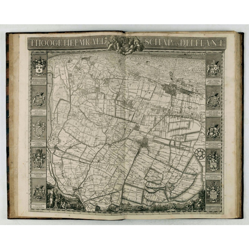
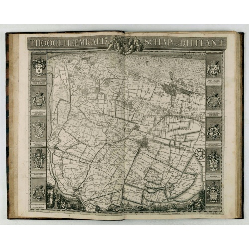
't Hooge Heemraedschap van Delfland met alle de Steden, Dorpen, Ambachten, Litmaten, Polders, (etc.).
BuyNow for €3.750
- Maker :
- KRUIKIUS, N. / J.
- Place :
- Delft
- Date :
- 1712-1750
- Color :
- Uncoloured
- Height mm.:
- 580
- Width mm.:
- 430
- Condition :
- Large-folio. Cont. mottled calf with raised bands, richly decorated. gilt back, gilt lettering 'Delfland' on both sides, surrounded by 2 gilt decorated. borders. Engraved title in 2 parts, engr. general map (2nd, altered edition, dated 1750) 25 numbered
- Bibliography :
- -
- Seller's ref. :
- 45658
This item is offered by Librairie_Loeb-Larocque
See other Items from this seller- Postage
-
Standard Shipping
€0 to Netherlands
- Select Country
- Zip/Post Code
- Quantity
€3.750
Description
The so-called Kruquius map is a wall-map of the Delfland water board district. The map consists of 25 engraved map sheets. Several maps flanked by fine large armorial cartouches. All sheets together cover a wall map with a total area of 230 x 280 cm. The map was often bound in a rich gilted calf binding and presented as gifts to important persons. The atlas than included also the overview map.According to Prof. Koeman "Thanks to the quality of the cartography (a “sensitive” scale of 1:10,000 was used) rather than its size, the map surpasses all other water authority maps which were produced in the 17th and 18th centuries".
[How the Indians cured the Spanish thirst for gold....by pouring it down their throats!]
A brutal scene depicting native Indians tying down Spanish men and pouring liquid gold down their throats. Scenes of cannibalism in the background.In 1631 Johann Ludwig Gottfried, inherited the Theodor De Bry’s publishing firm, among the illustrated accounts of the expeditions of Magellan, Columbus, Vespucci, Cortes, Balboa, Raleigh, Drake, Smith, and many others.Gottfried issued together with Matthaeus Merian a one-volume condensation "Newe Welt Vnd Americanische Historien/ Jnhaltende Warhaff...
€80
Maker : GOTTFRIED, J.L. / DE BRY.
Place : Frankfurt, M.Merian
Date : 1633
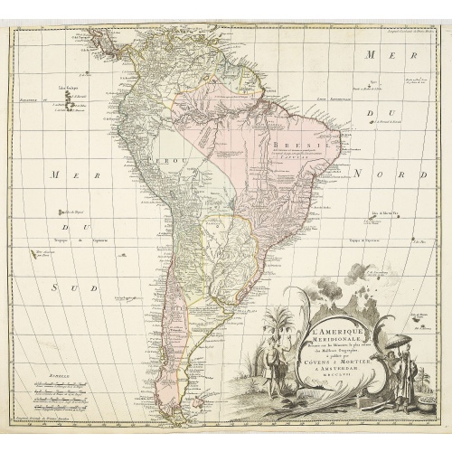
L'amerique meridionale dressee sur les memoires le plus recens. . .
Rare and decorative map of South America with good detail and interesting notations concerning the explorations of the interior. With in the lower right corner a title cartouche flanked by natives with a background of erupting volcanoes.The Amsterdam publishing firm of Covens and Mortier (1721 - c. 1862) was the successor to the extensive publishing empire built by Frenchman Pierre Mortier (1661 - 1711). Upon Mortier's death in 1711 his firm was taken over by his son, Cornelius Mortier (1699 -...
€550
Maker : COVENS, J. / MORTIER, C.
Place : Amsterdam
Date : 1757
Brasilia.
Fine copy of this map by Krystof Arciszewski, a Polish general who worked for the Dutch West Indian Company. The map perpetuates various myths including the Parime Lago , although it is generally more accurate than its predecessors. Orientated with west to the top. Including the mouth of the Amazon.
€700
Maker : BLAEU, J.
Place : Amsterdam
Date : 1647
[Spanish take over Cusco] / [Atahualpa is garrotted].
Two engravings. [486] After Atahualpa was killed, Pizarro set out with his troops to find the city of Cuzco, which he had heard was rich in gold. The journey from Cajamarca to Cuzco by road was nearly a thousand miles and took three months. Although there was considerable resistance to the Spanish during this long march, the final descent into the great city, in November 1533, was in fact, not as portrayed but a relatively peaceful affair. [485] While Atahualpa was still held captive rumors spre...
€80
Maker : GOTTFRIED, J.L. / DE BRY.
Place : Frankfurt, M.Merian
Date : 1633
Postage & Shipping
-
Item Location
Terms and conditions - Item Location
- 75013, Ile-de-France, France
- Ships To
- United States, United Kingdom, Albania, Argentina, Armenia, Australia, Austria, Bahamas, Belgium, Bermuda, Bosnia and Herzegowina, Brazil, Bulgaria, Canada, Chile, China, Costa Rica, Denmark, Dominica, Egypt, El Salvador, Finland, France, Germany, Greece, Guatemala, Hong Kong, Hungary, Iceland, India, Italy, Japan, Korea (South), Kuwait, Liechtenstein, Lithuania, Luxembourg, Madagascar, Mexico, Monaco, Morocco, Netherlands, Netherlands Antilles, New Zealand, Norway, Paraguay, Peru, Philippines, Poland, Portugal, Qatar, Reunion, Romania, San Marino, Saudi Arabia, Seychelles, Singapore, Slovenia, South Africa, Spain, Sri Lanka, Suriname, Sweden, Switzerland, Taiwan, Thailand, Tunisia, Turkey, United Arab Emirates, Uruguay, Vietnam
- Pick-ups
- No pick-ups
This item is owned and offered by the seller Librairie_Loeb-Larocque - All items are available for immediate sale, offered subject to prior sale.
Invoices are created by the seller by using our shopping cart or be prepared by the seller the day following the order and are emailed to you.
Items offeres by different sellers are invoiced separately.
Shipping fees are extra. The buyer is responsible for all applicable taxes, including any VAT, customs clearance, import duties, or equivalent costs arriving at the customer's home border. Payment is due on receipt of the invoice. The item(s) are shipped as soon as possible after receipt of your payment.
Before buying please read the complete Terms Conditions of Sale.
- Payment Methods
- Visa, Mastercard, Bank Transfer, American Express, iDEAL, PayPal, Google Pay
- Returns Accepted
- No
Post Message
Feel free to ask the seller a question. Please note that the seller could be located in an area with a different time zone. Our seller will do their best to respond within 24 hours.Post your message below.
Sign in to ask the seller a question.


![[How the Indians cured the Spanish thirst for gold....by pouring it down their throats!]](/uploads/cache/40483-500x500.jpg)

![[Spanish take over Cusco] / [Atahualpa is garrotted].](/uploads/cache/41092-500x500.jpg)
