ID: 386
Open
![[Spanish take over Cusco] / [Atahualpa is garrotted].](/uploads/41092.jpg)
[Spanish take over Cusco] / [Atahualpa is garrotted].
BuyNow for €80
- Maker :
- GOTTFRIED, J.L. / DE BRY.
- Place :
- Frankfurt, M.Merian
- Date :
- 1633
- Color :
- Uncoloured
- Height mm.:
- 150
- Width mm.:
- 195
- Condition :
- Copper plate engraving on text sheet. Paper lightly browned and stained, as is usual. One engraving with extensive repairs to bottom margin and borders. Size of sheet: 345 x 222 mm. German text and on verso.
- Bibliography :
- -
- Seller's ref. :
- 41092
This item is offered by Librairie_Loeb-Larocque
See other Items from this seller- Postage
-
France
€15 to France
- Select Country
- Zip/Post Code
- Quantity
€80
Description
Two engravings. [486] After Atahualpa was killed, Pizarro set out with his troops to find the city of Cuzco, which he had heard was rich in gold. The journey from Cajamarca to Cuzco by road was nearly a thousand miles and took three months. Although there was considerable resistance to the Spanish during this long march, the final descent into the great city, in November 1533, was in fact, not as portrayed but a relatively peaceful affair.[485] While Atahualpa was still held captive rumors spread that the Indians were planning a counter attack. De Soto tried to find out if there was any truth in them and, although no evidence was found, the rumors persisted.
Almagro persuaded Pizarro that, without a leader the Incas were ineffectual and, in order that they remain so, Atahualpa should be killed. In 1533, on a trumped-up charge of conspiracy, the Inca king was found guilty and sentenced to death by strangulation. Black slaves who were working for the Spanish, acted as executioners
In 1631 Johann Ludwig Gottfried, inherited the Theodor De Bry’s publishing firm, among the illustrated accounts of the expeditions of Magellan, Columbus, Vespucci, Cortes, Balboa, Raleigh, Drake, Smith, and many others.
Gottfried issued together with Matthaeus Merian a one-volume condensation "Newe Welt Vnd Americanische Historien/ Jnhaltende Warhafftige vnd volkommene Beschreibungen Aller West-Jndianischen Landschafften..." that used many of the original copper plates and supplemented them with new ones of more recent voyages. The book was published by Matthaeus Merian. The work was reprinted in 1655 / 1657.
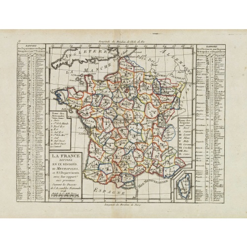
La France Divisée en IX Régions, 10 Métropoles, et 85 Départements ..
Scarce map of France prepared after J.B.Nolin and published by Mondhare for his Atlas Général a l'usage des colleges et maisons d'education.. Lower right inset map of Corsica. In left and right margins key references to Départements and Provinces. Louis Joseph Mondhare was active in Paris and published several smaller atlases and re-published the wall maps of Nolin.
€60
Maker : MONDHARE, L.J. / NOLIN, J.B.
Place : Paris
Date : 1783
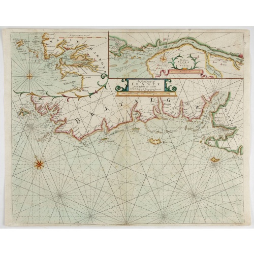
The Sea Coast of France from Ushent to Olone.
Chart showing the Brittany coast from Ushent to Ollone, with Belle-Ile. In insets : Rade de Brest and Mouth of the Loire between St. Nazaire and Nantes.Originally engraved by John Seller, here with the address "Sold by Ri. Mount at the Postern on Great Tower Hill LONDON". Mount and Page was a firm of religious and maritime publishers that flourished in the 18th century. The name became well-known worldwide as an imprint of nautical charts.The firm was founded in 1701 by Richard Mount (1654–172...
€550
Maker : MOUNT, R.. / PAGE, T.
Place : London, ca. 1680
Date : 1680
![[The bloody battle at Chupas] / [Francesco Pizzaro is killed].](/uploads/cache/41093-500x500.jpg)
[The bloody battle at Chupas] / [Francesco Pizzaro is killed].
Two engravings. [492] Even before Pizarro’s death, a new royal governor, Vaca de Castro, was on his way to settle the turmoil in Peru. He refused to accept Almagro the younger, when he heard he had appointed himself the new governor and summoned his troops for battle. They were later joined by Alonso de Alvarado and by other Pizarrists. This culminated in a bloody battle at Chupas in 1542, near the city of Ayacucho. Many men on both sides died, before Almagro the younger, fled to Cuzco. He was...
€80
Maker : GOTTFRIED, J.L. / DE BRY.
Place : Frankfurt, M.Merian
Date : 1633
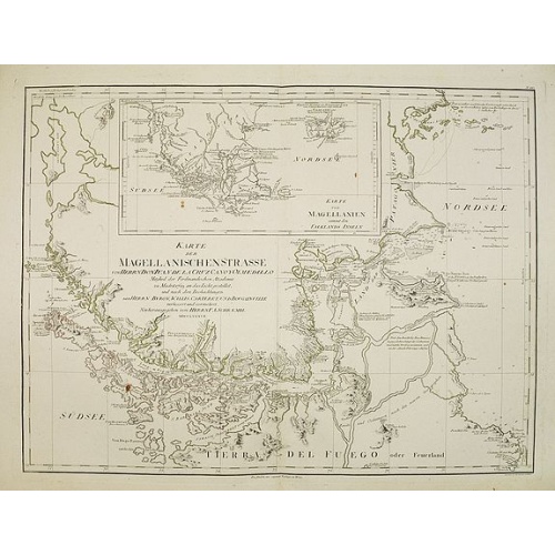
Karte der Magellanischen-Strasse. . .
Very detailed map of Strait of Magellan, with in top inset map of Southern tip of South America with the Falklands. Prepared by Don Juan de La Cruz of Spain.Engraved by Jos. Gestner.
€600
Maker : SCHRAEMBL, F.A.
Place : Vienna
Date : 1787
Postage & Shipping
-
Item Location
Terms and conditions - Item Location
- 75013, Ile-de-France, France
- Ships To
- United States, United Kingdom, Albania, Argentina, Armenia, Australia, Austria, Bahamas, Belgium, Bermuda, Bosnia and Herzegowina, Brazil, Bulgaria, Canada, Chile, China, Costa Rica, Denmark, Dominica, Egypt, El Salvador, Finland, France, Germany, Greece, Guatemala, Hong Kong, Hungary, Iceland, India, Italy, Japan, Korea (South), Kuwait, Liechtenstein, Lithuania, Luxembourg, Madagascar, Mexico, Monaco, Morocco, Netherlands, Netherlands Antilles, New Zealand, Norway, Paraguay, Peru, Philippines, Poland, Portugal, Qatar, Reunion, Romania, San Marino, Saudi Arabia, Seychelles, Singapore, Slovenia, South Africa, Spain, Sri Lanka, Suriname, Sweden, Switzerland, Taiwan, Thailand, Tunisia, Turkey, United Arab Emirates, Uruguay, Vietnam
- Pick-ups
- Buyer can pick-up
This item is owned and offered by the seller Librairie_Loeb-Larocque - All items are available for immediate sale, offered subject to prior sale.
Invoices are created by the seller by using our shopping cart or be prepared by the seller the day following the order and are emailed to you.
Items offeres by different sellers are invoiced separately.
Shipping fees are extra. The buyer is responsible for all applicable taxes, including any VAT, customs clearance, import duties, or equivalent costs arriving at the customer's home border. Payment is due on receipt of the invoice. The item(s) are shipped as soon as possible after receipt of your payment.
Before buying please read the complete Terms Conditions of Sale.
- Payment Methods
- Visa, Mastercard, Bank Transfer, American Express, iDEAL, PayPal, Google Pay
- Returns Accepted
- No
Post Message
Feel free to ask the seller a question. Please note that the seller could be located in an area with a different time zone. Our seller will do their best to respond within 24 hours.Post your message below.
Sign in to ask the seller a question.
![[Spanish take over Cusco] / [Atahualpa is garrotted].](/uploads/cache/41092-500x500.jpg)
![[Captain Weert dines with the Chief].](/uploads/cache/39922-500x500.jpg)