ID: 456
Open
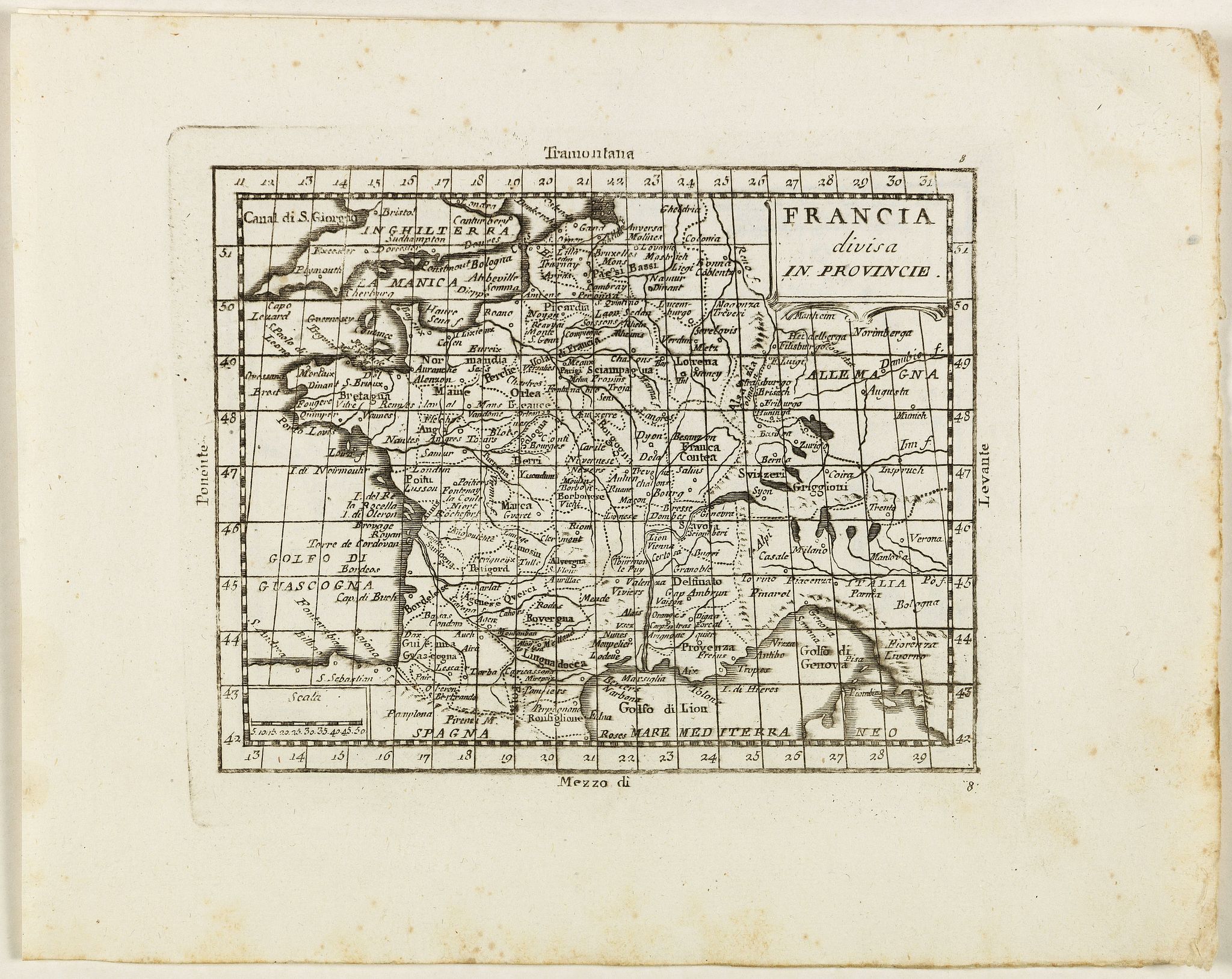
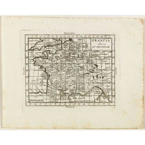
Francia divisa in provincie.
BuyNow for €50
- Maker :
- ZEMPEL, G.
- Place :
- Rome
- Date :
- 1780
- Color :
- Uncoloured
- Height mm.:
- 135
- Width mm.:
- 170
- Condition :
- Very good condition. Paper very minor marginal spotting. With nice margins.
- Bibliography :
- Rare not in ICCU. OCLC, 41139358.
- Seller's ref. :
- 41320
This item is offered by Librairie_Loeb-Larocque
See other Items from this seller- Postage
-
France
€15 to France
- Select Country
- Zip/Post Code
- Quantity
€50
Description
Rare map of France, from "Atlante Novissimo ad uso Dei Giovani Studiosi Contenuto In Carte XXVII.", published by Giovanni Zempel in Rome, ca. 1780.The map is based on Claude Buffier (1661-1737) geography.
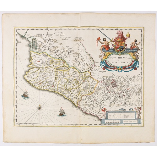
Nova Hispania et Nova Galicia.
Map of New Spain and New Galicia shows the city of Mexico situated by a large lake, as well as the location of many silver and gold mines. The map's elaborate cartouche is surmounted by the Spanish Royal coat of arms. Based on Ortelius map of 1579 which became the basis for many of the seventeenth century maps of the area. From early on Willem Jansz. Blaeu aimed of publishing an atlas to compete with the Hondius-Jansson Atlas. By 1630, he had published at least 17 folio size maps. Blaeu was ab...
€850
Maker : BLAEU, W.
Place : Amsterdam
Date : 1644
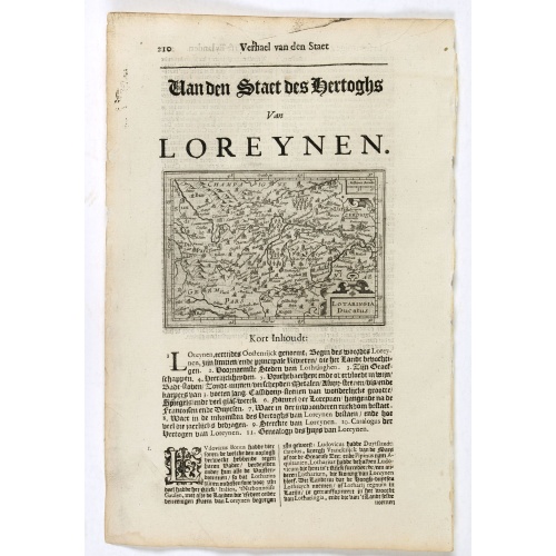
Lotaringia Ducatus.
Small map of Lorraine, oriented with West on top and surrounded by text in Dutch. Nicolaes de Clerck (de Klerc) was active as an engraver and publisher in Delft from 1599-1621.Included in the rare book : Wereld Spiegel, waer in vertoontword de Beschryvinge der Rijken Staten, ende vorstendommen des gantsen Aerdbodems… which was a Dutch translation of "Les estats, empires et principautez de monde" by Pierre Davity.The map is engraved by Jodocus Hondius before 1616 and first published in Petrus ...
€75
Maker : DE CLERCK, N.
Place : Amsterdam, Cloppenburch
Date : 1621
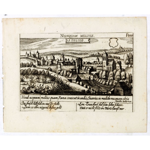
S. Iulius.
A very nice view of the castle of Saint Julius. On the foreground, several frogs are depicted. With a verse in two languages underneath the picture.The poet and topographer from Comothau, Daniel Meisner (1585-1625), started his first publication entitled Thesaurus Philo-Politicus in Frankfurt in 1623, initially in parts, each one containing about fifty plans. The work was engraved circa 1623-1650, and printed 1678, and was published by Eberhard Kieser. In 1678 the collection of copperplates was...
€60
Maker : MEISNER, D.
Place : Frankfurt
Date : 1623-1678
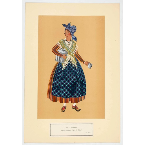
Laitière Bordelaise, d'après de Gallard (110, La Guyenne).
Plate published in "Les costumes régionaux de France" with illustrations by Gratiane de Gardilanne (painter and designer) and Elisabeth Whitney Moffat.Costume plate printed in collotype, pochoir and retouched by hand. Dimension of 24.5 x 38cm. The originals were donated by an American patron to the Metropolitan Museum of Art in New York and constitute a set of 200 plates. Good condition.
€75
Maker : GARDILANNE (G.de) et MOFFAT (E.W.)
Place : Paris, Editions du Pégase
Date : 1929
Postage & Shipping
-
Item Location
Terms and conditions - Item Location
- 75013, Ile-de-France, France
- Ships To
- United States, United Kingdom, Albania, Argentina, Armenia, Australia, Austria, Bahamas, Belgium, Bermuda, Bosnia and Herzegowina, Brazil, Bulgaria, Canada, Chile, China, Costa Rica, Denmark, Dominica, Egypt, El Salvador, Finland, France, Germany, Greece, Guatemala, Hong Kong, Hungary, Iceland, India, Italy, Japan, Korea (South), Kuwait, Liechtenstein, Lithuania, Luxembourg, Madagascar, Mexico, Monaco, Morocco, Netherlands, Netherlands Antilles, New Zealand, Norway, Paraguay, Peru, Philippines, Poland, Portugal, Qatar, Reunion, Romania, San Marino, Saudi Arabia, Seychelles, Singapore, Slovenia, South Africa, Spain, Sri Lanka, Suriname, Sweden, Switzerland, Taiwan, Thailand, Tunisia, Turkey, United Arab Emirates, Uruguay, Vietnam
- Pick-ups
- Buyer can pick-up
This item is owned and offered by the seller Librairie_Loeb-Larocque - All items are available for immediate sale, offered subject to prior sale.
Invoices are created by the seller by using our shopping cart or be prepared by the seller the day following the order and are emailed to you.
Items offeres by different sellers are invoiced separately.
Shipping fees are extra. The buyer is responsible for all applicable taxes, including any VAT, customs clearance, import duties, or equivalent costs arriving at the customer's home border. Payment is due on receipt of the invoice. The item(s) are shipped as soon as possible after receipt of your payment.
Before buying please read the complete Terms Conditions of Sale.
- Payment Methods
- Visa, Mastercard, Bank Transfer, American Express, iDEAL, PayPal, Google Pay
- Returns Accepted
- No
Post Message
Feel free to ask the seller a question. Please note that the seller could be located in an area with a different time zone. Our seller will do their best to respond within 24 hours.Post your message below.
Sign in to ask the seller a question.