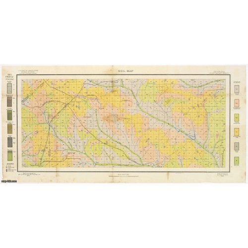
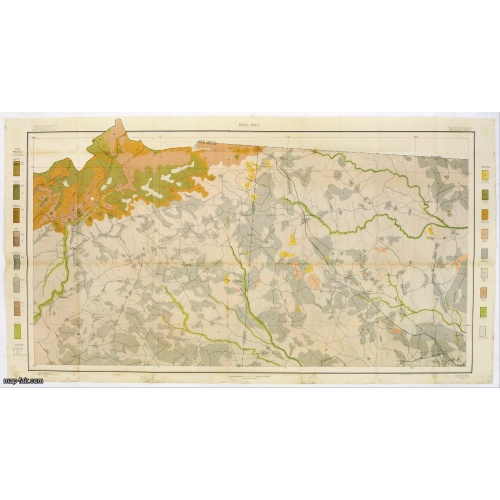
Soil map - Georgia, Fort Valley sheet.
Early color lithographed soil map by Julius Bien & Co. in New York for Department of Agriculture. Legends at side give detail on soil type, etc. They also include interesting details of the cities, roads, railroads, rivers, canals, etc. Scale of 1" = 1 mile. The map is giving great detail of the area in the year 1903. Soils are surveyed by Wm. G. Smith and Wm. T. Carter Jr. in the same year. To the left and right color keys to the different types of soil.Upper left: U.S.Department of Agricult...
$50
Maker : U.S. DEPT. OF ARGICULTURE
Place : New York, 1903
Date : 1903
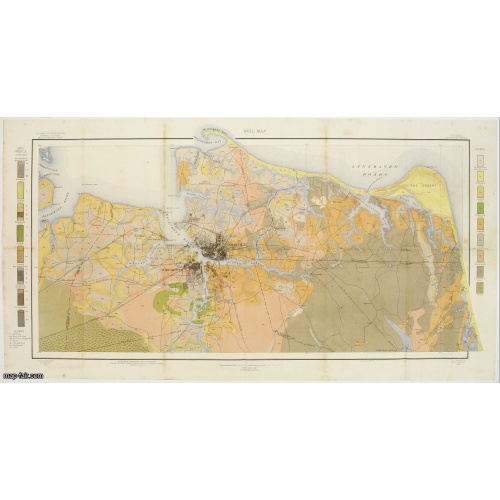
Soil map - Virginia Norfolk Sheet.
Soil map printed by Julius Bien & Co. in New York for the Department of Agriculture. The map gives great detail of the area centered on Norfolk, Potsmouth, Chesapeake, Virginia Beach in the year 1903. Soils are surveyed by J.E.Lapham in the same year. To the left and right, color keys to the different soil types.Upper left: U.S.Department of Agriculture, Bureau of soils, Milton Whitney, Chief.Julies Bien (later Bien & Co) was born and educated in Germany, and moved to America in 1849. He started...
$50
Maker : U.S. DEPT. OF ARGICULTURE
Place : New York 1903
Date : 1903
Soil map - South Carolina Campobello Sheet.
Early color lithographed soil map by Julius Bien & Co. in New York for the Department of Agriculture. Legends at the side provide detail on soil type, etc. They also include interesting details of the cities, roads, railroads, rivers, and canals. A scale of 1" = 1 mile. The map gives great detail of the northern part of South Carolina, including Spatanburg and the area northwest of it, with Tiger River, South Pacolet River, and North Saluda River in the lower right-hand corner, in 1903. A.G. Man...
$50
Maker : U.S. DEPT. OF ARGICULTURE
Place : New York, 1903
Date : 1903
[Map of the Monterey Peninsula.]
A lovely example of Jo Mora's Del Monte Properties Company' California's Fun' playground tourist map of the Monterey Peninsular, published in San Francisco in 1927. The rare first state and among the rarest maps by Jo Mora.A lively map full of interesting, fun illustrations of the region. The map borders are surrounded by many small illustrations of modern and historical Monterey. These include animals, historical figures, native Indians, missionaries, cowboys, singing & dancing, the 'gold rush'...
€900
Maker : ROBERTSON, A.M.
Place : San Francisco
Date : 1927
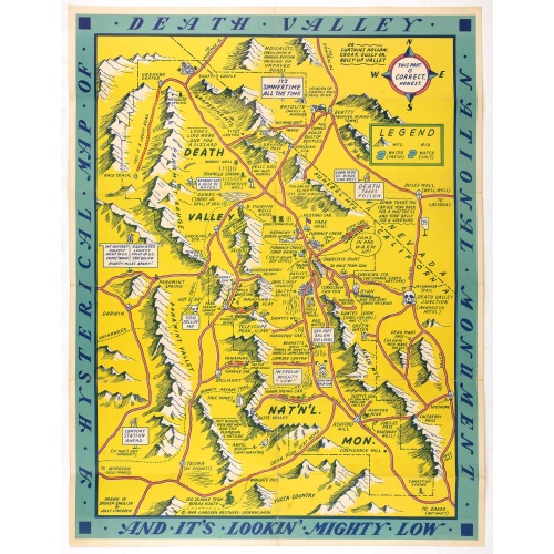
A Hysterical Map Of Death Valley National Monument -- And It's Looking Mighty Low
First edition Humorous map of Death Valley. "Drawn In Broken English by Jolly Lindgren," this comic pictorial map is full of puns and comic vignettes related to Death Valley. The Lindgren Brothers issued a number of other silly whimsical maps of national parks and other parts of the West.
$500
Maker : LINDGREN, J.
Place : Spokane, Wash., Lindgren Brothers,
Date : 1948
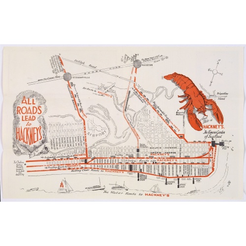
Map of Atlantic City to Hackney's Famous Garden of Sea Food . . .
A mid 1950s brochure for the famous Atlantic City Seafood Restaurant - 'Hackneys'. One side proclaims that "All Roads lead to Hackney's". It shows a nice plan of Atlantic City in NJ. Highlighted in red are the famous Boardwalk, Pacific, Atlantic, Albany and Mediterranean Avenues plus Absecon Boulevard, and all roads that lead off them.Other major thoroughfares and roads are shown, together with the Airport and bus and car route. Famous piers are in bold, plus there are small illustrations of sea...
€50
Maker : ANONYMOUS.
Place : New Jersey
Date : 1954

![[Map of the Monterey Peninsula.]](/assets/images/image-loading.svg)
