
![[Lot of 8 maps and prints] Norvegiae Maritimae ab Elf-burgo ad Dronten / Pascaert van Noorwegen streckende van Elf-burg tot Dronten.](/uploads/cache/84130-500x500.jpg)
[Lot of 8 maps and prints] Norvegiae Maritimae ab Elf-burgo ad Dronten / Pascaert van Noorwegen streckende van Elf-burg tot Dronten.
Norvegiae Maritimae ab Elf-burgo ad Dronten / Pascaert van Noorwegen streckende van Elf-burg tot Dronten.Frederick de Wit's fine sea chart of southern Norway. An attractive sea chart of southern Norway and Sweden, richly embellished with a stunning large decorative title cartouche, showing the drying of cod. A lot of 8 maps including:-Carte du Detroit de Waeigats ou de Nassau 1758 -Partie de la Mer Glaciale 1758 -RVGIA VSEDO MIAE ET IVLINAE -Carte du Spits-Berg 1758 -Carte Des Pais Habites par�...
€900
Maker : DE WIT, Frederick.
Place : Amsterdam
Date : 1675
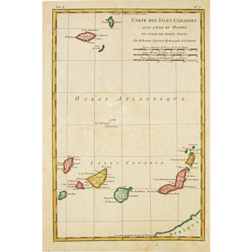
Nieuwe Pascaert van de Kust van Maroca en Zanhaga. . .
A very fine sea chart of the west coast of Morocco between C.Cantin tot C.Bajador and the Canary Islands, Lanzerote and Fuerteventura. With a very large decorative title-cartouche and an inset depicting Porto de Nao en Po. de Cavallos on Lanzerote. Rhumb lines. Johannes van Keulen is the founder of the successful van Keulen firm that published charts, pilot guides and sea-atlases for over 2 centuries. In 1680, he published his immensely popular 'Zee Atlas of te Water Werelt'.
€600
Maker : VAN KEULEN, Johannes.
Place : Amsterdam
Date : ca 1685
![[Lot of 5 maps of the mouth of the Gironde river] Carte des Entrees et Cours de la Gironde](/uploads/cache/86010-500x500.jpg)
[Lot of 5 maps of the mouth of the Gironde river] Carte des Entrees et Cours de la Gironde
A large sea chart of the mouth and course of the Gironde river as far inland as Bordeaux. Decorated with three cartouches.Jacques Nicolas Bellin (1702-720) was the most important French hydrographer of the 18th century. Sea-atlas 'Hydrographique Français' , 1756-65, atlas to accompany Prévost d' Exile's ' Histoire. des Voyages', 1738-75. A lot of 5 maps of the mouth of the Gironde river.- Carte des Entrees et Cours de la Gironde ((96x65 cm)- Carte du Gouvernent de Guyenne et Gascogne- Gou...
€350
Maker : BELLIN, J. N.
Place : Paris
Date : c. 1740
![[Lot of 6] Carte de la Baye d'Hocsieu. Fukin. (3 Maps + 3 Gravure of China)](/uploads/cache/20019-500x500.jpg)
[Lot of 6] Carte de la Baye d'Hocsieu. Fukin. (3 Maps + 3 Gravure of China)
[Lot of 6 items]. (3 Maps +3 gravure )- Carte de la Baye d'Hocsieu et des Entrees de la Riviere de Chang Situees dans la Province de Fokyen. J.N.Berlin 1748- Carte de l’Isle de Cheu Chan ou Isle de Chusan de la Province de Che-Kiang Avec les Costes et Isles voisines- Carte de la Baye d'Hocsieu et des Entrées de la Riviere de Chang. Situées, Dans la Province de Fokyen- Tempel van Quang-Que-Myau- Temple Chinois- De Seije-Reedery, uit de HaldeA detailed small chart of the estuary of the Chiang...
€280
Maker : BELLIN, J. N.
Place : Amsterdam
Date : 1759
![[Lot of 6 maps / prints] Schets van de Donkere Baai in Nieuw Zeeland 1773.](/uploads/cache/86004-500x500.jpg)
[Lot of 6 maps / prints] Schets van de Donkere Baai in Nieuw Zeeland 1773.
A map of Dusky Bay, visited by James Cook in 1773. From a Dutch edition of ‘Cook's voyages'. Schets van de Donkere Baai in Nieuw Zeeland 1773. Nicolas Bellin's map of the Marianas islands with an inset map of Guam. A view of Easter Island, of men of Hapahee in a fighting contest and a plan of a Tahitian war proha. Together 6 maps / views of the Pacific Ocean.Captain James Cook (1728-79), explorer, circumnavigator and hydrographer. Three voyages, 1768-71, 1772-75 and 1776-79. From 1778 on p...
€350
Maker : James Cook
Place : London
Date : ca. 1790
![[Lot of 2 maps] Important plan of Port Bucarelli 1384 / Chart of the entrance of "Bassin de L'Quest", La Perouse. 1709](/assets/images/image-loading.svg)
[Lot of 2 maps] Important plan of Port Bucarelli 1384 / Chart of the entrance of "Bassin de L'Quest", La Perouse. 1709
Chart of the entrance of "Bassin de L'Quest", La Perouse. 1709 / With antique print of Alaska] Pirogue du port des Francais. / Pirogue, trouvee au port des Francais. 5958 / [Antique map of Alaska] Plan der Haven van Namganoodha in het eiland van Oonolaska. 2665 / Antique detail chart of the Nootka Channel] Schets van het Kanaal van Nootka. 3860. Plus 6 prints of natives of Alaska and their utensils. A plan of Port Bucarelli, Jean François Galoup, Comte de la Pérouse (1741-88), outstanding Fren...
€350
Maker : La Pérouse, J.B.G. Comte de.
Place : Paris
Date : 1797
![[Lot of 3] Celestial chart depicting astronomical division of the earth.](/uploads/cache/84235-500x500.jpg)
[Lot of 3] Celestial chart depicting astronomical division of the earth.
A chart depicting the astronomical division of the earth. With on both sides a descriptionary text. All within an elaborate and very decorative border. A very fine item.Claude Buy de Mornas (d. 1783), géographe du roi (1764). Atlas Méthodique et Elémentaire de Géographie et d' Histoire, 1761, Atlas Historique et Géographique, 1762. A chart depicting the astronomical division of the earth. With on both sides a descriptionary text. All within an elaborate and very decorative border. A very fi...
€250
Maker : BUY DE MORNAS, C.
Place : Paris, L.C. Desnos
Date : 1761.