ID: 193
Open
[Lot of 6 maps / prints] Schets van de Donkere Baai in Nieuw Zeeland 1773.
BuyNow for €350
- Maker :
- James Cook
- Place :
- London
- Date :
- ca. 1790
- Color :
- Colored
- Height mm.:
- 200
- Width mm.:
- 375
- Condition :
- good condition.
- Bibliography :
- -
- Seller's ref. :
- 86004
This item is offered by Papyro
See other Items from this seller- Postage
-
Standard Shipping
€25 to Netherlands
- Select Country
- Zip/Post Code
- Quantity
€350
Description
A map of Dusky Bay, visited by James Cook in 1773. From a Dutch edition of ‘Cook's voyages'.
Schets van de Donkere Baai in Nieuw Zeeland 1773. Nicolas Bellin's map of the Marianas islands with an inset map of Guam. A view of Easter Island, of men of Hapahee in a fighting contest and a plan of a Tahitian war proha. Together 6 maps / views of the Pacific Ocean.Captain James Cook (1728-79), explorer, circumnavigator and hydrographer. Three voyages, 1768-71, 1772-75 and 1776-79. From 1778 on printed editions of ' Captain Cook's Travels' appeared in English, Italian, French and Dutch.
Jean François Galoup, Comte de la Pérouse (1741-88), outstanding French explorer and hydrographer. ' Voyage autour du Monde…Atlas', 1797. La Perouse commanded a French scientific expedition to the Pacific in 1785-88. Recognized as one the foremost naval commanders and navigators in France, he was selected by King Louis XVI to complete Captain James Cook's exploration of the western Pacific. He explored the coasts of the Gulf of Alaska and northwestern North America in search of the fabled Northwest Passage. After leaving America his expedition crossed the Pacific Occean.
Carte de I;Isle Necker, part of the Hawaiian archipelago
A large chart from La Pérouse's 'Voyage autour du Monde', depicting the island of Necker, part of the Hawaiian archipelago, discovered by la Perouse on November 4th, 1786. Ref.: Fitzpatrick, The Early Mapping of Hawai'i, p. 30, plate 11.
[lot of 6] maps & prints / views of the Pacific Ocean.
- Schets van de donkere Baai in Nieuw Zeeland
- carte de toutes les découvertes. (Tome 119, page 298)
- Tekeningen van plan en doorsnede van de BRITANNIA (een dubbele Otahitische oorlog-kano).- Carte de la L’Archipel de St Lazare
- Vuist gevegt van de inboorlingen van Hapaee
- Oude gedenktekenen op het Paasch-Eiland
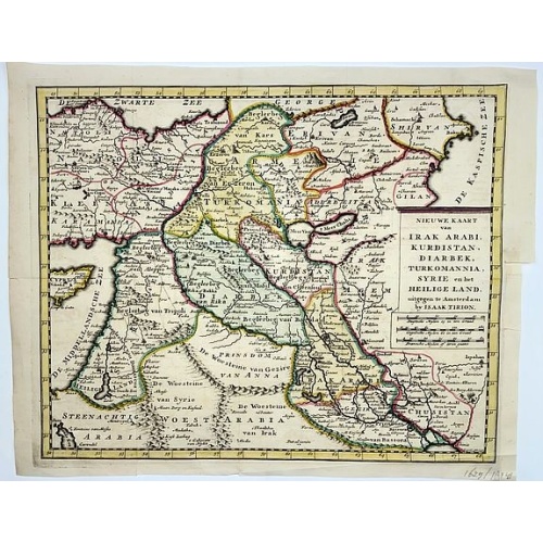
Irak, Arabi, Kurdistan, Diarbek, Turkomania, Syrie en het Heilige Land.
Isaak Tirion's map of the Near East. His 'Nieuwe en beknopte handatlas' saw 6 editions between before 1740 and after 1784. Also the 'Atlas van de Nederlandse Provintien' (1739-57) and ' Atlas van Zeeland' (1760).
€350
Maker : TIRION, Isaak.
Place : Amsterdam
Date : ca. 1750
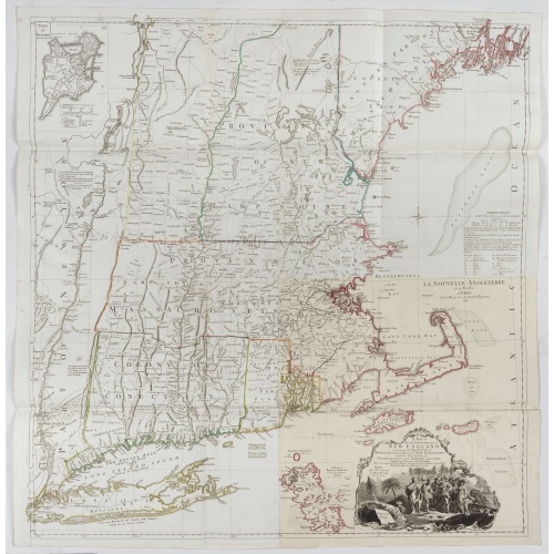
A Map of the most Inhabited part of New England containing the Provinces of Massachusetts Bay and New Hampshire, with the Colonies of Connecticut and Rhode Island.
A copper engraving in four sheets, published in Georges Louis Le Rouge, in his "Atlas Ameriqua in Septentrional Contenant les details des differentes provinces, de ce vaste continent, traduit des cartes levées par ordre du Gouvernement Britannique". This is a very close copy of the second edition, the second issue of the Jefferys-Green map, even down to the spelling, in the statement of sources, of Connecticut with 'k's (but translated into French). The title cartouche is also a straight copy, ...
€4.000
Maker : LE ROUGE, G. L.
Place : Paris, 1777
Date : Paris, 1777
[Lot of 3] Celestial chart depicting astronomical division of the earth.
A chart depicting the astronomical division of the earth. With on both sides a descriptionary text. All within an elaborate and very decorative border. A very fine item.Claude Buy de Mornas (d. 1783), géographe du roi (1764). Atlas Méthodique et Elémentaire de Géographie et d' Histoire, 1761, Atlas Historique et Géographique, 1762. A chart depicting the astronomical division of the earth. With on both sides a descriptionary text. All within an elaborate and very decorative border. A very fi...
€250
Maker : BUY DE MORNAS, C.
Place : Paris, L.C. Desnos
Date : 1761.
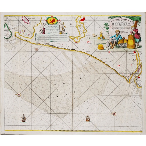
Nieuwe Paskaert van de Kust van HOLLANDT - Tussen Texel en de Maes.
Nieuwe Paskaert van de Kust van Hollandt Tussen Texel en de Maes. A very attractive sea chart off the coast of Holland by Johannes van Keulen with a pair of decorative cartouches, ships sailing off the coast, rhumb lines, compass rose etc. Van Keulen was the founder of the successful van Keulen firm that published charts, pilot guides and sea-atlases for over 2 centuries. In 1680, he published his immensely popular 'Zee Atlas ofte Water Werelt'.
€500
Maker : van Keulen, J.
Place : Amsterdam
Date : ca 1685
Postage & Shipping
-
Item Location
Terms and conditions - Item Location
- Amsterdam, , Netherlands
- Ships To
- Worldwide
- Pick-ups
- Buyer can pick-up
This item is owned and offered by the seller Papyro - All items are available for immediate sale, offered subject to prior sale.
Invoices are created by the seller by using our shopping cart or be prepared by the seller the day following the order and are emailed to you.
Items offeres by different sellers are invoiced separately.
Shipping fees are extra. The buyer is responsible for all applicable taxes, including any VAT, customs clearance, import duties, or equivalent costs arriving at the customer's home border. Payment is due on receipt of the invoice. The item(s) are shipped as soon as possible after receipt of your payment.
Before buying please read the complete Terms Conditions of Sale.
- Payment Methods
- Visa, Mastercard, Bank Transfer, PayPal
- Returns Accepted
- No
Post Message
Feel free to ask the seller a question. Please note that the seller could be located in an area with a different time zone. Our seller will do their best to respond within 24 hours.Post your message below.
Sign in to ask the seller a question.

![[Lot of 6 maps / prints] Schets van de Donkere Baai in Nieuw Zeeland 1773.](/assets/images/image-loading.svg)


![[Lot of 3] Celestial chart depicting astronomical division of the earth.](/uploads/cache/84235-500x500.jpg)

![[Lot of 6 maps / prints] Schets van de Donkere Baai in Nieuw Zeeland 1773.](/uploads/cache/86004-500x500.jpg)