ID: 85
Open
Amstelodamum, Celebre Emporium Forma Plana.
BuyNow for $5.000
- Maker :
- VISSCHER, Claes Jansz.
- Place :
- Amsterdam
- Date :
- c. 1636
- Color :
- Uncoloured
- Height mm.:
- 462
- Width mm.:
- 560
- Condition :
- Split of 22 cm at centerfold re-enforced and backed with a large strip of paper. Lower margin cut into the scale border. Adhesive strip at lower left corner. Dark impression.
- Bibliography :
- Caert Thresoor 2019-2, research study by Gijs Boink
- Seller's ref. :
- 44392-(1)
This item is offered by Paulus_Swaen_Old_Maps
See other Items from this seller- Postage
-
Standard Shipping
$0 to Netherlands
- Select Country
- Zip/Post Code
- Quantity
$5.000
Description
Second state of this rare and decorative plan of Amsterdam with Visscher's imprint. With a panoramic view seen from the IJ and further insets of Council House, The Exchange, House of the Dutch East India Company and House of the West India Company.This state figures the fourth extension with the projected growth of the city added to the left half of the sheet; on the west side, the "Realeneiland" has been extended, above the image of the west India House, the imprint of Visscher has been added, and, on the bastion right next to the St. Anthonispoort, a windmill has appeared.
This map appeared at the height of the Golden Age of the Dutch Empire, which was built on its dominance in international finance and the spice trade. Accordingly, the institutions highlighted in the corners of the map are not churches or monasteries but economic institutions such as the stock market, the headquarters of the Dutch West and East India Companies, and the old statehouse.
A new mape of Ye XVII Provinces of Low Germanie.
Showing all 17 Provinces of the Netherlands before the split between Spain and the Protestant Provinces under the House of Orange.The map was first published. At the same time, the war of independence was still being fought against Philip II. With columns of figures on either side and surmounted by eight city prospects. A famous and most decorative item.A fourth state published by Thomas Basset and Richard Chiswell. The date has been removed and Speed's name has been added to the title cartouche...
$2.300
Maker : SPEED, J.
Place : London, 1676
Date : 1626
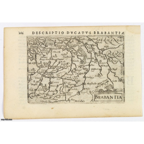
Brabantia.
A lovely miniature map of the Duchy of Brabant, published by Petrus Bertius, in Amsterdam at the beginning of the seventeenth century. There is a nice, small strap-work title, a little stippled sea, and the map depicts local topography and towns including Mechelen, Breda, Cleve, Maestricht, Cologne, Brussels and Namur. This example is from the Tabularum Geographicarum Contractarum. Bertius (1565-1629) was a Flemish cartographer, theologian, historian and geographer. Although he published much in...
$100
Maker : LANGENES, B. / BERTIUS, P.
Place : Amsterdam, 1606
Date : 1606
Jules Verne. Le Tour du Monde en 80 jours. [Goose game board inspired by Jules Verne's novel Tour du Monde en 80 jours.]
This Goose game board is inspired by Jules Verne's novel whose boxes are illustrated with town views and figures and the center is occupied by a world map. Vignette illustrations numbered from 1 to 80, captioned in French and arranged counterclockwise.The game block illustrates views of arrival in New York (75), Chicago (68), San Francisco (57). The diverse illustrations also include Hong Kong, Singapore (44), Yankees (72), Japanese, Calcutta (25), Bombay (21), etc.The first two numbered blocks ...
$1.100
Maker : HETZEL, Jules.
Place : Paris
Date : 1876
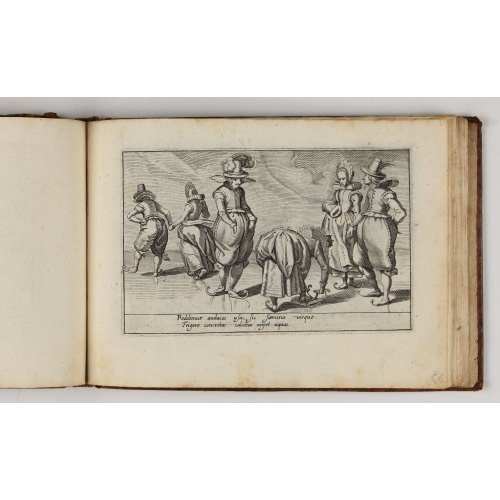
Deliciae Batavicae.
It is a charming book illustrated with portraits of Willem of Orange and Prince Maurits and eight engraved armorial plates. Followed by thirthy engraved views or scenes of Dutch cities, most with Latin text at the foot.The plates include views of Amsterdam, Leiden, a skating scene, and Prince Maurits sailing wagon. The Anatomy Theatre of the University of Leiden with a finely attired man looking at the dissected body of a man lying on the central table, surrounded by concentric benches with hum...
$5.000
Maker : MARCUS, J.
Place : Amsterdam, Johannes Janssonius
Date : 1618
Postage & Shipping
-
Item Location
Terms and conditions - Item Location
- Amsterdam, Alabama, United States
- Ships To
- United States, United Kingdom, Albania, Argentina, Armenia, Australia, Azerbaijan, Bahamas, Belgium, Bermuda, Cambodia, Canada, Chile, China, Croatia, Cyprus, Czech Republic, Denmark, Estonia, Finland, France, Germany, Gibraltar, Greece, Greenland, Guatemala, Hong Kong, Iceland, India, Indonesia, Israel, Italy, Japan, Latvia, Lithuania, Luxembourg, Malta, Mexico, Monaco, Netherlands, Norway, Singapore, Spain, Sweden, Switzerland, Turkey
- Pick-ups
- No pick-ups
This item is owned and offered by the seller Paulus_Swaen_Old_Maps - All items are available for immediate sale, offered subject to prior sale.
Invoices are created by the seller by using our shopping cart or be prepared by the seller the day following the order and are emailed to you.
Items offeres by different sellers are invoiced separately.
Shipping fees are extra. The buyer is responsible for all applicable taxes, including any VAT, customs clearance, import duties, or equivalent costs arriving at the customer's home border. Payment is due on receipt of the invoice. The item(s) are shipped as soon as possible after receipt of your payment.
Before buying please read the complete Terms Conditions of Sale.
- Payment Methods
- Visa, Mastercard, Bank Transfer, American Express, iDEAL, PayPal, Google Pay
- Returns Accepted
- No
Post Message
Feel free to ask the seller a question. Please note that the seller could be located in an area with a different time zone. Our seller will do their best to respond within 24 hours.Post your message below.
Sign in to ask the seller a question.

-800x800.jpg)


![Jules Verne. Le Tour du Monde en 80 jours. [Goose game board inspired by Jules Verne's novel Tour du Monde en 80 jours.]](/uploads/cache/44962-500x500.jpg)

-500x500.jpg)