ID: 315
Open
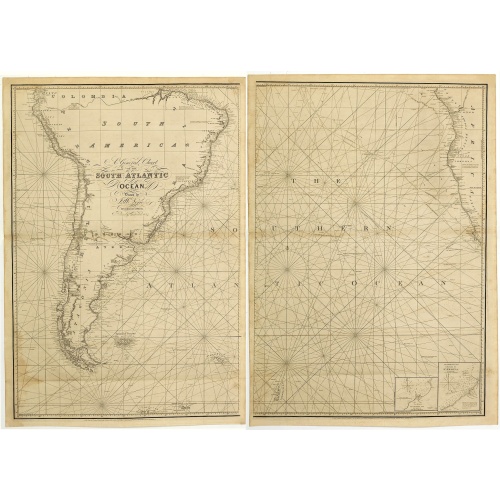
A general chart of the South Atlantic Ocean Drawn by J.W.Norie hydrographer. Revised & Corrected 1854.
BuyNow for $600
- Maker :
- NORIE, J.W.
- Place :
- London
- Date :
- 1854
- Color :
- Uncolored
- Height mm.:
- 925
- Width mm.:
- 1250
- Condition :
- Two unjointed plates. If joined 925 x 1250mm. Printed on heavy paper. Very dark impression.
- Bibliography :
- -
- Seller's ref. :
- 41655
This item is offered by Paulus_Swaen_Old_Maps
See other Items from this seller- Postage
-
Europe
$36 to France
- Select Country
- Zip/Post Code
- Quantity
$600
Description
A 2-sheet chart of the South Atlantic Ocean, showing the coast of South America from the mouth of the Amazon to Quito in Peru. The right hand part showing Africa's coast at Angola. Scale: circa 1:8,000,000. Chart of the South Atlantic, in two sheets. Two insets, Port of Ascension and Anchorage off N.W. side of St. Helena.
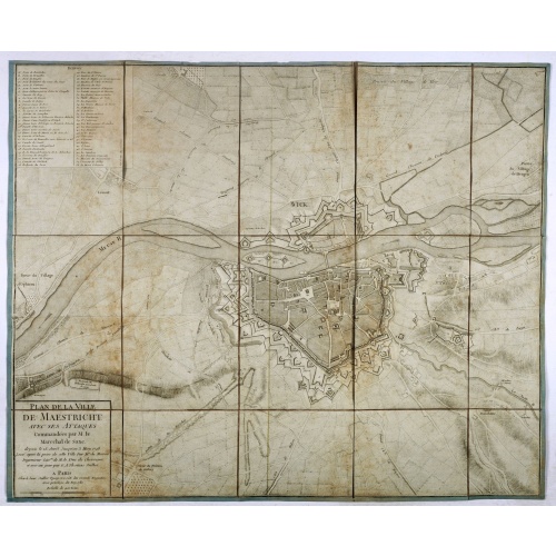
Plan de la ville de Maestricht avec ses attaques commandées par M. le maréchal de Saxe, depuis le 15 avril jusqu'au 3 may 1748 . . .
A plan of Maastricht rising after the capture of the city by the French troops led by the Marshal of Saxony. The city was besieged between 15 April and 3 May 1748, during the War of Succession of Austria.With numbered key (1-53).
$600
Maker : JAILLOT, J.
Place : Paris
Date : 1781
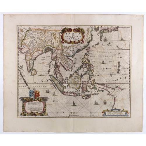
India quae Orientalis dicitur, et Insulae adiacentes.
A fine map of South East Asia, extending from India to Tibet to Japan to New Guinea. Formosa appears on this map, and even parts of Japan and Australia are seen. A handsome map in the typically baroque Dutch style.Noteworthy for being the second map to include the discoveries made in New Guinea and northern Queensland, Australia by the Dutch vessel Duyfken in 1605-06. Under the command of Willem Janzoon, the Duyfken explored the eastern shore of the Gulf of Carpentaria, just below the Cape York ...
$1.850
Maker : JANSSONIUS, J. / HONDIUS, H.
Place : Amsterdam
Date : 1640
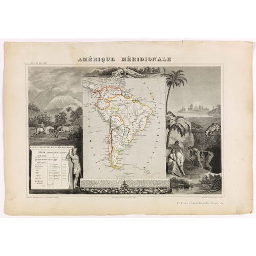
Amérique Méridionale.
Map of South America.Lovely map from one of the last decorative atlases of the nineteenth century.The rather simple map is framed by horses, Indians, jaguars, tapirs, and mining, as well as personifications of the rivers Amazon and La Plata at the top of the map. Victor Levasseur's "Atlas National Illustré" and "Atlas Universel Illustré" are among the last great decorative atlases published. This map comes from the Atlas National Illustré.
$90
Maker : LEVASSEUR, V.
Place : Paris, A. Combette
Date : 1852
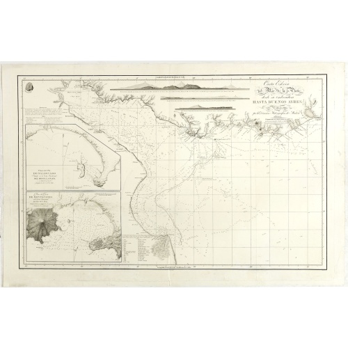
Carta esférica del Rio de la Plata : desde su embocadura hasta Buenos Aires.
Large nautical chart illustrating the estuary formed by the combination of the Uruguay River and the Paraná River. It forms part of the border between Argentina and Uruguay, with the major ports and capital cities of Buenos Aires in the southwest and Montevideo in the northeast.
$750
Maker : DIRECTION HIDROGRAFICA
Place : Madrid
Date : 1812-1838
Postage & Shipping
-
Item Location
Terms and conditions - Item Location
- 75013, Ile-de-France, France
- Ships To
- United States, United Kingdom, Albania, Argentina, Armenia, Australia, Azerbaijan, Bahamas, Belgium, Bermuda, Cambodia, Canada, Chile, China, Croatia, Cyprus, Czech Republic, Denmark, Estonia, Finland, France, Germany, Gibraltar, Greece, Greenland, Guatemala, Hong Kong, Iceland, India, Indonesia, Israel, Italy, Japan, Latvia, Lithuania, Luxembourg, Malta, Mexico, Monaco, Netherlands, Norway, Singapore, Spain, Sweden, Switzerland, Turkey
- Pick-ups
- No pick-ups
This item is owned and offered by the seller Paulus_Swaen_Old_Maps - All items are available for immediate sale, offered subject to prior sale.
Invoices are created by the seller by using our shopping cart or be prepared by the seller the day following the order and are emailed to you.
Items offeres by different sellers are invoiced separately.
Shipping fees are extra. The buyer is responsible for all applicable taxes, including any VAT, customs clearance, import duties, or equivalent costs arriving at the customer's home border. Payment is due on receipt of the invoice. The item(s) are shipped as soon as possible after receipt of your payment.
Before buying please read the complete Terms Conditions of Sale.
- Payment Methods
- Visa, Mastercard, Bank Transfer, American Express, iDEAL, PayPal, Google Pay
- Returns Accepted
- No
Post Message
Feel free to ask the seller a question. Please note that the seller could be located in an area with a different time zone. Our seller will do their best to respond within 24 hours.Post your message below.
Sign in to ask the seller a question.


