ID: 376
Open
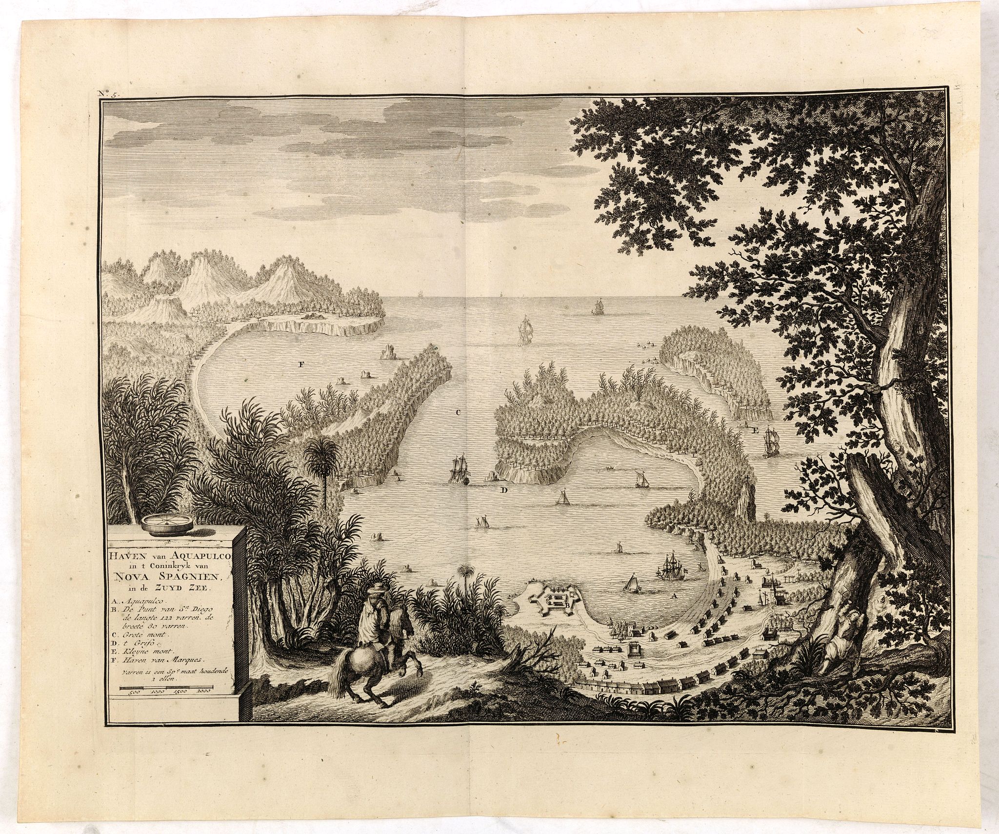
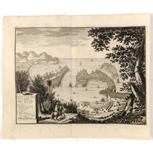
Haven van Aquapulco in ' Coninkryk van Nova Spagnien in de Zuyd Zee.
BuyNow for €650
- Maker :
- VALENTIJN, F.
- Place :
- Amsterdam
- Date :
- 1726
- Color :
- Uncoloured
- Height mm.:
- 260
- Width mm.:
- 350
- Condition :
- In very good to mint condition. With some vertical folds, as issued. Very good and dark impression.
- Bibliography :
- Landwehr (VOC), 467.1a (6).
- Seller's ref. :
- 35906
This item is offered by Librairie_Loeb-Larocque
See other Items from this seller- Postage
-
France
€15 to France
- Select Country
- Zip/Post Code
- Quantity
€650
Description
A finely engraved plan of the harbor, fort and village of Acapulco drawn from a hilltop vantage point looking out to sea. Several galleons are pictured approaching or anchored in the harbor. After Johannes Vingboons.
François Valentijn (1666-1727), a missionary, worked at Amboina from 1684 to 1694 and 1705 to 1713 and traveled extensively in the VOC's lands. He is best known for his monumental history and description, "Oud en Nieuw Oost-Indiën" which remains one of the most important primary sources for the East Indies and neighboring lands.
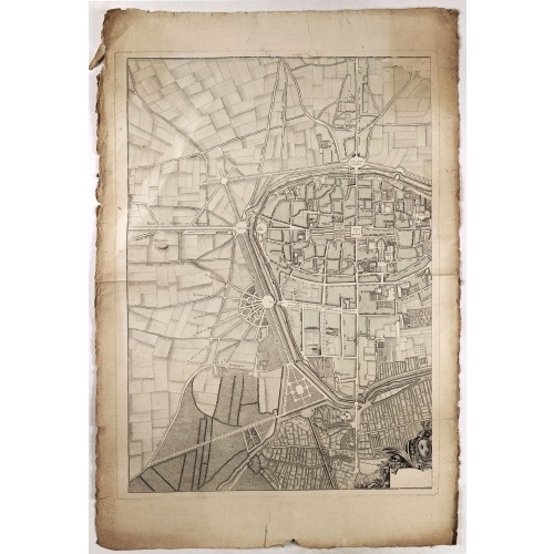
![[Les anciennes provinces Françaises à la ville de Saint Denis].](/uploads/cache/41681-500x500.jpg)
[Les anciennes provinces Françaises à la ville de Saint Denis].
Nine small chromolithography's trade cards for Ville de Saint Denis, each with French regions and places, with description in French on each verso.Cards of the regions : Bretagne, L'Angoumois, Ile de France, Anjou, Limousin, Picardie, Provence, Savoie, Poitou.
€80
Maker : H. LAAS / PECAUD / CIE PARIS
Place : Paris
Date : ca. 1900
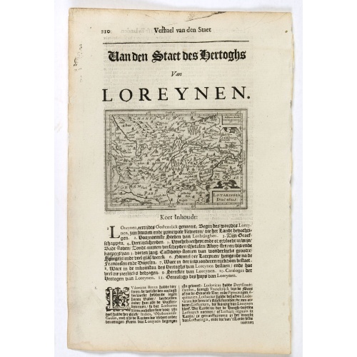
Lotaringia Ducatus.
Small map of Lorraine, oriented with West on top and surrounded by text in Dutch. Nicolaes de Clerck (de Klerc) was active as an engraver and publisher in Delft from 1599-1621.Included in the rare book : Wereld Spiegel, waer in vertoontword de Beschryvinge der Rijken Staten, ende vorstendommen des gantsen Aerdbodems… which was a Dutch translation of "Les estats, empires et principautez de monde" by Pierre Davity.The map is engraved by Jodocus Hondius before 1616 and first published in Petrus ...
€75
Maker : DE CLERCK, N.
Place : Amsterdam, Cloppenburch
Date : 1621
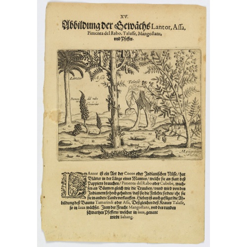
Plants Lantor, Assa, Pimenta, Mangostan and Pepper.
Lantor is a kind of coconut palm (or Indian nut) with fronds as long as a human body. These fronds are used as paper. Pimenta del Rabo (or cubebe) grows grape-like on trees and is held in such esteem by the Indians that they cook and preserve them, rather than sell them to other countries. Also shown is the Tamarind tree or Assa, the plant Talasse grows in Java, and the Mangostan fruit and the black pepper is called ‘Sahang’ in Java.Theodore de Bry, a German engraver and book dealer, began a...
€80
Maker : DE BRY, Th.
Place : Frankfurt
Date : 1598
Postage & Shipping
-
Item Location
Terms and conditions - Item Location
- 75013, Ile-de-France, France
- Ships To
- United States, United Kingdom, Albania, Argentina, Armenia, Australia, Austria, Bahamas, Belgium, Bermuda, Bosnia and Herzegowina, Brazil, Bulgaria, Canada, Chile, China, Costa Rica, Denmark, Dominica, Egypt, El Salvador, Finland, France, Germany, Greece, Guatemala, Hong Kong, Hungary, Iceland, India, Italy, Japan, Korea (South), Kuwait, Liechtenstein, Lithuania, Luxembourg, Madagascar, Mexico, Monaco, Morocco, Netherlands, Netherlands Antilles, New Zealand, Norway, Paraguay, Peru, Philippines, Poland, Portugal, Qatar, Reunion, Romania, San Marino, Saudi Arabia, Seychelles, Singapore, Slovenia, South Africa, Spain, Sri Lanka, Suriname, Sweden, Switzerland, Taiwan, Thailand, Tunisia, Turkey, United Arab Emirates, Uruguay, Vietnam
- Pick-ups
- No pick-ups
This item is owned and offered by the seller Librairie_Loeb-Larocque - All items are available for immediate sale, offered subject to prior sale.
Invoices are created by the seller by using our shopping cart or be prepared by the seller the day following the order and are emailed to you.
Items offeres by different sellers are invoiced separately.
Shipping fees are extra. The buyer is responsible for all applicable taxes, including any VAT, customs clearance, import duties, or equivalent costs arriving at the customer's home border. Payment is due on receipt of the invoice. The item(s) are shipped as soon as possible after receipt of your payment.
Before buying please read the complete Terms Conditions of Sale.
- Payment Methods
- Visa, Mastercard, Bank Transfer, American Express, iDEAL, PayPal, Google Pay
- Returns Accepted
- No
Post Message
Feel free to ask the seller a question. Please note that the seller could be located in an area with a different time zone. Our seller will do their best to respond within 24 hours.Post your message below.
Sign in to ask the seller a question.