
ID: 160
Open
Listing ID: #465 has been added to your wishlist.
.jpg)
Virulus marinus. Cete (Whale and whaling scene)
BuyNow for $300
- Maker :
- COLLAERT, Adriaen (after)
- Place :
- Antwerp
- Date :
- after 1598
- Color :
- Uncoloured
- Height mm.:
- 125
- Width mm.:
- 183
- Condition :
- Good impression, large margins.
- Bibliography :
- -
- Seller's ref. :
- 63621
This item is offered by Paulus_Swaen_Old_Maps
See other Items from this seller- Postage
-
Europe
$34 to Netherlands
- Select Country
- Zip/Post Code
- Quantity
$300
Description
Whale and whaling scene, set against a mountainous landscape in the manner of Pieter Brueghel the Elder. Plate number 1. The engraving is copied after Adrian Collaert plate in "Piscium Vivæ Icones" a series first published in Antwerp by Adriaen Collaert after 1598, later published between 1627 and 1677 by Galle family. Several copies were made of this series.Most of the ships in the background were copied from a series of ten prints known as the Sailing Vessels, executed by Frans Huys after designs by Pieter Brueghel the Elder.
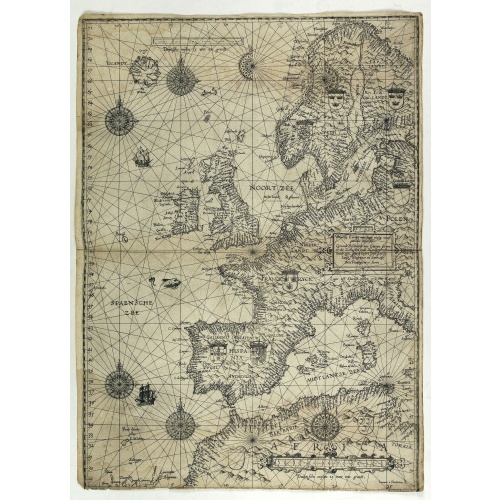
Universe Europae Maritime Eiusque Navigationis Descriptio. Generale Pascaerte van Europa . . .
This general chart of north-western Europe and the surrounding coastal waters is from the rare pilot-guide De Spiegel der Zeevaerdt , printed by Christopher Plantin in Leyden.FIRST PLATE AND FIRST STATE, which appeared in the first 3 editions, before Latin names of some seas and inscriptions in the scale bars were added. (editions 4-12). EXTREMELY RARE.The map's title is given in both Latin and Dutch, with the latter attributing it to Waghenaer and nothing a privilege of ten years. The date 1583...
$25.000
Maker : WAGHENAER, L.J.
Place : Leyden
Date : 1584
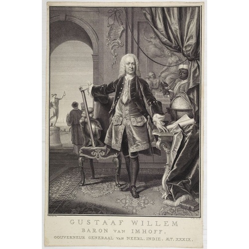
Gustaaf Willem Baron van Imhoff.
Decorative portrait of Gustaaf Willem Baron van Imhoff, who was Governor for the V.O.C. (Dutch East Indian Company) in Indonesia.
$750
Maker : TANJÉ, P.
Place : Amsterdam
Date : 1745
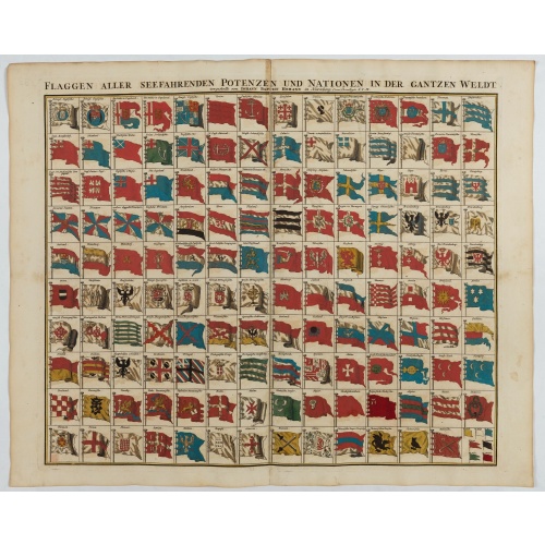
Flaggen aller seefahrenden potenzen und nationen…
A highly decorative and beautiful print with 139 flags of the sea-faring nations, factions, and trading companies. Among the more interesting flags are those of the Dutch West India Company (G.WC. /Geoctroyeerde Westindische Compagnie) and the Dutch East India Company (V.O.C. / Vereenigde Oostindische Compagnie). This plate is probably derived from a Dutch flag print issued by Cornelis Danckerts c. 1700.
$1.000
Maker : HOMANN, J.B.
Place : Nuremberg
Date : 1750
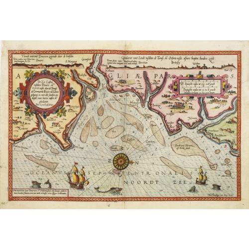
De zee cuften tufschen Dovere en Orfords nesse, daer de Teemse de Vermaerde Rivire van Lonen gelegens is. . .
A detailed chart of the English Channel coastland. Decorated by a colorful title cartouche and scale cartouche, one compass rose, several vessels and sea monsters. A very early edition rare Dutch text edition of this landmark contribution to the science of navigation. Waghenaer's own personal experiences as a pilot along European coasts were used to compile the Spiegel der Zeevaerdt, the first edition of which was published in Dutch at Leyden in 1584/85 by the House of Plantin. Although advertis...
$3.000
Maker : WAGHENAER, L. J.
Place : Leiden, Plantijn
Date : 1585
Postage & Shipping
-
Item Location
Terms and conditions - Item Location
- Amsterdam, , Netherlands
- Ships To
- United States, United Kingdom, Albania, Argentina, Armenia, Australia, Azerbaijan, Bahamas, Belgium, Bermuda, Cambodia, Canada, Chile, China, Croatia, Cyprus, Czech Republic, Denmark, Estonia, Finland, France, Germany, Gibraltar, Greece, Greenland, Guatemala, Hong Kong, Iceland, India, Indonesia, Israel, Italy, Japan, Latvia, Lithuania, Luxembourg, Malta, Mexico, Monaco, Netherlands, Norway, Singapore, Spain, Sweden, Switzerland, Turkey
- Pick-ups
- No pick-ups
This item is owned and offered by the seller Paulus_Swaen_Old_Maps - All items are available for immediate sale, offered subject to prior sale.
Invoices are created by the seller by using our shopping cart or be prepared by the seller the day following the order and are emailed to you.
Items offeres by different sellers are invoiced separately.
Shipping fees are extra. The buyer is responsible for all applicable taxes, including any VAT, customs clearance, import duties, or equivalent costs arriving at the customer's home border. Payment is due on receipt of the invoice. The item(s) are shipped as soon as possible after receipt of your payment.
Before buying please read the complete Terms Conditions of Sale.
- Payment Methods
- Visa, Mastercard, Bank Transfer, Direct Debit, American Express, iDEAL, PayPal
- Returns Accepted
- No
Post Message
Feel free to ask the seller a question. Please note that the seller could be located in an area with a different time zone. Our seller will do their best to respond within 24 hours.Post your message below.
Sign in to ask the seller a question.
-500x500.jpg)
![[Spanish take over Cusco] / [Atahualpa is garrotted].](/uploads/cache/41092-500x500.jpg)
![De Sota meets the Inca king near Cajamarca.]](/uploads/cache/40485-500x500.jpg)
![[Captain Weert dines with the Chief].](/uploads/cache/39922-500x500.jpg)