ID: 224
Open
Listing ID: #224 has been added to your wishlist.
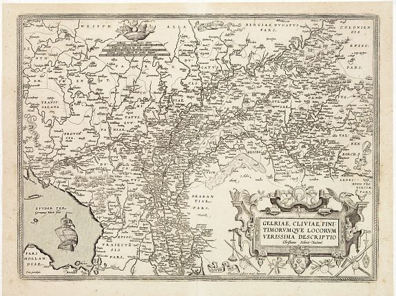
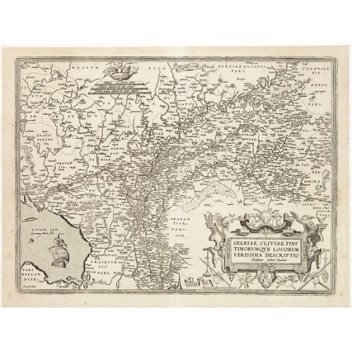
Gelriae, Cliviae, Finitimorumque Locorum Verissima Descriptio.
BuyNow for $1.250
- Maker :
- ORTELIUS, A. / GALLE, TH.
- Place :
- Antwerp
- Date :
- after 1612
- Color :
- Uncoloured
- Height mm.:
- 372
- Width mm.:
- 502
- Condition :
- A good and dark impression. Slight age toning of the paper. Light marginal discoloration. Some foxing in the corners.
- Bibliography :
- Broecke, Ortelius 61.4
- Seller's ref. :
- 23538
This item is offered by Paulus_Swaen_Old_Maps
See other Items from this seller- Postage
-
Standard Shipping
$0 to France
- Select Country
- Zip/Post Code
- Quantity
$1.250
Description
From the very rare Galle edition of the Ortelius Atlas, published after 1612.Fine map of Geldria and Limburg, prepared by Christian s'Grooten. Very fine title cartouche lower right with artist brushes and palettes as well as an owl gazing in a round mirror.
East to the top.
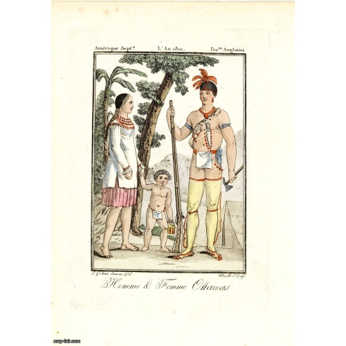
Homme & Femme Ottawas.
Hand-colored mezzotint of Native Americans engraved by Félix Mixelle and Lachaussée Jeune after Jacques Grasset de Saint-Sauveur.As an etcher, drawer and writer, Grasset de Saint-Sauveur was a prolific polygraph in keeping with the encyclopedic spirit of the eighteenth century: he wrote exotic novels as well as documentary works on various subjects. Called by one of his biographers a drawer without genius but a good example of the taste of his time, Grasset de Saint-Sauveur was literally bewit...
$75
Maker : GRASSET DE SAINT SAUVEUR,J.
Place : Paris,
Date : 1806
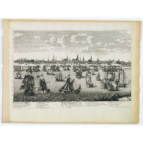
Amsterdam Ville du comté de Hollande. . .
A very decorative and very rare town view of Amsterdam, including a numbered key ( A- T) in the lower part. Engraved by Pierre-Alexandre Aveline. With the signature "Aveline avec privil. du Roy" in the lower right margin. Pierre Aveline (Paris, c.1656 - 23 May 1722), was an engraver, print-publisher and print-seller. He probably trained with Adam Pérelle and specialized in topographical representations like him. He engraved in suites many views of Paris and of provincial, European and African c...
$500
Maker : AVELINE, P.A.
Place : Paris
Date : 1692
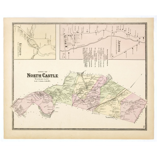
Town of North Castle.
Fine lithographed map of the town of North Castle. The map provides the names of specific homeowners, as well as information about the occupations and physical locations of the various tradesmen in each village from Beer's famous county atlas "Atlas of New York and vicinity, a documentary record of nineteenth-century life and delightful specimens of American folk art." F. W. Beers, along with other members of his family, were among the leading county atlas publishers in the period immediately fo...
$90
Maker : DE BEERS, F.W.
Place : New York
Date : 1867
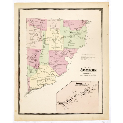
Town of Somers.
Fine lithographed map of the town of Somers. The map provides the names of specific homeowners, as well as information about the occupations and physical locations of the various tradesmen in each village from Beer's famous county atlas "Atlas of New York and vicinity," "a documentary record of nineteenth-century life and delightful specimens of American folk art." F. W. Beers, along with other members of his family, were among the leading county atlas publishers in the period immediately follo...
$90
Maker : DE BEERS, F.W.
Place : New York
Date : 1867
Postage & Shipping
-
Item Location
Terms and conditions - Item Location
- 75013, Ile-de-France, France
- Ships To
- United States, United Kingdom, Albania, Argentina, Armenia, Australia, Azerbaijan, Bahamas, Belgium, Bermuda, Cambodia, Canada, Chile, China, Croatia, Cyprus, Czech Republic, Denmark, Estonia, Finland, France, Germany, Gibraltar, Greece, Greenland, Guatemala, Hong Kong, Iceland, India, Indonesia, Israel, Italy, Japan, Latvia, Lithuania, Luxembourg, Malta, Mexico, Monaco, Netherlands, Norway, Singapore, Spain, Sweden, Switzerland, Turkey
- Pick-ups
- No pick-ups
This item is owned and offered by the seller Paulus_Swaen_Old_Maps - All items are available for immediate sale, offered subject to prior sale.
Invoices are created by the seller by using our shopping cart or be prepared by the seller the day following the order and are emailed to you.
Items offeres by different sellers are invoiced separately.
Shipping fees are extra. The buyer is responsible for all applicable taxes, including any VAT, customs clearance, import duties, or equivalent costs arriving at the customer's home border. Payment is due on receipt of the invoice. The item(s) are shipped as soon as possible after receipt of your payment.
Before buying please read the complete Terms Conditions of Sale.
- Payment Methods
- Visa, Mastercard, Bank Transfer, iDEAL, PayPal
- Returns Accepted
- No
Post Message
Feel free to ask the seller a question. Please note that the seller could be located in an area with a different time zone. Our seller will do their best to respond within 24 hours.Post your message below.
Sign in to ask the seller a question.