
ID: 357
Open
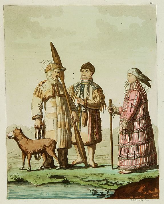
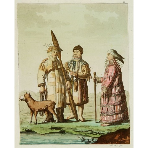
Les Aleuts.
BuyNow for €50
- Maker :
- FERRARIO, G.
- Place :
- Milan
- Date :
- 1827
- Color :
- In original color
- Height mm.:
- 155
- Width mm.:
- 200
- Condition :
- color aquatint. In very good condition. Nice margins for framing.
- Bibliography :
- -
- Seller's ref. :
- 16291
This item is offered by Librairie_Loeb-Larocque
See other Items from this seller- Postage
-
France
€15 to France
- Select Country
- Zip/Post Code
- Quantity
€50
Description
From Giulio Ferrario's work Le Costume ancien et moderne ou histoire du gouvernement, de la milice, de la religion, des arts, etc. published in Milan by the author between 1816 and 1827.This aquatint engraved plate was color printed on fine wove paper of a soft aged white color, bearing the embossed seal of authenticity impressed at the time of publication with the legend "Il Costume Antico E Moderno" surrounding the initials GF.
A beautifully hand colored aquatint with additional hand-coloring.
The Aleut people are the native inhabitants of the Aleutian Islands, the southwestern part of the Alaskan peninsula and the off-shore islands of Shumagin. Since the beginning of the 19th century there have been resettled Aleuts living on Commander Islands (Bering and Mednyi) which are under Soviet jurisdiction. The Aleut District in the Kamchatka Region was established in 1932. In 1969 the Aleuts of those two islands were gathered to live in Nikolskoye, Bering Island.
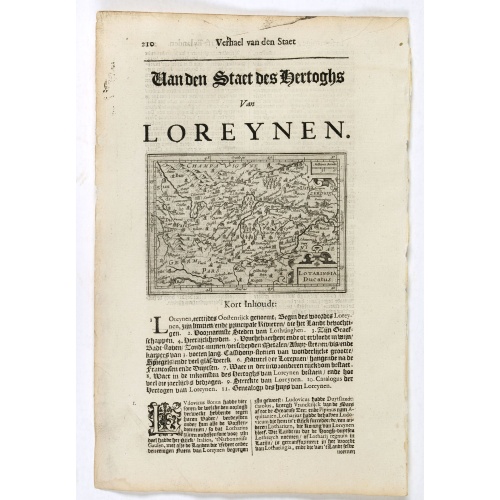
Lotaringia Ducatus.
Small map of Lorraine, oriented with West on top and surrounded by text in Dutch. Nicolaes de Clerck (de Klerc) was active as an engraver and publisher in Delft from 1599-1621.Included in the rare book : Wereld Spiegel, waer in vertoontword de Beschryvinge der Rijken Staten, ende vorstendommen des gantsen Aerdbodems… which was a Dutch translation of "Les estats, empires et principautez de monde" by Pierre Davity.The map is engraved by Jodocus Hondius before 1616 and first published in Petrus ...
€75
Maker : DE CLERCK, N.
Place : Amsterdam, Cloppenburch
Date : 1621
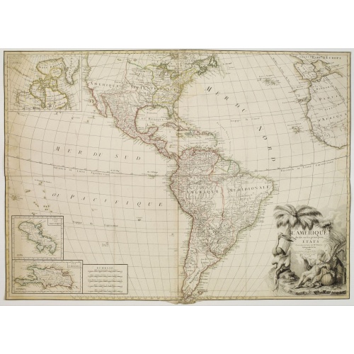
L'Amérique divisée en ses principaux Etats Dressée d'après les Cartes de Mr. Bonne
Rare, wall map of America in 2 sheets, after R. Bonne. With 3 inset maps of Hispaniola, Martinique and Hudson Bay. Beautiful title cartouche depicting a Native American leaning on a shell, under a palm tree, the figure is surrounded by typical elements of the flora and fauna of the continent as a beaver and 2 pelicans.
€5.500
Maker : BONNE, R. / LATTRÉ, J.
Place : Paris
Date : 1788
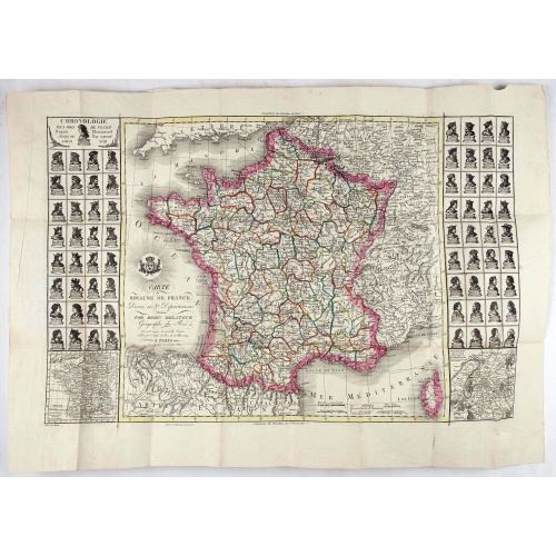
Carte du royaume de France divisé en 87 départemens / dressée par Brion de la Tour..., où sont tracées les nouvelles limites fixées par le traité de paix du 30 mai 1814. . .
Very decorative and uncommon map of France, with Corsica prepared by Brion de la Tour showing the new border set by the Peace Treaty of May 30, 1814. Engraved by Chaumier. The map is bordered by French Kings up to Louis XVIII.The Treaty of Paris was made between representatives of the allies and France following the restoration of Louis XVIII. The terms towards France were relatively lenient to assist the Bourbon restoration, although provisions were made for a strengthening of the states border...
€750
Maker : DESNOS/ BRION DE LA TOUR.
Place : Paris
Date : ca. 1814
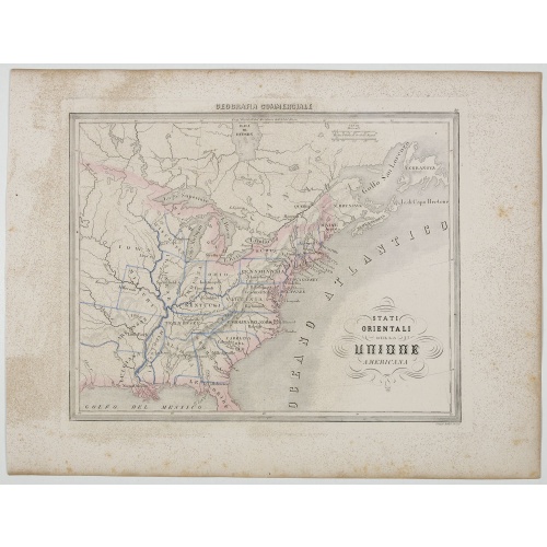
Stati Orientali della Unione Americana.
Uncommon map of Northeastern America prepared by Francesco Costantino Marmocchi. Above the map "Geografia Commerciale". From "Il Globo Atlante di carte Geografiche compilate da F.C. Marmocchi per servire di corredo al suu corso di geografia commerciale", with the maps engraved by engraved by Gius. Cattaneo, Campo Antico, C. Poggiali, G. Bonatti, and Ces. Magrini.Marmocchi (Poggibonsi, 1805-Geneva, 1858) was known as a geographer and cartographer. He emigrated to Rome, and later to Corsica, later...
€50
Maker : MARMOCCHI, F.C.
Place : Genova, Paolo Rivara fu Giacomo
Date : 1858
Postage & Shipping
-
Item Location
Terms and conditions - Item Location
- 75013, Alsace, France
- Ships To
- United States, United Kingdom, Albania, Argentina, Armenia, Australia, Austria, Bahamas, Belgium, Bermuda, Bosnia and Herzegowina, Brazil, Bulgaria, Canada, Chile, China, Costa Rica, Denmark, Dominica, Egypt, El Salvador, Finland, France, Germany, Greece, Guatemala, Hong Kong, Hungary, Iceland, India, Italy, Japan, Korea (South), Kuwait, Liechtenstein, Lithuania, Luxembourg, Madagascar, Mexico, Monaco, Morocco, Netherlands, Netherlands Antilles, New Zealand, Norway, Paraguay, Peru, Philippines, Poland, Portugal, Qatar, Reunion, Romania, San Marino, Saudi Arabia, Seychelles, Singapore, Slovenia, South Africa, Spain, Sri Lanka, Suriname, Sweden, Switzerland, Taiwan, Thailand, Tunisia, Turkey, United Arab Emirates, Uruguay, Vietnam
- Pick-ups
- No pick-ups
This item is owned and offered by the seller Librairie_Loeb-Larocque - All items are available for immediate sale, offered subject to prior sale.
Invoices are created by the seller by using our shopping cart or be prepared by the seller the day following the order and are emailed to you.
Items offeres by different sellers are invoiced separately.
Shipping fees are extra. The buyer is responsible for all applicable taxes, including any VAT, customs clearance, import duties, or equivalent costs arriving at the customer's home border. Payment is due on receipt of the invoice. The item(s) are shipped as soon as possible after receipt of your payment.
Before buying please read the complete Terms Conditions of Sale.
- Payment Methods
- Visa, Mastercard, Bank Transfer, American Express, iDEAL, PayPal, Google Pay
- Returns Accepted
- No
Post Message
Feel free to ask the seller a question. Please note that the seller could be located in an area with a different time zone. Our seller will do their best to respond within 24 hours.Post your message below.
Sign in to ask the seller a question.
![[Upper sheet map only] The Provinces New York, and New Jersey with part of Pensilvania and the Province of Quebec.](/uploads/cache/25624-500x500.jpg)