ID: 410
Open
Listing ID: #483 has been added to your wishlist.
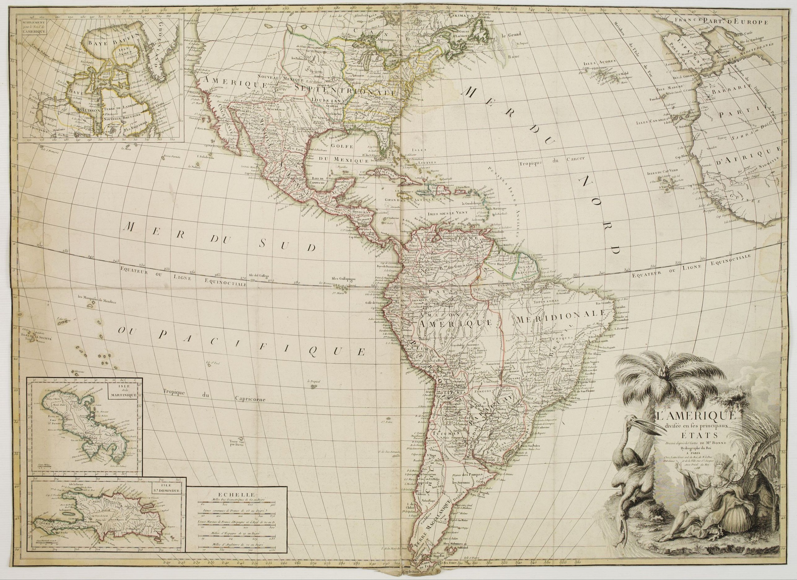
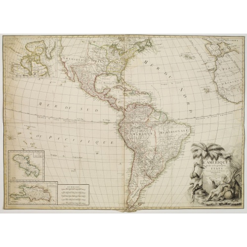
L'Amérique divisée en ses principaux Etats Dressée d'après les Cartes de Mr. Bonne
BuyNow for €5.500
- Maker :
- BONNE, R. / LATTRÉ, J.
- Place :
- Paris
- Date :
- 1788
- Color :
- In original outline colors
- Height mm.:
- 735
- Width mm.:
- 1005
- Condition :
- Some water stains, margins cut close to the plate mark, traces of creases, and a small tear in the lower part affecting ''Tierra del Fuego''.
- Bibliography :
- Not found in any reference book.
- Seller's ref. :
- 62081
This item is offered by Librairie_Loeb-Larocque
See other Items from this seller- Postage
-
Standard Shipping
€0 to France
- Select Country
- Zip/Post Code
- Quantity
€5.500
Description
Rare, wall map of America in 2 sheets, after R. Bonne. With 3 inset maps of Hispaniola, Martinique and Hudson Bay. Beautiful title cartouche depicting a Native American leaning on a shell, under a palm tree, the figure is surrounded by typical elements of the flora and fauna of the continent as a beaver and 2 pelicans.-500x500.jpg)
TOMBEAU DU DUC DE BREZE, DANS LA CATHEDRALE DE ROUEN. Dessiné d'après nature par Chapuy. Lith. par Monthelier. Fig. par Bayot.
Original lithography of the tomb of the duke of Brézé, in the cathedral of Rouen. Lithographed by Jules Monthelier (1801-1883) and Adolphe-Jean-Baptist Bayot (Alessandria 1810 - 1866) after a design by Chapuy and printed in Paris by Lemercier, Bernard Cie.
€50
Maker : CHAPUY
Place : Paris
Date : 1844
![Ancienne Gavle. [de l'Europe]](/uploads/cache/38440-500x500.jpg)
Ancienne Gavle. [de l'Europe]
A fine and uncommon early 17th century map of France.From the French text edition of "Description d'Univers", 1683. by Allain Manneson Mallet (1630-1706), a well travelled military engineer and geographer who worked in 17th century France under King Louis XIV.
€50
Maker : MALLET, A.M.
Place : Paris
Date : 1683

Mappa geographica Provinciæ Nova Eboraci ab Anglis New-York . . .
Lower part of the two sheets map of Homann Heirs' edition of Sauthier's celebrated map of New York and New Jersey, made during the Revolutionary War. Appears in Homann's Atlas geographicvs maior. 1759-[1784].
€750
Maker : HOMANN HEIRS.
Place : Nuremburg
Date : 1778
![[The strange sheep-like creatures that carried the silver .]](/uploads/cache/40481-500x500.jpg)
[The strange sheep-like creatures that carried the silver .]
When the Spanish discovered the silver mines of Potosí, they organised the transport of the rich ore westward by llama trains across the Altiplano and down to Arica on the coast, where it would be transported by ship to Panama. These strange creatures would sit down when angered or overburdened and, neither beatings nor kind words would make the animals get up again. If any of them ran away, they had to be shot to recover their valuable cargo.In 1631, Johann Ludwig Gottfried inherited Theodor D...
€80
Maker : GOTTFRIED, J.L. / DE BRY.
Place : Frankfurt, M.Merian, 1633
Date : 1633
Postage & Shipping
-
Item Location
Terms and conditions - Item Location
- 75013, Ile-de-France, France
- Ships To
- United States, United Kingdom, Albania, Argentina, Armenia, Australia, Austria, Bahamas, Belgium, Bermuda, Bosnia and Herzegowina, Brazil, Bulgaria, Canada, Chile, China, Costa Rica, Denmark, Dominica, Egypt, El Salvador, Finland, France, Germany, Greece, Guatemala, Hong Kong, Hungary, Iceland, India, Italy, Japan, Korea (South), Kuwait, Liechtenstein, Lithuania, Luxembourg, Madagascar, Mexico, Monaco, Morocco, Netherlands, Netherlands Antilles, New Zealand, Norway, Paraguay, Peru, Philippines, Poland, Portugal, Qatar, Reunion, Romania, San Marino, Saudi Arabia, Seychelles, Singapore, Slovenia, South Africa, Spain, Sri Lanka, Suriname, Sweden, Switzerland, Taiwan, Thailand, Tunisia, Turkey, United Arab Emirates, Uruguay, Vietnam
- Pick-ups
- Buyer can pick-up
This item is owned and offered by the seller Librairie_Loeb-Larocque - All items are available for immediate sale, offered subject to prior sale.
Invoices are created by the seller by using our shopping cart or be prepared by the seller the day following the order and are emailed to you.
Items offeres by different sellers are invoiced separately.
Shipping fees are extra. The buyer is responsible for all applicable taxes, including any VAT, customs clearance, import duties, or equivalent costs arriving at the customer's home border. Payment is due on receipt of the invoice. The item(s) are shipped as soon as possible after receipt of your payment.
Before buying please read the complete Terms Conditions of Sale.
- Payment Methods
- Visa, Mastercard, Bank Transfer, American Express, iDEAL, PayPal, Google Pay
- Returns Accepted
- No
Post Message
Feel free to ask the seller a question. Please note that the seller could be located in an area with a different time zone. Our seller will do their best to respond within 24 hours.Post your message below.
Sign in to ask the seller a question.