ID: 365
Open
Listing ID: #390 has been added to your wishlist.
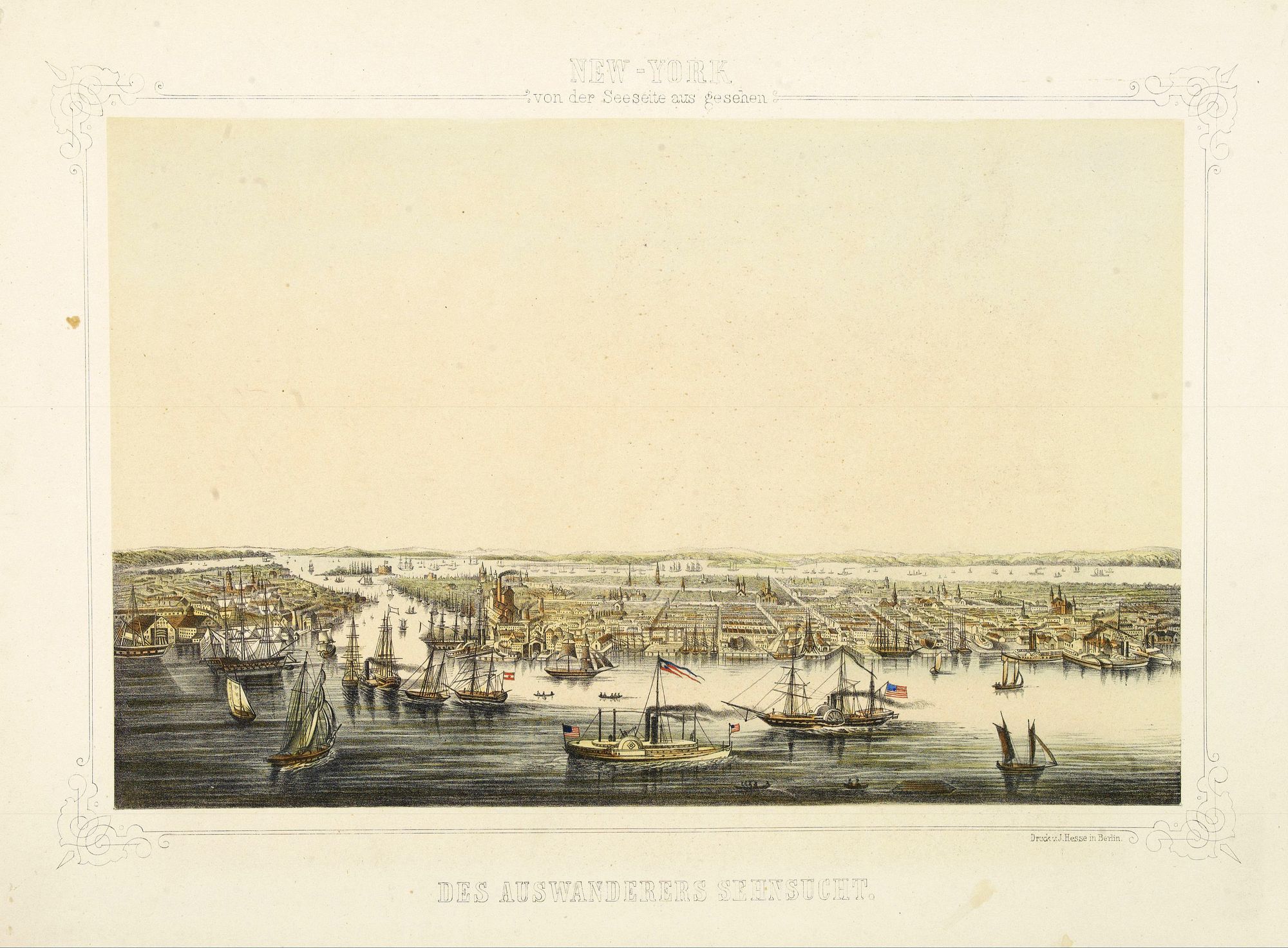
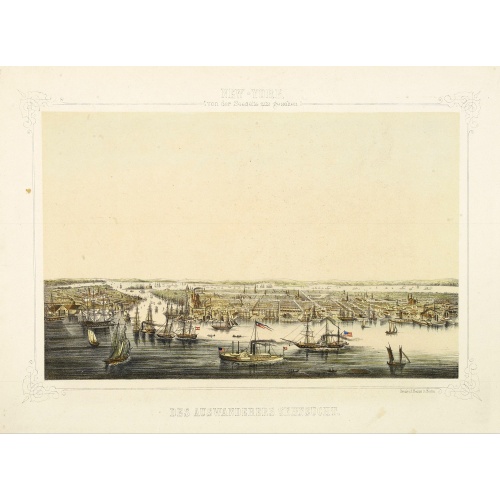
New York von der Seeseite aus gesehen.
BuyNow for €700
- Maker :
- HESSE, J.
- Place :
- Berlin
- Date :
- c. 1850
- Color :
- In original color
- Height mm.:
- 235
- Width mm.:
- 365
- Condition :
- Original hand colored lithography printed on tinted ground.
- Bibliography :
- Thieme-B.XVI 592.
- Seller's ref. :
- 01556
This item is offered by Librairie_Loeb-Larocque
See other Items from this seller- Postage
-
France
€15 to France
- Select Country
- Zip/Post Code
- Quantity
€700
Description
Very decorate view of New-York. J.Hesse was known as a portrait painter and publisher of lithographs. A long panorama of the shoreline from the sea, with sailing vessels and American steamships in the busy port.
Europa recens descripta à Guilielmo Blaeuw.
On either side columns depicting the manner of dress in the major countries of Europe, surmounted by nine city views and plans.For European mapmakers their own continent contained few mysteries or secrets by the seventeenth century. However, the mythical island of Frisland still appears between Iceland and Greenland. The map is decorated with ships and a sea monster on the sea, bears on northern Russia, and lions on North Africa.
€3.250
Maker : BLAEU, W.
Place : Amsterdam
Date : 1644
![[Upper sheet map only] The Provinces New York, and New Jersey with part of Pensilvania and the Province of Quebec.](/uploads/cache/25624-500x500.jpg)
[Upper sheet map only] The Provinces New York, and New Jersey with part of Pensilvania and the Province of Quebec.
Rare separately issued map, unfortunately only the upper part of the map. It is a variant of this important colonial map. The upper sheet showing the upper course of the St. Lawrence River. With 3 large insets: 1) A Chart of the Mouth of Hudson's River from Sandy Hook to New York. This is in effect a chart of New York Harbor, with depth soundings, shoals, and other marine information laid down. 2) A Plan of Amboy. The city of Perth Amboy, the old capital of New Jersey, and the most important por...
€750
Maker : HOLLAND, S./ BROENNER, H.L.
Place : Frankfurt
Date : 1777
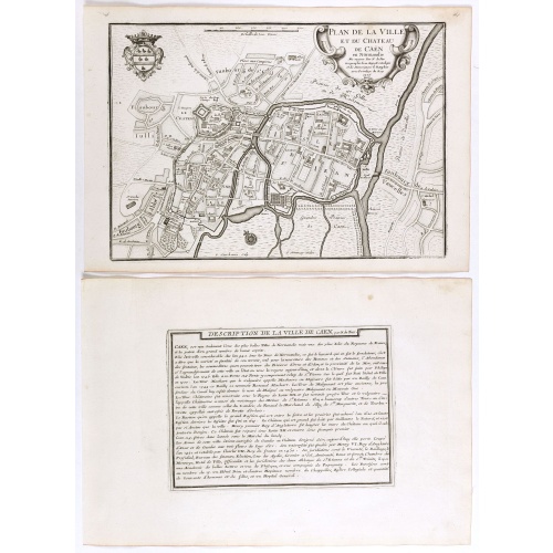
Plan de la ville et du château de Caën en Normandie.
Plan of the city of Caen, from Nicolas de Fer's "L'Atlas curieux ou le Monde réprésente dans des cartes. "The "Atlas Curieux" is a geographic encyclopedia of images and a celebration of the French Empire under the Sun King, with maps of French possessions in the western hemisphere, maps of France, with detailed views of the grand waterworks at Marly, views of the great palaces and chateaux, views and plans of the Paris Observatory, and samples of military architecture. Issued in six annual par...
€60
Maker : DE FER, N.
Place : Paris, 1705
Date : 1705
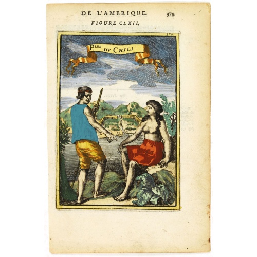
P.les du Chile.
A charming copper engraving depicting a town surrounded by a luxuriant landscape on the background and a couple of indigenous on the foreground.From the French text edition of Description d'Univers, 1683. by Allain Manneson Mallet (1630-1706), a well traveled military engineer and geographer who worked in 17th century France under King Louis XIV.
€60
Maker : MALLET, A.M.
Place : Paris
Date : 1683
Postage & Shipping
-
Item Location
Terms and conditions - Item Location
- 75013, Ile-de-France, France
- Ships To
- United States, United Kingdom, Albania, Argentina, Armenia, Australia, Austria, Bahamas, Belgium, Bermuda, Bosnia and Herzegowina, Brazil, Bulgaria, Canada, Chile, China, Costa Rica, Denmark, Dominica, Egypt, El Salvador, Finland, France, Germany, Greece, Guatemala, Hong Kong, Hungary, Iceland, India, Italy, Japan, Korea (South), Kuwait, Liechtenstein, Lithuania, Luxembourg, Madagascar, Mexico, Monaco, Morocco, Netherlands, Netherlands Antilles, New Zealand, Norway, Paraguay, Peru, Philippines, Poland, Portugal, Qatar, Reunion, Romania, San Marino, Saudi Arabia, Seychelles, Singapore, Slovenia, South Africa, Spain, Sri Lanka, Suriname, Sweden, Switzerland, Taiwan, Thailand, Tunisia, Turkey, United Arab Emirates, Uruguay, Vietnam
- Pick-ups
- No pick-ups
This item is owned and offered by the seller Librairie_Loeb-Larocque - All items are available for immediate sale, offered subject to prior sale.
Invoices are created by the seller by using our shopping cart or be prepared by the seller the day following the order and are emailed to you.
Items offeres by different sellers are invoiced separately.
Shipping fees are extra. The buyer is responsible for all applicable taxes, including any VAT, customs clearance, import duties, or equivalent costs arriving at the customer's home border. Payment is due on receipt of the invoice. The item(s) are shipped as soon as possible after receipt of your payment.
Before buying please read the complete Terms Conditions of Sale.
- Payment Methods
- Visa, Mastercard, Bank Transfer, American Express, iDEAL, PayPal, Google Pay
- Returns Accepted
- No
Post Message
Feel free to ask the seller a question. Please note that the seller could be located in an area with a different time zone. Our seller will do their best to respond within 24 hours.Post your message below.
Sign in to ask the seller a question.
![Cordelirs in Franckr. [France].](/uploads/cache/13799-500x500.jpg)