ID: 400
Open
Listing ID: #400 has been added to your wishlist.
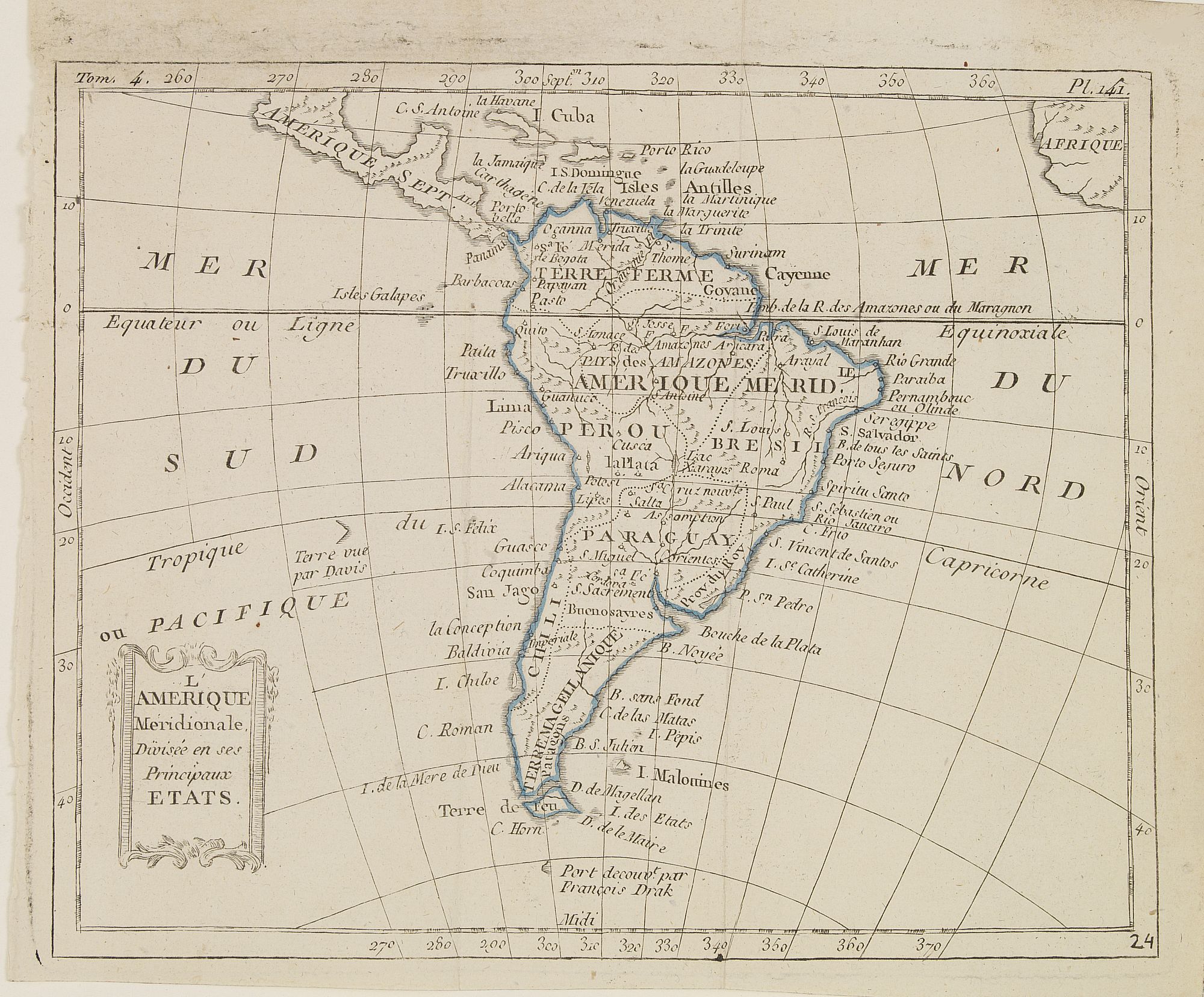
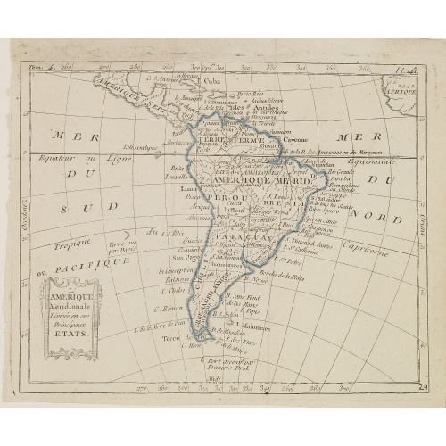
L'Amérique Méridionale, Divisée en ses Principaux Etats.
BuyNow for €60
- Maker :
- DELAPORTE, L'Abbé.
- Place :
- Paris, Prudhomme, Levrault, Debray
- Date :
- 1806
- Color :
- In original outline colors
- Height mm.:
- 178
- Width mm.:
- 220
- Condition :
- Two vertical folds as issued. Left margin cut close to border frame. Else good condition.
- Bibliography :
- -
- Seller's ref. :
- 24400
This item is offered by Librairie_Loeb-Larocque
See other Items from this seller- Postage
-
France
€15 to France
- Select Country
- Zip/Post Code
- Quantity
€60
Description
Map of South America, from Atlas de la Géographie de toutes les parties du monde .. Ouvrage destiné pour l'education, et nécessaire aux négocians, aux voyageurs, aux fonctionnaires publics, aux banquiers, aux agens de change, aux littérateurs, etc..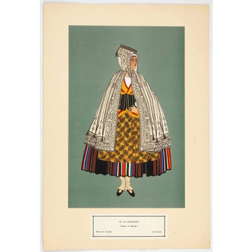
Femme de Barèges (106, La Gascogne).
Plate published in "Les costumes régionaux de France" with illustrations by Gratiane de Gardilanne (painter and designer) and Elisabeth Whitney Moffat.Costume plate printed in collotype, pochoir and retouched by hand. Dimension of 24.5 x 38cm. The originals were donated by an American patron to the Metropolitan Museum of Art in New York and constitute a set of 200 plates. Good condition.
€75
Maker : GARDILANNE (G.de) et MOFFAT (E.W.)
Place : Paris, Editions du Pégase, 1929
Date : 1929
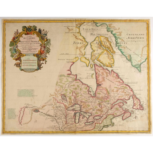
Carte du Canada ou de la Nouvelle France.
Fourth state of the map of Canada published by Delisle with the imprint "sur le Quai de l’Horloge a l’Aigle d’Or avec Privilege pour 20 ans, 1703". Beneath the title, Renard’s imprint is erased.Including the fictitious discoveries of Baron de Lahoutan: the legendary River Longue etc. The north west corner of Hudson Bay is left open, leaving the possibility of a north west passage open. De l'Isle's map was the first to show Detroit (founded by Cadillac) and the first to mention a settleme...
€500
Maker : DE L'ISLE, G.
Place : Paris
Date : 1703
![A Map of the United States and Canada, New-Scotland, New-Brunswick and New-Foundland ... [together with] A Map of the West-Indies and of the Mexican-Gulph...](/uploads/cache/39235-500x500.jpg)
A Map of the United States and Canada, New-Scotland, New-Brunswick and New-Foundland ... [together with] A Map of the West-Indies and of the Mexican-Gulph...
A Map of the United States and Canada, New-Scotland, New-Brunswick and New-Foundland / Carte des Etats Unis, avec Le Canada, la Nouvelle Ecosse, le Nouveau Brunswick & Terre-Neuve. Dressée par LAPIE, Capitaine-Ingénieur-Géographe. Publiée par P.A.F.TARDIEU, Graveur, Editeur propriétaire a Paris. Déposée à la Bibliothèque Imperiale, le 10 Juin 1806. [together with]A Map of the West-Indies and of the Mexican-Gulph / Carte des Indes Occidentales et du Golfe du Mexique. Dressée par LAPIE, ...
€5.000
Maker : P.A.F. TARDIEU
Place : Paris
Date : 1806
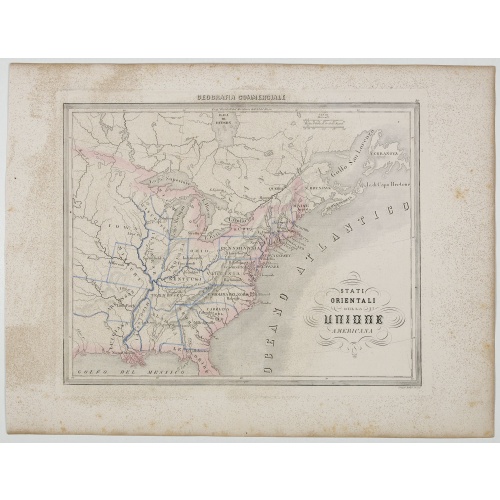
Stati Orientali della Unione Americana.
Uncommon map of Northeastern America prepared by Francesco Costantino Marmocchi. Above the map "Geografia Commerciale". From "Il Globo Atlante di carte Geografiche compilate da F.C. Marmocchi per servire di corredo al suu corso di geografia commerciale", with the maps engraved by engraved by Gius. Cattaneo, Campo Antico, C. Poggiali, G. Bonatti, and Ces. Magrini.Marmocchi (Poggibonsi, 1805-Geneva, 1858) was known as a geographer and cartographer. He emigrated to Rome, and later to Corsica, later...
€50
Maker : MARMOCCHI, F.C.
Place : Genova, Paolo Rivara fu Giacomo
Date : 1858
Postage & Shipping
-
Item Location
Terms and conditions - Item Location
- 75013, Alsace, France
- Ships To
- United States, United Kingdom, Albania, Argentina, Armenia, Australia, Austria, Bahamas, Belgium, Bermuda, Bosnia and Herzegowina, Brazil, Bulgaria, Canada, Chile, China, Costa Rica, Denmark, Dominica, Egypt, El Salvador, Finland, France, Germany, Greece, Guatemala, Hong Kong, Hungary, Iceland, India, Italy, Japan, Korea (South), Kuwait, Liechtenstein, Lithuania, Luxembourg, Madagascar, Mexico, Monaco, Morocco, Netherlands, Netherlands Antilles, New Zealand, Norway, Paraguay, Peru, Philippines, Poland, Portugal, Qatar, Reunion, Romania, San Marino, Saudi Arabia, Seychelles, Singapore, Slovenia, South Africa, Spain, Sri Lanka, Suriname, Sweden, Switzerland, Taiwan, Thailand, Tunisia, Turkey, United Arab Emirates, Uruguay, Vietnam
- Pick-ups
- Buyer can pick-up
This item is owned and offered by the seller Librairie_Loeb-Larocque - All items are available for immediate sale, offered subject to prior sale.
Invoices are created by the seller by using our shopping cart or be prepared by the seller the day following the order and are emailed to you.
Items offeres by different sellers are invoiced separately.
Shipping fees are extra. The buyer is responsible for all applicable taxes, including any VAT, customs clearance, import duties, or equivalent costs arriving at the customer's home border. Payment is due on receipt of the invoice. The item(s) are shipped as soon as possible after receipt of your payment.
Before buying please read the complete Terms Conditions of Sale.
- Payment Methods
- Mastercard, Bank Transfer, American Express, iDEAL, PayPal, Google Pay
- Returns Accepted
- No
Post Message
Feel free to ask the seller a question. Please note that the seller could be located in an area with a different time zone. Our seller will do their best to respond within 24 hours.Post your message below.
Sign in to ask the seller a question.