ID: 408
Open
Listing ID: #408 has been added to your wishlist.
Listing ID: #422 has been added to your wishlist.
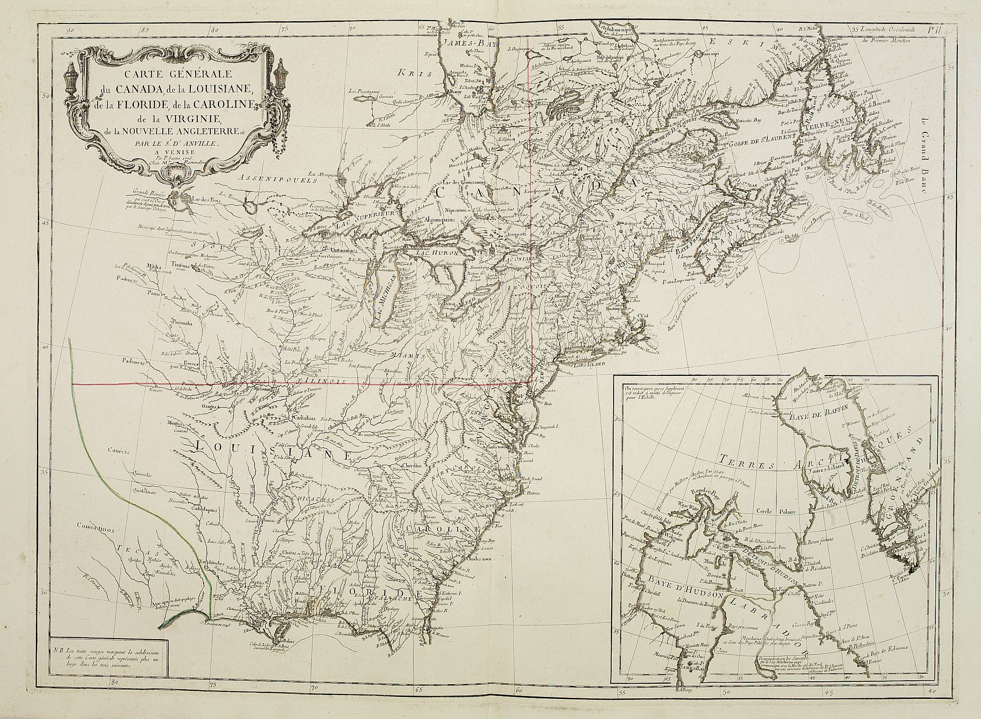
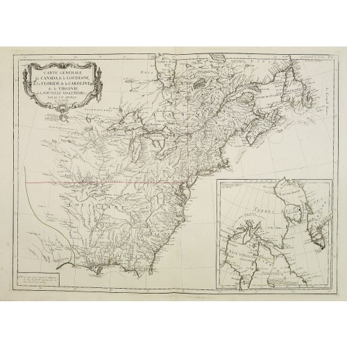
Carte Générale du Canada, de la Louisiane, de la Floride, de la Caroline..
BuyNow for €750
- Maker :
- SANTINI, P. / REMONDINI, M.
- Place :
- Venice
- Date :
- 1784
- Color :
- In original outline colors
- Height mm.:
- 479
- Width mm.:
- 655
- Condition :
- Minor marginal spotting. Else very good condition.
- Bibliography :
- -
- Seller's ref. :
- 24967
This item is offered by Librairie_Loeb-Larocque
See other Items from this seller- Postage
-
France
€15 to France
- Select Country
- Zip/Post Code
- Quantity
€750
Description
Map of the eastern part of the United States and Canada. With inset map of Hudson and Baffin bays. in the lower right corner.Venetian edition of d'Anville's map, from "Atlas Universel" printed in 1776-84.
Noteworthy topographical detail is shown, with particular focus on the Great Lakes. Lake Superior is shown attached to a convoluted river system reaching across the continent reminiscent of the Riviere Longue of Baron Lahontan's memoirs.
On the Gulf Coast the region of Tecas (Texas) is named with a nearby note about the Atac-apa tribe of Indians, who are noted as Antrophages (Cannibals) and Indiens errans.
The map was prepared by the Venetian cartographer and publisher François (Père) Santini and first published in Santini's 'Atlas Universel dresse sur les meuilleures cartes modernes 1776.'
Santini collaborated with Janvier and gives credit to him on most of his maps. The atlas is effectively an Italian copy of the Robert de Vaugondy 'Atlas Universel'.
In 1784 Santini sold the plates to M. Remondini, whose name appears on this particular example - indicating that this is the second state of the map.
![Carte generale de France. [de l'Europe]](/uploads/cache/38442-500x500.jpg)
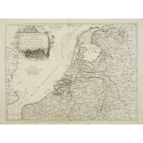
Carte generale de France. [de l'Europe]
A fine and uncommon early 17th century map of France printed from two copper plates. Engraved by Liébaux.From the French text edition of "Description d'Univers", 1683. by Allain Manneson Mallet (1630-1706), a well travelled military engineer and geographer who worked in 17th century France under King Louis XIV.
€80
Maker : MALLET, A.M.
Place : Paris
Date : 1683
![[Collective suicide under Spanish rule.]](/uploads/cache/40480-500x500.jpg)
[Collective suicide under Spanish rule.]
The natives of Hispaniola, who saw no end to the fearful oppression of Spanish rule, preferred death. So many, devoid of all hope, went into the woods to kill their children and hang themselves. After taking certain natural poisons, the women followed their husbands to death by means of the noose. Others threw themselves down mountains, jumped into the sea or into rivers, while some died by self-imposed starvation or even stabbed themselves to death with razor sharp stone knives:In 1631 Johann L...
€80
Maker : GOTTFRIED, J.L. / DE BRY.
Place : Frankfurt, M.Merian
Date : 1633
-500x500.jpg)
Nuovo Mondo parte Settentrionale.
Uncommon map of North America prepared by Francesco Costantino Marmocchi. Above the map "Geografia Commerciale". From "Il Globo Atlante di carte Geografiche compilate da F.C. Marmocchi per servire di corredo al suu corso di geografia commerciale", with the maps engraved by engraved by Gius. Cattaneo, Campo Antico, C. Poggiali, G. Bonatti, and Ces. Magrini.Marmocchi (Poggibonsi, 1805-Geneva, 1858) was known as a geographer and cartographer. He emigrated to Rome, and later to Corsica, later settle...
€50
Maker : MARMOCCHI, F.C.
Place : Genova, Paolo Rivara fu Giacomo
Date : 1858
![De Sota meets the Inca king near Cajamarca.]](/uploads/cache/40485-500x500.jpg)
De Sota meets the Inca king near Cajamarca.]
When the Spanish arrived in Cajamarca, they found only a few inhabitants. The Inca army was camped in the surrounding hills and the residence of the Inca king, Atahualpa, was a few miles away, so de Soto went ahead to meet him and to announce the arrival in the town of Pizarro and his troops. As de Soto approached, he pulled his stallion to a halt in front of Atahualpa and the foam from the horse’s mouth was said to have flown into the face of the Inca king. Many of the nobles, who had never s...
€80
Maker : GOTTFRIED, J.L. / DE BRY.
Place : Frankfurt, M.Merian
Date : 1633
Postage & Shipping
-
Item Location
Terms and conditions - Item Location
- 75013, Ile-de-France, France
- Ships To
- United States, United Kingdom, Albania, Argentina, Armenia, Australia, Austria, Bahamas, Belgium, Bermuda, Bosnia and Herzegowina, Brazil, Bulgaria, Canada, Chile, China, Costa Rica, Denmark, Dominica, Egypt, El Salvador, Finland, France, Germany, Greece, Guatemala, Hong Kong, Hungary, Iceland, India, Italy, Japan, Korea (South), Kuwait, Liechtenstein, Lithuania, Luxembourg, Madagascar, Mexico, Monaco, Morocco, Netherlands, Netherlands Antilles, New Zealand, Norway, Paraguay, Peru, Philippines, Poland, Portugal, Qatar, Reunion, Romania, San Marino, Saudi Arabia, Seychelles, Singapore, Slovenia, South Africa, Spain, Sri Lanka, Suriname, Sweden, Switzerland, Taiwan, Thailand, Tunisia, Turkey, United Arab Emirates, Uruguay, Vietnam
- Pick-ups
- No pick-ups
This item is owned and offered by the seller Librairie_Loeb-Larocque - All items are available for immediate sale, offered subject to prior sale.
Invoices are created by the seller by using our shopping cart or be prepared by the seller the day following the order and are emailed to you.
Items offeres by different sellers are invoiced separately.
Shipping fees are extra. The buyer is responsible for all applicable taxes, including any VAT, customs clearance, import duties, or equivalent costs arriving at the customer's home border. Payment is due on receipt of the invoice. The item(s) are shipped as soon as possible after receipt of your payment.
Before buying please read the complete Terms Conditions of Sale.
- Payment Methods
- Visa, Mastercard, Bank Transfer, iDEAL, PayPal
- Returns Accepted
- No
Post Message
Feel free to ask the seller a question. Please note that the seller could be located in an area with a different time zone. Our seller will do their best to respond within 24 hours.Post your message below.
Sign in to ask the seller a question.