ID: 461
Open
Listing ID: #461 has been added to your wishlist.
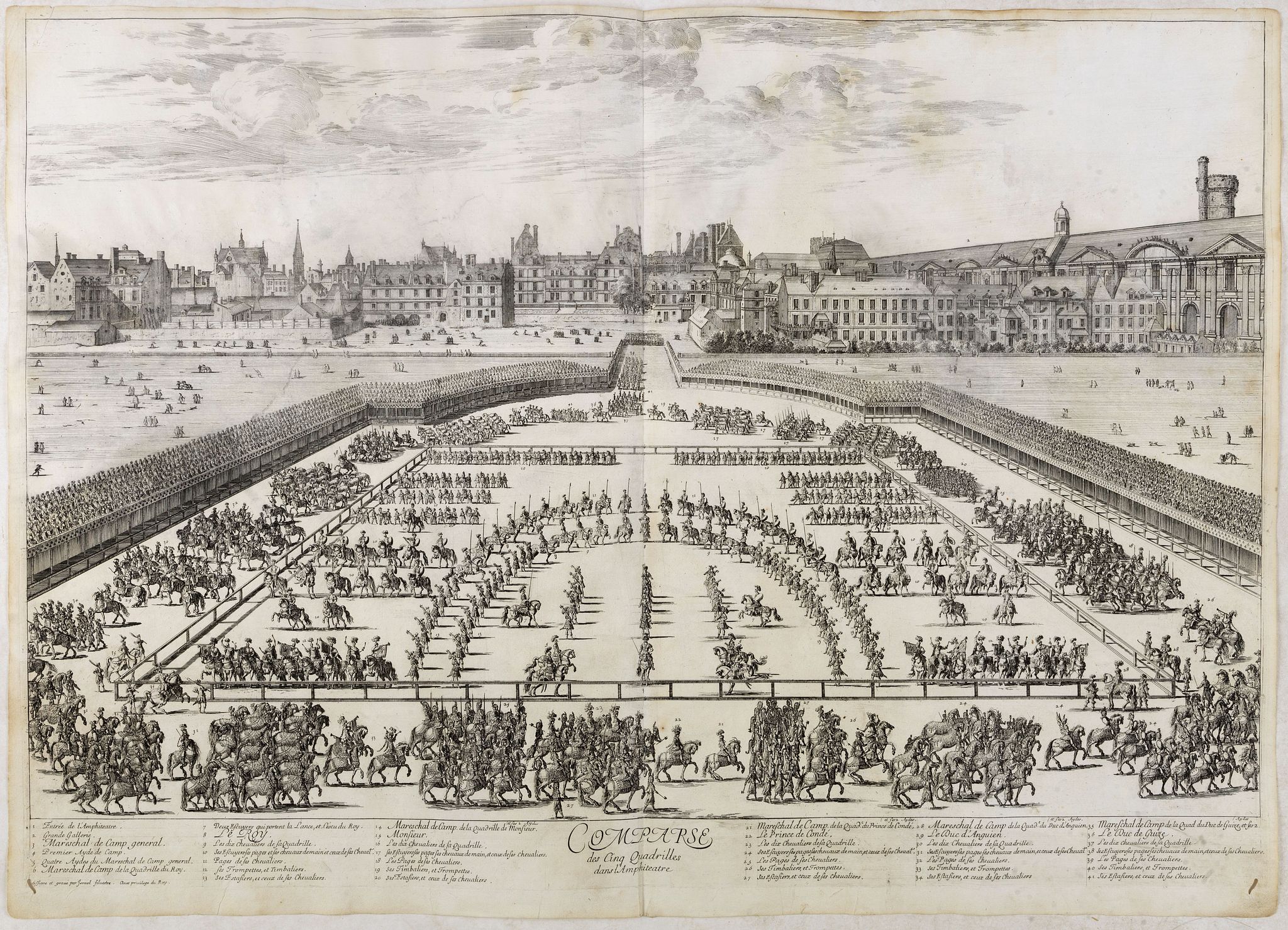
Comparse des Cinq Quadrilles dans l'Amphitheatre.
BuyNow for €550
- Maker :
- SYLVESTRE, I.
- Place :
- Paris, Imprimerie royale
- Date :
- 1670
- Color :
- Uncoloured
- Height mm.:
- 530
- Width mm.:
- 750
- Condition :
- A fantastic large engraving full of movement and detail. Upper margin cut short. Small worm trace in lower left and right hand corner filled in.
- Bibliography :
- -
- Seller's ref. :
- 36511
This item is offered by Librairie_Loeb-Larocque
See other Items from this seller- Postage
-
France
€15 to France
- Select Country
- Zip/Post Code
- Quantity
€550
Description
An early and intriguing engraving recording one of the most celebrated and spectacular festivals held at Paris by the young Louis XIV. The multi-day tournament took place in front of the Tuileries, in a huge area today known as the Place de Carrousel.Groups of costumed noblemen representing "Romans" (lead by the French King), "Persians," "Turks," "Indians" and "Americans" participated in games of skill.
This engraving was included as an illustration to a scarce work titled, "Courses de Testes et de Bagues Faittes par le Roy et par Les Princes et Seigneurs de sa cour En l'année 1662", written by Charles Perrault (French 1628-1703) Assistant Secretary and Advisor in matters relating to Arts and Sciences, Controller General of the Department of Public Works.
The book contained 7 engravings on double page plates drawn and engraved by Israel Silvestre the renown French draftsman, etcher and print dealer who specialized in topographical views and perspectives of famous buildings.
François Chauveau was entrusted with the 30 portrait engravings of the various actors.
This engraving shows the race ring and layout of the Quadrilles in the amphitheater, drummers, trumpeters, pages, horses, footmen, knights and squires.
The book was published as the tenth volume of the famous collection of prints known as the "Cabinet du Roi".
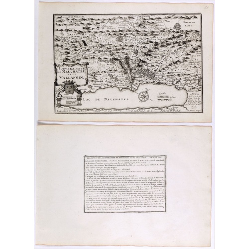
Souveraineté de Neuchatel et de Vallangin.
Map of the Neuchatel region, from Nicolas de Fer's "L'Atlas curieux ou le Monde réprésente dans des cartes. "The "Atlas Curieux" is a geographic encyclopedia of images and a celebration of the French Empire under the Sun King, with maps of French possessions in the western hemisphere, maps of France, with detailed views of the grand waterworks at Marly, views of the great palaces and chateaux, views and plans of the Paris Observatory, and samples of military architecture. Issued in six annual ...
€60
Maker : DE FER, N.
Place : Paris
Date : 1705
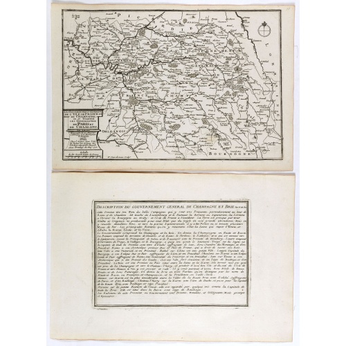
Les Gouvernements generaux de l'Isle de France et de Champagne, ou se trouvent les generalitez de Paris et Chaalons.
Map of the Isle de France and Champagne regions, from Nicolas de Fer's "L'Atlas curieux ou le Monde réprésente dans des cartes. "The "Atlas Curieux" is a geographic encyclopedia of images and a celebration of the French Empire under the Sun King, with maps of French possessions in the western hemisphere, maps of France, with detailed views of the grand waterworks at Marly, views of the great palaces and chateaux, views and plans of the Paris Observatory, and samples of military architecture. I...
€60
Maker : DE FER, N.
Place : Paris
Date : 1705
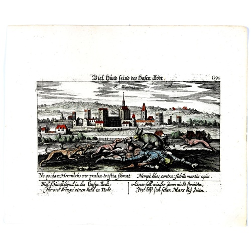
Vincennes - Viel hund Feind.des Hasen Todt.
A very nice picture representing Vincennes. With a verse in German and Latin. The German text reads : "Viel Hundt feind ja des Hasen Todr, Ihr viel bringn einen bald in Noht. Einer soll wieder zwen nicht streittn, Jtzt läst sich sehen Mars bey Zeitn." two languages underneath the picture.The poet and topographer from Comothau, Daniel Meisner (1585-1625), started his first publication entitled Thesaurus Philo-Politicus in Frankfurt in 1623, initially in parts, each one containing about fifty pl...
€70
Maker : MEISNER, D.
Place : Frankfurt
Date : 1623-1678
![[The strange sheep-like creatures that carried the silver .]](/uploads/cache/40481-500x500.jpg)
[The strange sheep-like creatures that carried the silver .]
When the Spanish discovered the silver mines of Potosí, they organised the transport of the rich ore westward by llama trains across the Altiplano and down to Arica on the coast, where it would be transported by ship to Panama. These strange creatures would sit down when angered or overburdened and, neither beatings nor kind words would make the animals get up again. If any of them ran away, they had to be shot to recover their valuable cargo.In 1631, Johann Ludwig Gottfried inherited Theodor D...
€80
Maker : GOTTFRIED, J.L. / DE BRY.
Place : Frankfurt, M.Merian, 1633
Date : 1633
Postage & Shipping
-
Item Location
Terms and conditions - Item Location
- 75013, Ile-de-France, France
- Ships To
- United States, United Kingdom, Albania, Argentina, Armenia, Australia, Austria, Bahamas, Belgium, Bermuda, Bosnia and Herzegowina, Brazil, Bulgaria, Canada, Chile, China, Costa Rica, Denmark, Dominica, Egypt, El Salvador, Finland, France, Germany, Greece, Guatemala, Hong Kong, Hungary, Iceland, India, Italy, Japan, Korea (South), Kuwait, Liechtenstein, Lithuania, Luxembourg, Madagascar, Mexico, Monaco, Morocco, Netherlands, Netherlands Antilles, New Zealand, Norway, Paraguay, Peru, Philippines, Poland, Portugal, Qatar, Reunion, Romania, San Marino, Saudi Arabia, Seychelles, Singapore, Slovenia, South Africa, Spain, Sri Lanka, Suriname, Sweden, Switzerland, Taiwan, Thailand, Tunisia, Turkey, United Arab Emirates, Uruguay, Vietnam
- Pick-ups
- Buyer can pick-up
This item is owned and offered by the seller Librairie_Loeb-Larocque - All items are available for immediate sale, offered subject to prior sale.
Invoices are created by the seller by using our shopping cart or be prepared by the seller the day following the order and are emailed to you.
Items offeres by different sellers are invoiced separately.
Shipping fees are extra. The buyer is responsible for all applicable taxes, including any VAT, customs clearance, import duties, or equivalent costs arriving at the customer's home border. Payment is due on receipt of the invoice. The item(s) are shipped as soon as possible after receipt of your payment.
Before buying please read the complete Terms Conditions of Sale.
- Payment Methods
- Visa, Mastercard, Bank Transfer, American Express, iDEAL, PayPal, Google Pay
- Returns Accepted
- No
Post Message
Feel free to ask the seller a question. Please note that the seller could be located in an area with a different time zone. Our seller will do their best to respond within 24 hours.Post your message below.
Sign in to ask the seller a question.