ID: 67
Open
Listing ID: #67 has been added to your wishlist.
Currus Veliferi Illmi. Pr. Mauritii Nassouvii. (Prince Maurits' sailing-carriage, designed by Simon Stevin. )
BuyNow for $1.800
- Maker :
- BLAEU, J.
- Place :
- Amsterdam
- Date :
- 1649
- Color :
- Colored
- Height mm.:
- 431
- Width mm.:
- 565
- Condition :
- With Latin text on verso. In very fine condition.
- Bibliography :
- -
- Seller's ref. :
- 00921-(1)
This item is offered by Paulus_Swaen_Old_Maps
See other Items from this seller- Postage
-
Standard Shipping
$0 to Netherlands
- Select Country
- Zip/Post Code
- Quantity
$1.800
Description
Prince Maurits' sailing carriages had been designed by Simon Stevin. The Prince, always accessible to new inventions of his old instructor, could not please the foreign ambassadors more than by inviting them for a ride in his carriage.The big sailing-carriage could seat 28 persons and could reach a speed of seven miles per hour.
Land sailing : The Chinese had "wind-driven carriages" since the 6th century AD, during the Liang Dynasty, and eventually mounted masts and sails on large wheelbarrows.The earliest text describing the Chinese use of mounting masts and sails on large vehicles is the Book of the Golden Hall Master written by the Daoist scholar and crown prince Xiao Yi, who later became Emperor Yuan of Liang (r. 552–554 AD).He wrote that Gaocang Wushu invented a "wind-driven carriage" which was able to carry thirty people at once.
There was another built in about 610 for the Emperor Yang of Sui (r. 604–617), as described in the Continuation of the New Discourses on the Talk of the Times.
The precursor to the modern land yacht was invented in the autumn of the year 1600 by the Flemish scientist Simon Stevin in Flanders as a commission for Prince Maurice of Orange. It was used by Prince Maurice for entertaining his guests. In 1898, the Dumont brothers of De Panne, Belgium, developed a land yacht whose sails were based on contemporary Egyptian sailboats used on the Nile River.
The first races were held on the beaches of Belgium and France in 1909. Land yachts were also used in the late 19th century and early 20th century to transport goods on dry lakes in the United States.
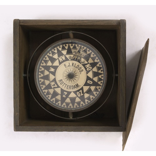
Compass.
A very nicely crafted sloop compass in original box. The compass is gimbaled and is executed in beautiful red copper. Made and signed by F.J. Kloos & Son of Rotterdam in the 1850-1875 period. The compass works fine. Height of the box: 13.5 cm (5.5 inches)
$2.250
Maker : KLOOS, F.J.
Place : Rotterdam
Date : 1850-1875
Transom of a ship in gilded carved wood bearing the inscription "DUMONT- DURVILLE"
Decorative transom sign in gilded carved wood bearing the inscription "DUMONT- DURVILLE" in a foliage environment. The transom usually kept the name of the ship and was often well-decorated.A transom is the flat, vertical surface at the back of a ship that connects the two sides of the hull. The sign holds the name of the great French explorer Jules Dumont d'Urville D’Urville who first visited New Zealand in 1824 as second-in-command to Louis Duperrey. On his second voyage of exploration and...
$7.500
Maker : ANONYMOUS
Place : France
Date : 1880
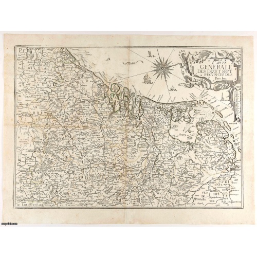
Les Provinces des Pais Bas Autrichiens contenants en XXIV Feuilles les comtées d'Artois, de Flandres, de Hainaut, de Namur et des Duchées de Luxembourg…
Rare wall map of the Catholic of Austrian Low Countries, roughly the southern part of present-day The Netherlands, Belgium and Luxembourg. Map has some large cartouches, ships in the North Sea.
$1.500
Maker : SEUTTER, M.
Place : Augsburg, 1725
Date : 1725
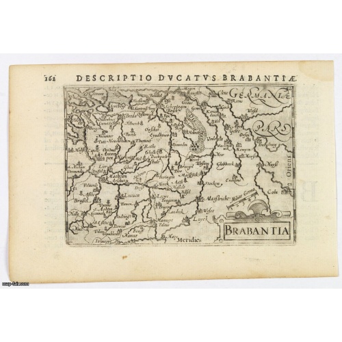
Brabantia.
A lovely miniature map of the Duchy of Brabant, published by Petrus Bertius, in Amsterdam at the beginning of the seventeenth century. There is a nice, small strap-work title, a little stippled sea, and the map depicts local topography and towns including Mechelen, Breda, Cleve, Maestricht, Cologne, Brussels and Namur. This example is from the Tabularum Geographicarum Contractarum. Bertius (1565-1629) was a Flemish cartographer, theologian, historian and geographer. Although he published much in...
$100
Maker : LANGENES, B. / BERTIUS, P.
Place : Amsterdam, 1606
Date : 1606
Postage & Shipping
-
Item Location
Terms and conditions - Item Location
- 75013, Ile-de-France, France
- Ships To
- United States, United Kingdom, Albania, Argentina, Armenia, Australia, Azerbaijan, Bahamas, Belgium, Bermuda, Cambodia, Canada, Chile, China, Croatia, Cyprus, Czech Republic, Denmark, Estonia, Finland, France, Germany, Gibraltar, Greece, Greenland, Guatemala, Hong Kong, Iceland, India, Indonesia, Israel, Italy, Japan, Latvia, Lithuania, Luxembourg, Malta, Mexico, Monaco, Netherlands, Norway, Singapore, Spain, Sweden, Switzerland, Turkey
- Pick-ups
- No pick-ups
This item is owned and offered by the seller Paulus_Swaen_Old_Maps - All items are available for immediate sale, offered subject to prior sale.
Invoices are created by the seller by using our shopping cart or be prepared by the seller the day following the order and are emailed to you.
Items offeres by different sellers are invoiced separately.
Shipping fees are extra. The buyer is responsible for all applicable taxes, including any VAT, customs clearance, import duties, or equivalent costs arriving at the customer's home border. Payment is due on receipt of the invoice. The item(s) are shipped as soon as possible after receipt of your payment.
Before buying please read the complete Terms Conditions of Sale.
- Payment Methods
- Visa, Mastercard, Bank Transfer, iDEAL, PayPal, Google Pay
- Returns Accepted
- No
Post Message
Feel free to ask the seller a question. Please note that the seller could be located in an area with a different time zone. Our seller will do their best to respond within 24 hours.Post your message below.
Sign in to ask the seller a question.

-800x800.jpg)


-500x500.jpg)