
ID: 73
Closed
Listing ID: #73 has been added to your wishlist.
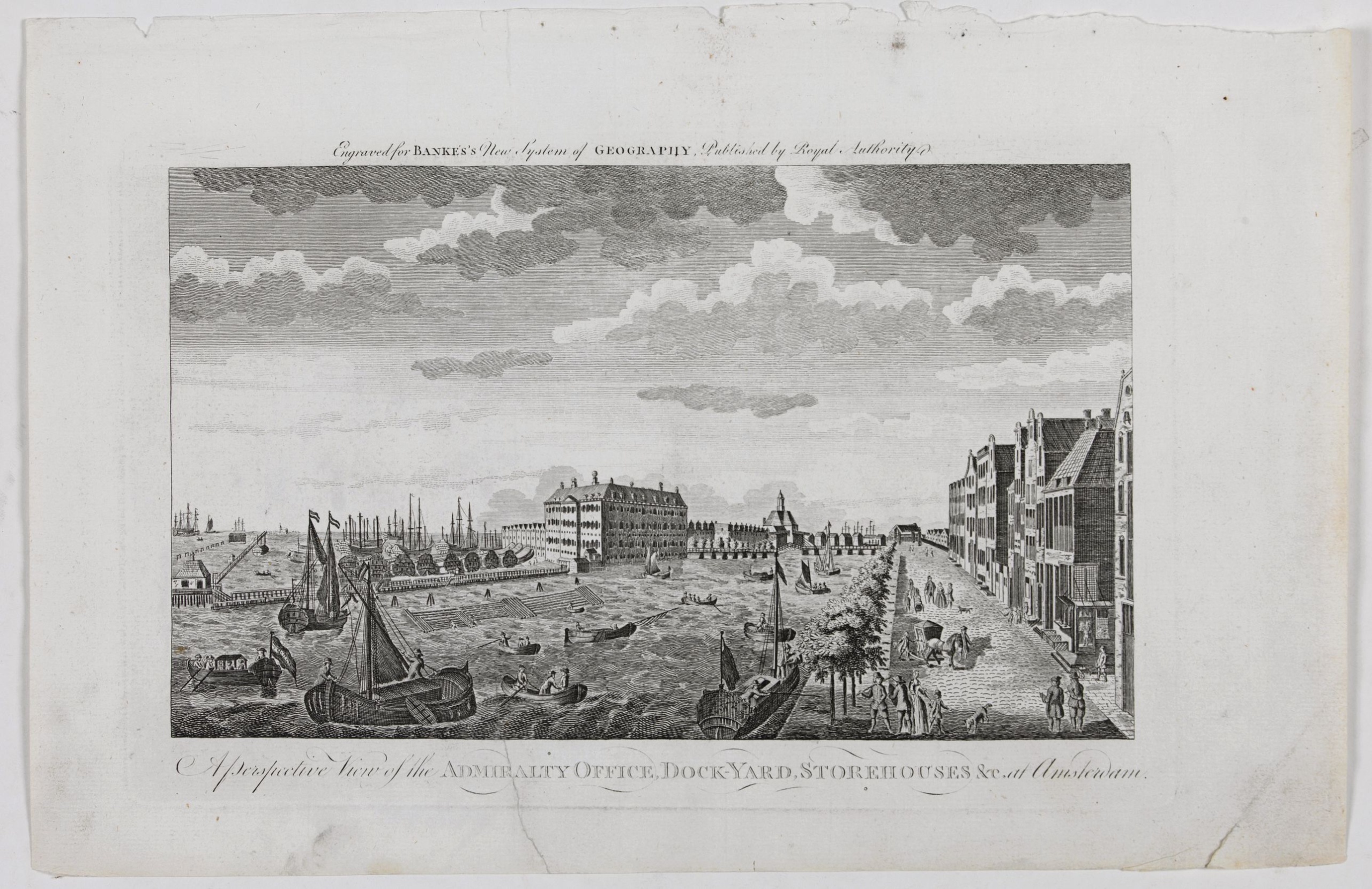
A Perspective View of the Admiralty Office, Dock-Yard, Storehouses &c. at Amsterdam.
BuyNow for $300
- Maker :
- BANKES
- Place :
- Amsterdam
- Date :
- 1780
- Color :
- Uncoloured
- Height mm.:
- 180
- Width mm.:
- 268
- Condition :
- Paper slightly age toned. Professional repair of tear on the lower margin, entering 2 cm into the image. Else good condition.
- Bibliography :
- -
- Seller's ref. :
- 22728
This item is offered by Paulus_Swaen_Old_Maps
See other Items from this seller- Postage
-
Europe
$34 to Netherlands
- Select Country
- Zip/Post Code
- Quantity
$300
Description
Decorative engraving giving good detail of the intense activity in the Amsterdam dockyards.Engraved for BANKES's New System of Geography

Zee caerte vande Sondt tvermaerste van Danemarcke . . .
A detailed chart of the coast of Denmark and its islands, Copenhagen in the center of the chart. West to the top. It is decorated by a title, scale and descriptive cartouche, a compass rose, several vessels and sea monsters, and depictions of mountains, fields, trees, small villages and animals.The chart shows soundings, sandbanks, landmarks and coastal profiles.Chart from an early Dutch text edition of this landmark contribution to the science of navigation. Waghenaer's own experiences as a pil...
$3.000
Maker : WAGHENAER, L. J.
Place : Leiden, Plantijn
Date : 1585

Marine parallel rulers in brass.
Very fine marine parallel rulers in brass. The parallel ruler is the oldest and most traditional way to measure and trace routes and bearings. The principle is simple: the ruler is placed on the road to be measured and then, like a pantograph, the other part of the ruler is placed on one of the declination roses on the map to determine the angle. They are, essentially, two straight-edges hinged so that they maintain the same angle. By alternating the moving edge, and securely holding down the no...
$1.500
Maker : ANONYMOUS
Place : Paris
Date : ca. 1880

Mappe-Monde pour connoitre les progres & les conquestes..
Unusual double hemisphere map with California as an Island. Dutch text describes the expeditions and colonial possessions of the Dutch East India Company. The map originated in about 1670. Chatelain acquired the plate; he added decorative elements, including sailing ships, the Dutch crest, and a figure representing Europa seated inside a native fort.Zacharie Chatelain (d.1723) was the father of Henri Abraham (1684-1743) and Zacharie Junior (1690-1754).They worked as a partnership publishing the ...
$800
Maker : CHATELAIN, H.
Place : Amsterdam
Date : 1729

Les Provinces des Pais Bas Autrichiens contenants en XXIV Feuilles les comtées d'Artois, de Flandres, de Hainaut, de Namur et des Duchées de Luxembourg…
Rare wall map of the Catholic of Austrian Low Countries, roughly the southern part of present-day The Netherlands, Belgium and Luxembourg. Map has some large cartouches, ships in the North Sea.
$1.500
Maker : SEUTTER, M.
Place : Augsburg, 1725
Date : 1725
Postage & Shipping
-
Item Location
Terms and conditions - Item Location
- 33765, Florida, United States
- Ships To
- United States, United Kingdom, Albania, Argentina, Armenia, Australia, Azerbaijan, Bahamas, Belgium, Bermuda, Cambodia, Canada, Chile, China, Croatia, Cyprus, Czech Republic, Denmark, Estonia, Finland, France, Germany, Gibraltar, Greece, Greenland, Guatemala, Hong Kong, Iceland, India, Indonesia, Israel, Italy, Japan, Latvia, Lithuania, Luxembourg, Malta, Mexico, Monaco, Netherlands, Norway, Singapore, Spain, Sweden, Switzerland, Turkey
- Pick-ups
- No pick-ups
This item is owned and offered by the seller Paulus_Swaen_Old_Maps - All items are available for immediate sale, offered subject to prior sale.
Invoices are created by the seller by using our shopping cart or be prepared by the seller the day following the order and are emailed to you.
Items offeres by different sellers are invoiced separately.
Shipping fees are extra. The buyer is responsible for all applicable taxes, including any VAT, customs clearance, import duties, or equivalent costs arriving at the customer's home border. Payment is due on receipt of the invoice. The item(s) are shipped as soon as possible after receipt of your payment.
Before buying please read the complete Terms Conditions of Sale.
- Payment Methods
- Visa, Mastercard, Bank Transfer, American Express, iDEAL, PayPal, Google Pay
- Returns Accepted
- No
Post Message
Feel free to ask the seller a question. Please note that the seller could be located in an area with a different time zone. Our seller will do their best to respond within 24 hours.Post your message below.
Sign in to ask the seller a question.
