ID: 385
Open
Listing ID: #385 has been added to your wishlist.
[Another Dutch fleet reaches Lima].
BuyNow for €80
- Maker :
- GOTTFRIED, J.L. / DE BRY.
- Place :
- Frankfurt, M.Merian
- Date :
- 1633
- Color :
- Uncoloured
- Height mm.:
- 153
- Width mm.:
- 175
- Condition :
- Copper plate engraving on text sheet. Paper slightly browned and stained, as is usual. Crude white tape repair to lower right margin. Lower left corner missing. Size of sheet: 345 x 222 mm. German text and on verso.
- Bibliography :
- -
- Seller's ref. :
- 41117
This item is offered by Librairie_Loeb-Larocque
See other Items from this seller- Postage
-
France
€15 to France
- Select Country
- Zip/Post Code
- Quantity
€80
Description
In 1624 a heavily armed Dutch fleet sailed from the Juan Fernandez Islands to Lima. The leader of the fleet, Jacob l’Hermite, was in such poor health that he had to hand over command to Admiral Jacobson. The fleet anchored outside the harbour near the island of San Lorenzo (‘I. de Lima’).The port was full of Spanish ships and was too well protected for a direct confrontation so, on the night of 11th May, the Dutch carried out a daring and devious plan.
In 1631 Johann Ludwig Gottfried, inherited the Theodor De Bry’s publishing firm, among the illustrated accounts of the expeditions of Magellan, Columbus, Vespucci, Cortes, Balboa, Raleigh, Drake, Smith, and many others.
Gottfried issued together with Matthaeus Merian a one-volume condensation "Newe Welt Vnd Americanische Historien/ Jnhaltende Warhafftige vnd volkommene Beschreibungen Aller West-Jndianischen Landschafften..." that used many of the original copper plates and supplemented them with new ones of more recent voyages. The book was published by Matthaeus Merian. The work was reprinted in 1655 / 1657.
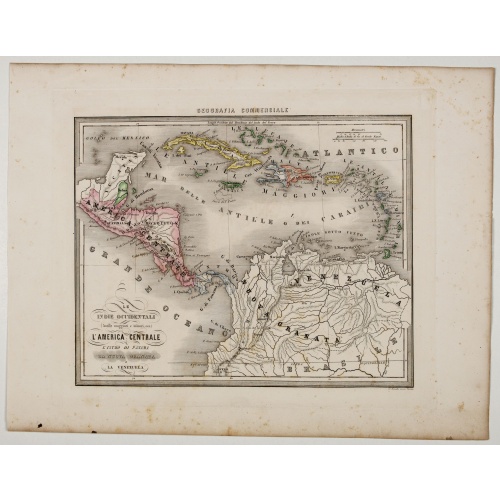
Le Indie Ocidentali ( Antille maggiori e minori, ecc) L'America Centrale . . .
Uncommon map of Central America and the Antilles prepared by Francesco Costantino Marmocchi. Above the map "Geografia Commerciale". From "Il Globo Atlante di carte Geografiche compilate da F.C. Marmocchi per servire di corredo al suu corso di geografia commerciale", with the maps engraved by engraved by Gius. Cattaneo, Campo Antico, C. Poggiali, G. Bonatti, and Ces. Magrini.Marmocchi (Poggibonsi, 1805-Geneva, 1858) was known as a geographer and cartographer. He emigrated to Rome, and later to Co...
€75
Maker : MARMOCCHI, F.C.
Place : Genova, Paolo Rivara fu Giacomo
Date : 1858
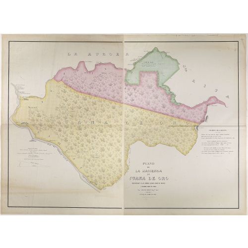
Plano de la Hacienda de Juana de Oro.
Wall-map sized map in 2 sheets, if joined 940 x 1300mm., showing the Hacienda (farm) of Juana de Oro in Ecuador. The cocoa farm was owned by Mrs. Leonor Carbo of Higgins and Virginia Carbo of Icaza. Cocoa plantations are depicted on the map by a multitude of shrubs. This plan provides information on cocoa productivity and distribution among the owners.
€750
Maker : DILLON, A.
Place : Guayaquil ( Equateur)
Date : 1868
Parisius & Maguncia. [Paris & Munich] Folio XXXIX
Imaginary view of Paris and on verso Munich : however the earliest obtainable views of this period.In the forground a large vessel, who was the symbol of the powerful corporate body of the Marchands de l'eau, and is dating back to the Middle Ages. The city motto, "Fluctuat nec mergitur" ("It is beaten by the waves without being submerged") is equally a reference to this vessel. The first mention of coat of arms of Paris with the vessel appears as early as 1190 when Philippe Augustus gave the des...
€900
Maker : SCHEDEL, H.
Place : Nuremberg
Date : 12 July 1493
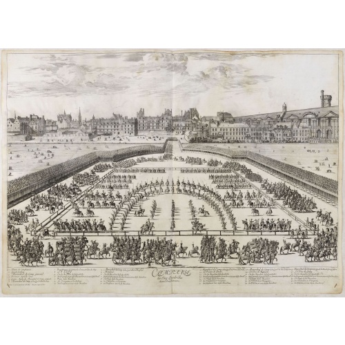
Comparse des Cinq Quadrilles dans l'Amphitheatre.
An early and intriguing engraving recording one of the most celebrated and spectacular festivals held at Paris by the young Louis XIV. The multi-day tournament took place in front of the Tuileries, in a huge area today known as the Place de Carrousel. Groups of costumed noblemen representing "Romans" (lead by the French King), "Persians," "Turks," "Indians" and "Americans" participated in games of skill. This engraving was included as an illustration to a scarce work titled, "Courses de Testes e...
€550
Maker : SYLVESTRE, I.
Place : Paris, Imprimerie royale
Date : 1670
Postage & Shipping
-
Item Location
Terms and conditions - Item Location
- 75013, Ile-de-France, France
- Ships To
- United States, United Kingdom, Albania, Argentina, Armenia, Australia, Austria, Bahamas, Belgium, Bermuda, Bosnia and Herzegowina, Brazil, Bulgaria, Canada, Chile, China, Costa Rica, Denmark, Dominica, Egypt, El Salvador, Finland, France, Germany, Greece, Guatemala, Hong Kong, Hungary, Iceland, India, Italy, Japan, Korea (South), Kuwait, Liechtenstein, Lithuania, Luxembourg, Madagascar, Mexico, Monaco, Morocco, Netherlands, Netherlands Antilles, New Zealand, Norway, Paraguay, Peru, Philippines, Poland, Portugal, Qatar, Reunion, Romania, San Marino, Saudi Arabia, Seychelles, Singapore, Slovenia, South Africa, Spain, Sri Lanka, Suriname, Sweden, Switzerland, Taiwan, Thailand, Tunisia, Turkey, United Arab Emirates, Uruguay, Vietnam
- Pick-ups
- Buyer can pick-up
This item is owned and offered by the seller Librairie_Loeb-Larocque - All items are available for immediate sale, offered subject to prior sale.
Invoices are created by the seller by using our shopping cart or be prepared by the seller the day following the order and are emailed to you.
Items offeres by different sellers are invoiced separately.
Shipping fees are extra. The buyer is responsible for all applicable taxes, including any VAT, customs clearance, import duties, or equivalent costs arriving at the customer's home border. Payment is due on receipt of the invoice. The item(s) are shipped as soon as possible after receipt of your payment.
Before buying please read the complete Terms Conditions of Sale.
- Payment Methods
- Visa, Mastercard, Bank Transfer, American Express, iDEAL, PayPal, Google Pay
- Returns Accepted
- No
Post Message
Feel free to ask the seller a question. Please note that the seller could be located in an area with a different time zone. Our seller will do their best to respond within 24 hours.Post your message below.
Sign in to ask the seller a question.

![[Another Dutch fleet reaches Lima].](/assets/images/image-loading.svg)


![Parisius & Maguncia. [Paris & Munich] Folio XXXIX](/uploads/cache/29718-500x500.jpg)

![[Another Dutch fleet reaches Lima].](/uploads/cache/41117-500x500.jpg)