ID: 114
Open
Listing ID: #114 has been added to your wishlist.
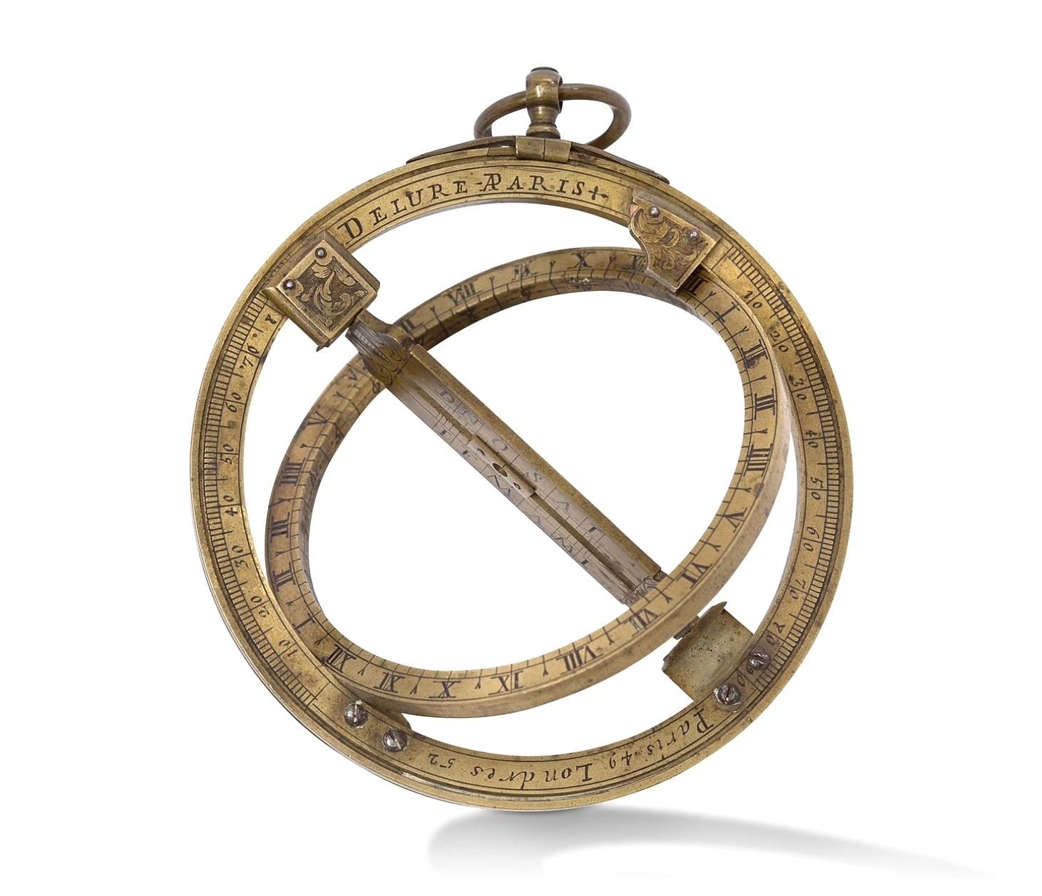
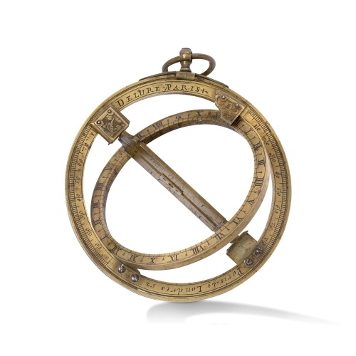
Very fine brass astronomical equinoctial ring with two brass circles.
BuyNow for $8.000
- Maker :
- JEAN-BAPTISTE NICOLAS DELURE À PARIS
- Place :
- Paris
- Date :
- ca. 1690
- Color :
- Uncoloured
- Height mm.:
- 160
- Width mm.:
- 160
- Condition :
- Diameter of the equinoctial ring is 10cm.
- Bibliography :
- A Butterfield ring dial of similar design but smaller, is illustrated in Sundial at Greenwich, Hester Highton, OUP 2001, page 200, catalogue no. 186.
- Seller's ref. :
- 48701
This item is offered by Paulus_Swaen_Old_Maps
See other Items from this seller- Postage
-
Standard Shipping
$0 to Netherlands
- Select Country
- Zip/Post Code
- Quantity
$8.000
Description
Very fine brass astronomical equinoctial ring with two brass circles with engraved foliage decoration, signed "Jean-Baptiste-Nicolas Delure A Paris", on the hanger ring.
The meridian ring is engraved with a latitude scale 90-0-90 degrees, reverse with a scale for determining solar altitude and zennith distance, an equinoctial ring with obverse engraved with hour scale in Roman numerals, the central bridge with pin-hole sliding over calendar and zodiac scales, 100 mm diam.
Jean-Baptiste-Nicolas Delure (1695-1766) was a renowned French instrument, globe maker and horologist was given the title "Ingénieur du Roi, juré en 1721-1723" (under the license of the king" (Louis the XIV) in 1721-1723). He was a Master and Juror of the Corporation des Fondeurs and appointed Ingénieur du Roi to Louis XIV. He had two workshops, both on Il de la Cite, Paris.
Jean-Baptiste-Nicolas Delure (1695-1766) was a renowned French instrument, globe maker and horologist was given the title "Ingénieur du Roi, juré en 1721-1723" (under the license of the king" (Louis the XIV) in 1721-1723). He was a Master and Juror of the Corporation des Fondeurs and appointed Ingénieur du Roi to Louis XIV. He had two workshops, both on Il de la Cite, Paris.
He was father-in-law to the fifth son of the eminent Parisian instrument maker Nicolas Bion.
Jean-Baptiste Nicolas Bion carried on both their businesses until around 1770.
Jean-Baptiste Nicolas Bion carried on both their businesses until around 1770.
The meridian ring is engraved with a latitude scale 90-0-90 degrees, the reverse with a scale for determining solar altitude and zenith distance, the quadrennials ring with obverse engraved with an hour scale in Roman numerals, the central bridge with pin-hole sliding over the calendar and zodiac scales, 100 mm diam.
This is a relatively large example of the classic pendant ring dial, useable anywhere on earth without a compass. Only the date and one's latitude are needed to determine the apparent solar time and even the North. the latitude can be determined using the quadrennial degree scale at the backside to measure the solar meridian altitude.
As the other stars appear to rotate, their position at any moment indicates the time. Sometimes called “horologium nocturnum” or “Nocturlabe” are related to the astrolabe and the sundials.
The mention of a dedicated instrument for its measurement was not found before the Middle Ages. The earlier image presenting the use of a nocturnal is in a manuscript dating from the 12th century.
Raymond Lull repeatedly described the use os a “Sphera horarum noctis”. With Martin Cortés de Albacar´s book “Arte de Navegar” published in 1551 the name and the instrument gained a larger popularity.
Timekeeping was very important to navigators at sea. Precise time was needed to use tide tables to enter harbors safely and also to regulate work shifts aboard.. Thus, the navigators could tell the time at night if the weather was clear.
The problem was that when the sky was obscured in foul weather, they had no way of knowing the exact time except by running the sand-glasses. By the middle of the 18th century, more accurate clocks became available, known as chronometers and the nocturnals fell out of use. Nocturnals are really simple analog computers. The nocturnal is simpler to use than other instruments requiring mathematical tables and trigonometry.
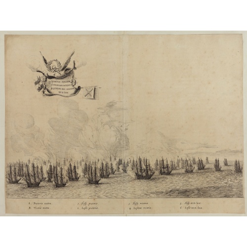
Quartum Praelium Coniovian inter et Fluvium Rio Grande XVII Ian
Decorative engraving of the fourth sea battle with the Portuguese fleet offshore at the Rio Grande, in 1640. Engraved by J. van Brosterhuyzen after a design by Frans J. Post (1612-1680). Below the engraving a numbered key (1-6). Signed in the plate "F. Post 1645" and decorative title cartouche, with "[Quartum praelium coniovian inter et fluvium Rio Grande XVII Jan" in the upper left corner.Taken from C. BARLAEUS, Rerum per octennium in Brasilia (...).
$450
Maker : POST, F. J.
Place : Joannes Blaeu, Amsterdam 1647
Date : 1647
![[Captain Weert dines with the Chief].](/uploads/cache/39922-500x500.jpg)
[Captain Weert dines with the Chief].
Scarce print with a German text sheet. Captain Weert and the chief ate modestly on roast plantain, smoked fish and wine fermented from palm, bought by a local woman. However, when Weert ordered Spanish wine to be brought from his ship, the chief forgot his temperance and drank so much he had to be carried to rest. Weert had to stay the night but returned to his ship in the morning.On the way back he was confronted by an ugly, naked woman carrying ashes in a box. After circling him three times an...
$80
Maker : GOTTFRIED, J.L. / DE BRY.
Place : Frankfurt, M.Merian
Date : 1633
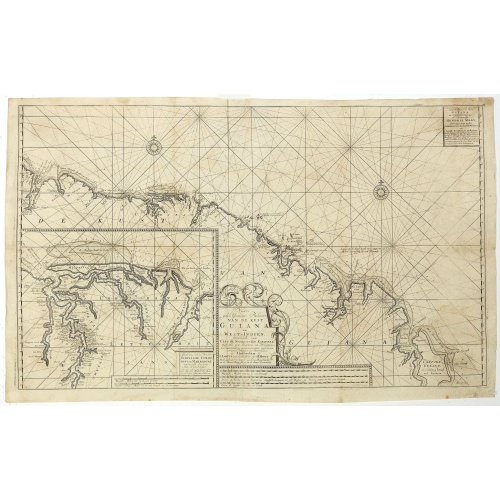
Nieuwe gelyk Graadige Paskaart van de Kust van Guiana in West-Indien.
Detailed chart of Guiana in South America. Two scales are given in both maps: Dutch, French and English nautical miles.The inset chart provide detailed view of the Camopi and Maroni or Marowijne Rivers that forms the border between French Guiana and Suriname. The charts are prepared by Johannes Loots and H.Mooy.
$650
Maker : VAN KEULEN, G.
Place : Amsterdam
Date : 1684 - 1704
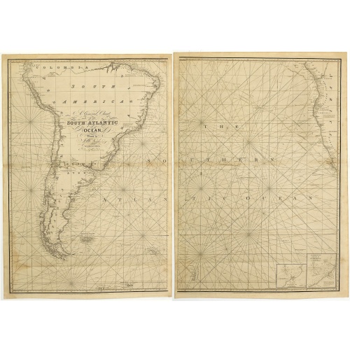
A general chart of the South Atlantic Ocean Drawn by J.W.Norie hydrographer. Revised & Corrected 1854.
A 2-sheet chart of the South Atlantic Ocean, showing the coast of South America from the mouth of the Amazon to Quito in Peru. The right hand part showing Africa's coast at Angola. Scale: circa 1:8,000,000. Chart of the South Atlantic, in two sheets. Two insets, Port of Ascension and Anchorage off N.W. side of St. Helena.The chart is published for the first time in 1833, according to a date lower part map. This is A Revised & corrected edition by J.W. Norie in 1854
$600
Maker : NORIE, J.W.
Place : London
Date : 1854
Postage & Shipping
-
Item Location
Terms and conditions - Item Location
- 75013, Ile-de-France, France
- Ships To
- United States, United Kingdom, Albania, Argentina, Armenia, Australia, Azerbaijan, Bahamas, Belgium, Bermuda, Cambodia, Canada, Chile, China, Croatia, Cyprus, Czech Republic, Denmark, Estonia, Finland, France, Germany, Gibraltar, Greece, Greenland, Guatemala, Hong Kong, Iceland, India, Indonesia, Israel, Italy, Japan, Latvia, Lithuania, Luxembourg, Malta, Mexico, Monaco, Netherlands, Norway, Singapore, Spain, Sweden, Switzerland, Turkey
- Pick-ups
- No pick-ups
This item is owned and offered by the seller Paulus_Swaen_Old_Maps - All items are available for immediate sale, offered subject to prior sale.
Invoices are created by the seller by using our shopping cart or be prepared by the seller the day following the order and are emailed to you.
Items offeres by different sellers are invoiced separately.
Shipping fees are extra. The buyer is responsible for all applicable taxes, including any VAT, customs clearance, import duties, or equivalent costs arriving at the customer's home border. Payment is due on receipt of the invoice. The item(s) are shipped as soon as possible after receipt of your payment.
Before buying please read the complete Terms Conditions of Sale.
- Payment Methods
- Visa, Mastercard, Bank Transfer, American Express, iDEAL, PayPal, Google Pay
- Returns Accepted
- No
Post Message
Feel free to ask the seller a question. Please note that the seller could be located in an area with a different time zone. Our seller will do their best to respond within 24 hours.Post your message below.
Sign in to ask the seller a question.
![[How the Inca nobility are buried] / [Bridge of Huaynacapaco]](/uploads/cache/41094-500x500.jpg)