
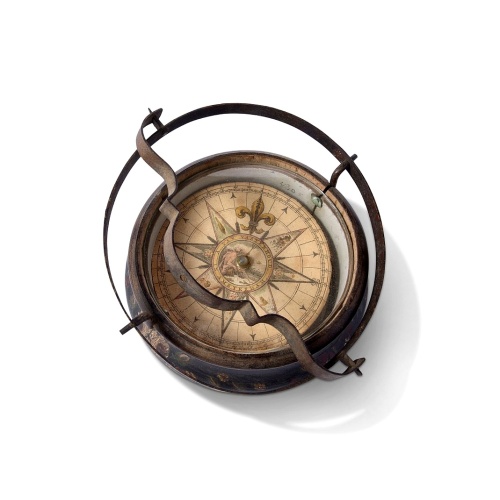
Inverted nautical Compass, called "mouchard" (~ "spy-glass")
Inverted maritime compass called "mouchard" (spy) in wood and brass, signed "A Van Vastenhoud In Amsterdam". This type of compass was found in the captain's cabin and hanging above the captain's bed. The captain was so able to see the direction when he was in his cabin. This example is mounted in a wooden box to keep it safe. The compass itself is mounted on brass gimbals to keep it steady on a moving ship. It has a single iron needle with a brass cap that rests on a spike projecting from the bo...
$7.500
Maker : VAN VASTENHOUD, A.
Place : Amsterdam
Date : ca. 1780
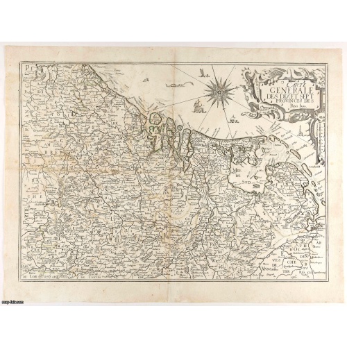
Les Provinces des Pais Bas Autrichiens contenants en XXIV Feuilles les comtées d'Artois, de Flandres, de Hainaut, de Namur et des Duchées de Luxembourg…
Rare wall map of the Catholic of Austrian Low Countries, roughly the southern part of present-day The Netherlands, Belgium and Luxembourg. Map has some large cartouches, ships in the North Sea.
$1.500
Maker : SEUTTER, M.
Place : Augsburg, 1725
Date : 1725
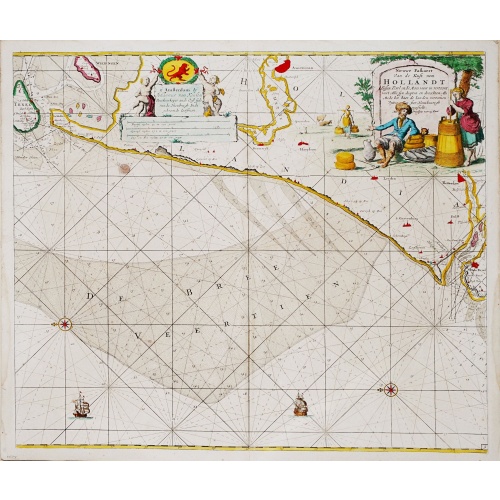
Nieuwe Paskaert van de Kust van HOLLANDT - Tussen Texel en de Maes.
Nieuwe Paskaert van de Kust van Hollandt Tussen Texel en de Maes. A very attractive sea chart off the coast of Holland by Johannes van Keulen with a pair of decorative cartouches, ships sailing off the coast, rhumb lines, compass rose etc. Van Keulen was the founder of the successful van Keulen firm that published charts, pilot guides and sea-atlases for over 2 centuries. In 1680, he published his immensely popular 'Zee Atlas ofte Water Werelt'.
€500
Maker : van Keulen, J.
Place : Amsterdam
Date : ca 1685
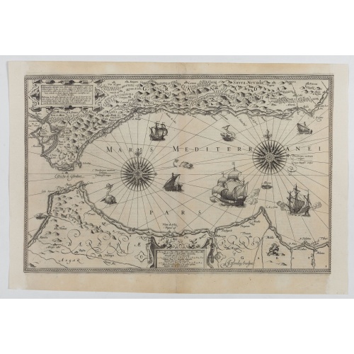
Hydrograhica descriptio
This very rare chart is important as the first printed sea chart of the Mediterranean coast of Spain, Gibraltar, also depicting the northern coast of Marocco.Willem Barentsz (1560-1597) was a famous pilot, discoverer and cartographer. Author of 'Nieuwe Beschrhryvinghe ende caertboeck van de Midlantsche Zee', the first printed pilot-guide of the Mediterranean. It is considered the supplement of Waghenaer's 'Spieghel der Zeevaerdt' for the Mediterranean waters.
€4.000
Maker : BARENDTSZ, W.
Place : Amsterdam, W. Blaeu
Date : 1612
![[Lot of 6 Maps of Germany] PALATINATUS BAVARIAE.](/assets/images/image-loading.svg)
[Lot of 6 Maps of Germany] PALATINATUS BAVARIAE.
[Lot of 6 Maps of Germany]- La Basse Partie Du Cercle Du Haut Rhein divisé en tous ses Estats et Souverainetés. 1696 - (875x580 mm)- Wirtenberg Ducatus (Hondius) 1638 - (494x415 mm)- Partie Orientale Du Palatinat et Eslectorat Du Rhein. Les Eveschés De Spire, De Wormes et Le Comté de Linange. 1692 - (565x430 mm)An attractive map of Bayern, embellished with a fine strapwork title-cartouche and a cartouche with scales.From the Latin, 1613 edition.Gerard Mercator (1512-94). His ' Atlas sive...
€700
Maker : MERCATOR, G. / HONDIUS, J.
Place : Amsterdam
Date : 1619
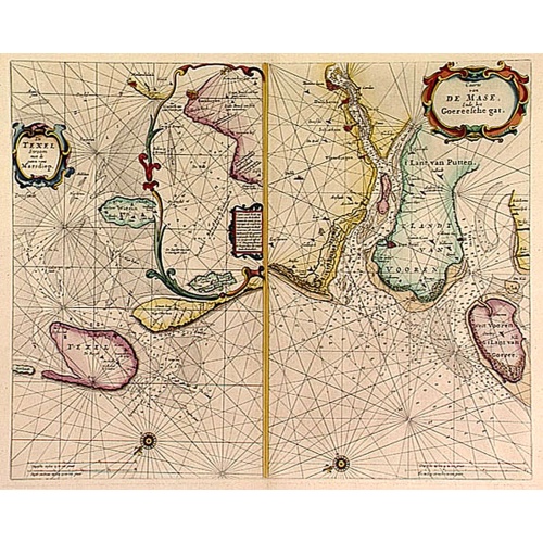
De Texel Stroom .. vant Marsdiep./ Caarte van De Mase...
Two decorative charts on one sheet, one depicting Texel and the entrance of the Zuider Zee with an inset showing the north coast of West-Friesland, the other depicting the river Maas as far inland as Rotterdam and the islands of South Holland.
$600
Maker : GOOS, P.
Place : Amsterdam
Date : 1660
AFRICAE PROPRIAE TABULA In qua, Punica regna vides; Tyrios, et Agenoris / urbem.
AFRICAE PROPRIAE TABULA In qua, Punica regna vides; Tyrios, et Agenoris / urbem. Antique map of North Africa with Carthage. A very decorative map of North Africa with an inset with the town of Carthage. From the rare Spanish edition of Abraham Ortelius’ ‘Theatrum Orbis Terrarum’, published by Vrientius. Abraham Ortelius(1527-98), Dutch cartographer and publisher of the first modern atlas, ' Theatrum Orbis Terrarum' in 1570. Editions till 1612. Also an atlas of ancient cartography, the '...
€350
Maker : ORTELIUS, A.
Place : Antwerp
Date : 1590
-500x500.jpg)
Virulus marinus. Cete (Whale and whaling scene)
Whale and whaling scene, set against a mountainous landscape in the manner of Pieter Brueghel the Elder. Plate number 1. The engraving is copied after Adrian Collaert plate in "Piscium Vivæ Icones" a series first published in Antwerp by Adriaen Collaert after 1598, later published between 1627 and 1677 by Galle family. Several copies were made of this series.Most of the ships in the background were copied from a series of ten prints known as the Sailing Vessels, executed by Frans Huys after des...
$300
Maker : COLLAERT, Adriaen (after)
Place : Antwerp
Date : after 1598
-500x500.jpg)
Osservazioni meteorologiche e punti neri all'orizzonte
Osservazioni meteorologiche e punti neri all'orizzonte
€450
Maker : Gioannetti Leonida diresse
Place : Italy
Date : 1896
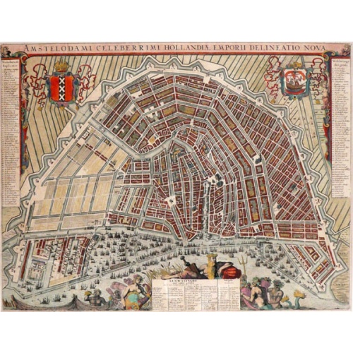
Leti, Amsterdam
54x42,5 cm. Amstelodami Celeberrimi Hollandiae emporii Delineato Nova. Colored Copper engraving. G. Leti. Amsterdam 1690
€2.250
Maker : LETI, G.
Place : Amsterdam
Date : 1690
-500x500.jpg)
Hollandt: Hollandia quae olim Catthorum
One of the Earliest Printed Maps of Holland Produced in the Low Countries
$19.500
Maker : Cornelis de Hooghe
Place : Antwerp?
Date : 1565
![A pair of extremely rare Valk table globes [GLOBES – TERRESTRIAL & CELESTIAL].](/uploads/cache/12345-500x500.jpg)
A pair of extremely rare Valk table globes [GLOBES – TERRESTRIAL & CELESTIAL].
A pair of extremely rare Valk table globes [GLOBES – TERRESTRIAL & CELESTIAL].VALK, Gerard and Leonard. [Terrestrial globe:] Cosmotheore, caelesti nostro globo, par, et plane novus, hic terrestris ut existeret, certo scias, errore veterum sublato, non tantum utriusque orbis, longitudines ac latitudines, par reiterates neotericorum observationes, hicce esse restitutas, sed et nullum typis emendatiorem prodiisse, hoc igitur novissimô tam diu fruere, donec sub majori forma, meô aere alios excud...
€275.000
Maker : VALK, L and G.
Place : Amsterdam
Date : 1700/1750
Celestial table globe. URANOGRAPHIA / SYDERUM ET STELLARUM / in Singulis Syderibus conspicuarum / exhibens Delineationem accuratissimam...
An extraordinary, eye-catching set of these rare globes.
€207.000
Maker : Valk Leonard, Valk, Gerard
Place : Amsterdam
Date : 1750
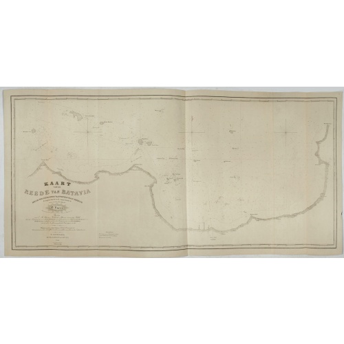
Kaart van de Reede van Batavia met de verschillende vaarwaters naar dezelve trigometrisch opgenomen op last van deb schout bijnacht E.Lucas.
Very large and rare so-called blue-black chart centered on Jakarta's harbor.The chart is prepared by B.G.Escher, I.A.C. Eschauzier, B.H.Staring and E.H.Boom during an expedition in 1841 by the ships Krokodil and Hekla. The chart is engraved by J.C.Zurcher and updated for and published in 1847 by Jacob Swart. When Gerard Hulst van Keulen died in 1801, his widow ran the firm until her death in 1810, at which time Johannes Hulst van Keulen became the last van Keulen to run the firm.In 1823, Jacob S...
$1.800
Maker : HULST VAN KEULEN, Wed. G.
Place : Amsterdam
Date : (1841) 1847
[Lot of 17 maps] L' ISLE DE FRANCE Pariensis agri descriptio. Francois de la Hoeye fecit, Jean le Clerc excud.
The map of Ile de France which Jean Leclerc added in his re-issue of Maurice Bouguereau's atlas 'Theatre Francois' , as ' La Theatre geographique de France' in 1619. An uncommon and decorative map.[Lot of 17] maps of F R A N C E- L'Isle de France, Parisiensis agri descrip(tio). - Gouvernemens de Picardie, de Boulonnois, et d’Artois (1768)- V. Descrittione del Regno della Gallia (1598)-La France Divisée en ses quarante Gouvernamens Généraux et Militaire.- - Topographia aug. Turon. duca...
€1.000
Maker : Jean Leclerc
Place : Paris
Date : 1619
[Lot of 7 Flower prints] Talauma mutabilis. flower Talauma mutabilis from 'FLORA MALESIANA' Arckenhausen del. / Hutz Lith.
The flower Talauma mutabilis from 'FLORA MALESIANA'. Talauma mutabilis by Karl Ludwig von Blume (9 June 1796, Braunschweig – 3 February 1862, Leiden) was a German-Dutch botanist. (3454)Lot of 7 flower prints.- Talauma mutabilis - Sobralia Macrantha- Détails de la liane femelle du Chili- Liane femelle du Chili- Détails de la lianne màle du Chili- Dianthus sinensis heddewigii- Dianthus sinensis laciniatus
€300
Maker : BLUME, Carl Ludwig. von
Place : Germany
Date : 1829
[Religious ritual on Hispaniola].
Scarce print with a German text sheet.On certain feast-days the Indian cacique, while beating a drum, led a procession of his people to the worship of their idol, which was a strange hybrid-like creature with several heads. The men were painted black, red and yellow and came first, dressed in parrot feathers and necklaces of seashells. The women, decorated with jewellery, followed with their naked daughters. When all were assembled, the cacique inserted a stake into his throat, which made him vo...
$80
Maker : GOTTFRIED, J.L. / DE BRY.
Place : Frankfurt, M.Merian
Date : 1633
![[Cavendish reaches Morro Moreno.]](/uploads/cache/39910-500x500.jpg)
[Cavendish reaches Morro Moreno.]
Scarce print with a German text sheet showing Cavendish’s fleet anchor at a place called Morro Moreno, on the coast of Chile. The Indians came down from the high cliffs to greet the voyagers and brought with them firewood and fresh water as a sign of friendship. Later the English were taken to their homes, which were made from two sticks in the ground, with others laid across and covered with straw. The whole family, including children, lay underneath on animal skins. They were skilled fisherm...
$80
Maker : GOTTFRIED, J.L. / DE BRY.
Place : Frankfurt, M.Merian
Date : 1633
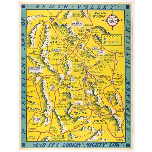
A Hysterical Map Of Death Valley National Monument -- And It's Looking Mighty Low
First edition Humorous map of Death Valley. "Drawn In Broken English by Jolly Lindgren," this comic pictorial map is full of puns and comic vignettes related to Death Valley. The Lindgren Brothers issued a number of other silly whimsical maps of national parks and other parts of the West.
$500
Maker : LINDGREN, J.
Place : Spokane, Wash., Lindgren Brothers,
Date : 1948
-500x500.jpg)
Nuovo Mondo parte Settentrionale.
Uncommon map of North America prepared by Francesco Costantino Marmocchi. Above the map "Geografia Commerciale". From "Il Globo Atlante di carte Geografiche compilate da F.C. Marmocchi per servire di corredo al suu corso di geografia commerciale", with the maps engraved by engraved by Gius. Cattaneo, Campo Antico, C. Poggiali, G. Bonatti, and Ces. Magrini.Marmocchi (Poggibonsi, 1805-Geneva, 1858) was known as a geographer and cartographer. He emigrated to Rome, and later to Corsica, later settle...
€50
Maker : MARMOCCHI, F.C.
Place : Genova, Paolo Rivara fu Giacomo
Date : 1858