Showing results 1 to 80
Trippini
Osservazioni meteorologiche e punti neri all'orizzonte
€450
Loeb-Larocque
Boertige reis door Europa. . . [with] Europa volgens de nieuwste verdeeling. . .
Rare illustrated publication including a rare map of Europe as a regal queen with the title "Geheimzinnige toebereidselen tot eene boertige reis door Europa. [...] voorgeleezen in [...] de maatschappij der verdiensten, onder de spreuk: Felix Meritis. / By A. Fokke Simonsz".The book contains a map of Europe (168x2369mm.) engraved by H.Klockhoff and a cartographical curiosity, "Europa volgens de nieuwste verdeeling...", Europe as a regal queen but with an interesting twist and political commentary...
€1.900
Loeb-Larocque
't Hooge Heemraedschap van Delfland met alle de Steden, Dorpen, Ambachten, Litmaten, Polders, (etc.).
The so-called Kruquius map is a wall-map of the Delfland water board district. The map consists of 25 engraved map sheets. Several maps flanked by fine large armorial cartouches. All sheets together cover a wall map with a total area of 230 x 280 cm. The map was often bound in a rich gilted calf binding and presented as gifts to important persons. The atlas than included also the overview map. According to Prof. Koeman "Thanks to the quality of the cartography (a “sensitive” scale of 1:10,00...
€3.750
De_Roo
Terrestrial globe: Cosmotheore, Caelesti nostro Globo,
An extraordinary, eye-catching set of these rare globes.
€275.000
Caert-Thresoor
Caert-Thresoor verschijnt 4 keer per jaar op papier
Caert-Thresoor verschijnt 4 keer per jaar op papier. Een jaarabonnement kost in Nederland € 37,50, in België € 40,00, en in overige Europese landen en buiten Europa € 47,50.Voor overige vragen, zoals advertenties en losse nummers, schrijf naar: Caert-Thresoor Abonnementen en administratie administratie@caert-thresoor.nl
€38
Papyro
Painting made by a sailor, signed W. Welman.
Painting made by a sailor, signed W.Welman.
€250
Paul_Bremmers
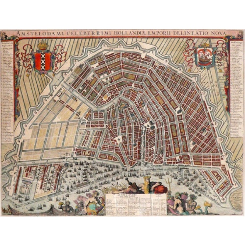
Leti, Amsterdam
54x42,5 cm. Amstelodami Celeberrimi Hollandiae emporii Delineato Nova. Colored Copper engraving. G. Leti. Amsterdam 1690
€2.250
Paulus_Swaen
Nieuwe Wassende Graade Zee Kaart over de Spaanse Zee Vant Kanaal tot 't Eyland Cuba in Westindia. . .
¤ Engraved by I.van Anse. A very representative example of a Dutch chart of the Atlantic, showing the north-east coast of America, the coasts of Africa and Europe and South America, including Florida and the West Indies. Gerard issued ca. 40 charts of this exceptionally large format. Collections of these large-size charts were issued in the shining sea-torch and as separate atlases.Title in Dutch, French and English. North America from Labrador to West Florida, including New Foundland, the Gulf...
$3.000
Paulus_Swaen
Vertoog van het regt, Dat de Vereenigde Nederlandsche Oost-Indische maatschappye Heeft op de Vaart en Koophandel naar Oost-Indiën, Tegen de inwooners van de Spaanse, nu de Oostenrykse Nederlanden.
Dutch translation of the Latin edition, published in 1723. Westerveen was the secretary of the Dutch East India Company and writes on the right of the VOC to trade as well as on VOC maritime trade with the East Indies. Westerveen also addresses these matters with regard to the Dutch West India Company and deals with Dutch trade in the light of the interests of both Spain and Portugal in the Americas and in Asia.Also contains an interesting Extract uyt de Resolutien door den Gouverneur Generaal e...
$1.200
Paulus_Swaen
Nader prolongatie van het Octroy voor de Westindische Compagnie voor den tyd van nog dertig jaaren. . .
A proclamation by the Dutch States General, dated 1761, extending the charter of the Dutch West India Company for another thirty years. Like the 1730 proclamation, it has detailed information about the import of slaves from West Africa to Surinam, Essequibo and Berbice, where the WIC was granted a monopoly in the slave trade, while others could import slaves to Curaçao and other parts of America, as the proclamation notes.
$1.500
Paulus_Swaen
Gustaaf Willem Baron van Imhoff.
Decorative portrait of Gustaaf Willem Baron van Imhoff, who was Governor for the V.O.C. (Dutch East Indian Company) in Indonesia.
$750
Paulus_Swaen
[Ternate].
Text engraving showing a bay on the Island of Ternate, an island in the Maluku Islands (Moluccas) of eastern Indonesia. Above the map a lettered key (A-E). Text engraving from "Premier livre de l'histoire de la navigation aux Indes Orientales, par les hollandois, et des choses a eux advenues . . . ", being the classic account of the first Dutch voyage to the East Indies under the command of Cornelis de Houtman. the expedition left in 1595, after Holland had achieved independence from Spain and c...
$150
Paulus_Swaen
Calendrier de la cour, tiré des éphémérides, pour l'Année bissextile.. / Notebook bearing silver plates with the VOC monogram.
A personal gift, only made for the trustees of the V.O.C. The silver plate was probably made by Drick van Hengel and Company because an entry in the diary of mintmaster Johann Georg Holtzhey for the years 1777-1784 reveals that silver work for book clasps for the Delft and Rotterdam chambers was to be supplied by Dirck van Hengel and Company on a yearly basis.The almanac contains a list of the daily sun rise and sun set, the phases of the moon, etc. Jacques Collombat (Grenoble, circa 1668 - idem...
$4.500
Paulus_Swaen
Virulus marinus. Cete (Whale and whaling scene)
Whale and whaling scene, set against a mountainous landscape in the manner of Pieter Brueghel the Elder. Plate number 1. The engraving is copied after Adrian Collaert plate in "Piscium Vivæ Icones" a series first published in Antwerp by Adriaen Collaert after 1598, later published between 1627 and 1677 by Galle family. Several copies were made of this series.Most of the ships in the background were copied from a series of ten prints known as the Sailing Vessels, executed by Frans Huys after des...
$300
Paulus_Swaen
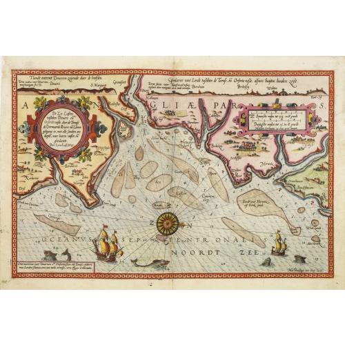
De zee cuften tufschen Dovere en Orfords nesse, daer de Teemse de Vermaerde Rivire van Lonen gelegens is. . .
A detailed chart of the English Channel coastland. Decorated by a colorful title cartouche and scale cartouche, one compass rose, several vessels and sea monsters. A very early edition rare Dutch text edition of this landmark contribution to the science of navigation. Waghenaer's own personal experiences as a pilot along European coasts were used to compile the Spiegel der Zeevaerdt, the first edition of which was published in Dutch at Leyden in 1584/85 by the House of Plantin. Although advertis...
$3.000
Paulus_Swaen
Beschrijvinge vande de zee Cuften va Vlanderen en Picardien. . .
DUTCH TEXT EDITION. A detailed chart of the coast of Flanders and Normandy decorated by a large colorful baroque title cartouche, and the coat of arms of Flanders with a colorful scale cartouche decorated with a compass, a compass rose, several vessels and sea monsters. From an early Dutch text edition of this landmark contribution to the science of navigation. Waghenaer's own personal experiences as a pilot along European coasts were used to compile the Spiegel der Zeevaerdt, the first edition ...
$3.000
Paulus_Swaen
Lyste vande prysen der goederen ingekoft by de Kamer. . .
Rare price list of meat, bacon, wheat, rye, butter, cheese, olive oil, Spanish wines, Bordeaux, brandy etc.On front page in letter press Lyste Van de Pryfen der Goederen, Ingekofst by de Kamer van de OOST-INDISCHE COMPAGNIE tot Gestelt na de datums van der zelver inkoop.Dated in manuscript 1685. Rare pricelist of articles purchased by the V.O.C. over the year 1685. Including large quantities of French wines!. Very rare.
$2.500
Paulus_Swaen
Carta prima Generale dell' Asia.
FIRST STATE of Robert Dudley's general chart of the Persian Gulf, going east through India to the southeastern coast of China showing Macau and the area of present-day Hong Kong. The map goes south through the Philippines, passing through Borneo, the western part of Celebes (now Sulawesi, Indonesia). It also includes the Maldives and the Chagos Archipelago.This elegant sea chart is crisply engraved in the sparse Florentine style with superb calligraphy throughout. Very decorative chart from the ...
$17.500
Paulus_Swaen
Belchrijuinghe vande zee custen van Engelandt. . .
A rare Dutch text edition of this detailed early chart of the northern coast of England. West to the top. The mileage cartouche has no Latin captures. Decorated by a colorful title cartouche and scale cartouche, one compass rose, and several vessels. An early Dutch text edition of this landmark contribution to the science of navigation. Waghenaer's own experiences as a pilot along European coasts were used to compile the Spiegel der Zeevaerdt, the first edition of which was published in Dutch at...
$3.000
Paulus_Swaen
New York Ferry Boat. (Bac à vapeur de New York).
A very decorative print showing the New York Ferry Boat "Fulton," published by Currier & Ives. The Ferry boat "Fulton" sails to the right. A single smokestack trails smoke, and two flags blow to the left. Passengers, horses, and a carriage are visible on deck, and a captain is in the wheelhouse at right.Published by Currier & Ives 125 Nassau Street, New York."Currier & Ives was a New York publishing firm that produced and sold thousands of impressions of more than 7,000 different lithographic pr...
$550
Paulus_Swaen
Very rare share in the Ostend Company. (4527)
Upper left hand corner share number 4527 in manuscript. In top emblem of the Ostend Company in copper engraving. Text: De Directeurs van de generale Keijserlijche- Indische compagnie, ordoneren aen hunnen cassier 'joan Baptist Cogels junior, te ontvangen van D'Heer Ferdinand Anthoin Baron de Veecquemans, Antwerp. de somme van tweehondert en vijftigh guldens wisselgeldt, voor het eerste payement sijnder actie van een duijsent guldens in het Capitael van de Selve compagnie, op de conditien in het ...
$2.000
Paulus_Swaen
India quae Orientalis dicitur, et Insulae adiacentes.
A fine map of South East Asia, extending from India to Tibet to Japan to New Guinea. Formosa appears on this map, and even parts of Japan and Australia are seen. A handsome map in the typically baroque Dutch style.Noteworthy for being the second map to include the discoveries made in New Guinea and northern Queensland, Australia by the Dutch vessel Duyfken in 1605-06. Under the command of Willem Janzoon, the Duyfken explored the eastern shore of the Gulf of Carpentaria, just below the Cape York ...
$1.850
Paulus_Swaen
Ware affbeeldinge wegens het casteel ende stadt Batavia. . .
A reduced version of Clement de Jonghe (1650) plan of Jakarta from 1650. The town plan has a vignette at the bottom showing Jakarta from the sea with the volcanoes Mount Gede, Mount Pangrnago and Mount Salak in the background. Engraved for Arnoldus Montanus "Gedenkwaerdige gesantschappen der Oost-Indische maatschappy in ’t Vereenigde Nederland. . ." (1669) but reissued by Pieter van der AA.Batavia, present-day Jakarta, the Dutch center of trading activities in the East Indies. European and nat...
$800
Paulus_Swaen
Americae Sive Novi Orbis, Nova Descriptio.
This is the second copperplate of Ortelius' map showing the western hemisphere, showing the prominent bulge in the South American coastline. An important map because of its influence on the European perceptions of America. When the map was first published by Abraham Ortelius at Antwerp in 1570, it was the best map of the Americas available.It was in fact the first of its kind to achieve-wide circulation through an atlas. Lower California is correctly shown as a peninsula and America is separated...
$5.500
Paulus_Swaen
Zee caerte vande Sondt tvermaerste van Danemarcke . . .
A detailed chart of the coast of Denmark and its islands, Copenhagen in the center of the chart. West to the top. It is decorated by a title, scale and descriptive cartouche, a compass rose, several vessels and sea monsters, and depictions of mountains, fields, trees, small villages and animals.The chart shows soundings, sandbanks, landmarks and coastal profiles.Chart from an early Dutch text edition of this landmark contribution to the science of navigation. Waghenaer's own experiences as a pil...
$3.000
Paulus_Swaen
Inventio Maris Magallanici.
Allegorical scene allegorical image celebrating the circumnavigation of the earth by Ferdinand Magellan. The image shows Magellan on board of his ship, surrounded by mythological figures including Apollo with sun and lyre, Zeus on his throne of clouds, Adam and Eve. A bird carrying an elephant and a depiction of the Tierra del Fuego.The image also includes cannon, banner with the double-headed Hapsburg eagle, anchor, broken mast, navigational instruments such as armillary sphere and dividers, se...
$400
Paulus_Swaen
Quartum Praelium Coniovian inter et Fluvium Rio Grande XVII Ian
Decorative engraving of the fourth sea battle with the Portuguese fleet offshore at the Rio Grande, in1640. Engraved by J. van Brosterhuyzen after a design by Frans J. Post (1612-1680). Below the engraving a numbered key (1-6). Signed in the plate "F. Post 1645" and decorative title cartouche, with "[Quartum praelium coniovian inter et fluvium Rio Grande XVII Jan" in the upper left corner.Taken from C. BARLAEUS, Rerum per octennium in Brasilia (...).
$450
Paulus_Swaen
The Royal Naval review at Spithead, June 26th, 1897. In Honour of Her Majesty Queen Victoria's Diamond Jubilee.
A very decorative and large chromolithographed plate showing a line up of international vessels at Spithead, June 26th, 1897 In Honour of her Majesty Queen Victoria'a Diamond Jubilee. Below names of all International and British vessels giving presence on that day.
$750
Paulus_Swaen
Britain's Empire on the Sea. Dedicated to Captain the Right Honourable Lord Charles Beresford...
A very decorative and large chromolithographed plate showing all the effective strength of the British navy with the name and class of each ship shown beneath, except for the torpedo boats destroyers denoted by numbers.The pate is dedicated to the Right Honourable Lord Charles William de la Poer Beresford (10 February 1846 – 6 September 1919). He was a British admiral and Member of Parliament. He combined the two careers of the navy and a member of parliament, making a reputation as a hero in ...
$1.000
Paulus_Swaen
A folding fan showing a nautical festival, ca. 1770.
Folded fan, painted in gouache a ship pulled by two horses. On board, a large company, among others joins them while fishermen watch the scene.Reverse painted with an exotic flower. Monogram "SK" on the left.The ivory frame is engraved with flowers enhanced with silver foil.
$1.500
Paulus_Swaen
Share of 1000 Florins to Michel de Knyff. N° 135.
Share of 1000 Florins, paid in four tranches at 250 Florins of Vienna, from "Compagnie Imperiale & Royale Octroyee d'Assurance de Commerce & d'escompte." dated in manuscript, Trieste, May 1, 1783. Share made out to Michel de Knyff of Antwerp.In their high-flying plans, the proud Habsburg monarchy very often relied on the money of the wealthy Antwerp bankers and wholesalers, who at that time belonged to the Austrian Netherlands. Among the financiers was the famous bank of Ertborn & Fils among man...
$1.500
Paulus_Swaen
Carte de l'Ile de Java. . .
An inset plan of Batavia and clearly indicated rice fields, mountains, forests, towns in profile, and even elephants, suggesting the wealth of detail found on this map. Modeled on Hadrien Reland's important Dutch map of a few years earlier, the superb topographical detail is complemented by drapery style cartouche and side panels which provide a full French text description of the island, its topography, history, flora, fauna and inhabitants. Above the map are two drapery style title banners wri...
$1.750
Paulus_Swaen
Transom of a ship in gilded carved wood bearing the inscription "DUMONT- DURVILLE"
Decorative transom sign in gilded carved wood bearing the inscription "DUMONT- DURVILLE" in a foliage environment. The transom usually kept the name of the ship and was often well-decorated.A transom is the flat, vertical surface at the back of a ship that connects the two sides of the hull. The sign holds the name of the great French explorer Jules Dumont d'Urville D’Urville who first visited New Zealand in 1824 as second-in-command to Louis Duperrey. On his second voyage of exploration and...
$7.500
Paulus_Swaen
Flaggen aller seefahrenden potenzen und nationen…
A highly decorative and beautiful print with 139 flags of the sea-faring nations, factions, and trading companies. Among the more interesting flags are those of the Dutch West India Company (G.WC. /Geoctroyeerde Westindische Compagnie) and the Dutch East India Company (V.O.C. / Vereenigde Oostindische Compagnie). This plate is probably derived from a Dutch flag print issued by Cornelis Danckerts c. 1700.
$1.000
Paulus_Swaen
[Columbus is standing in the bow of his ship]
Columbus is standing in the bow of his ship, which is near the shore. He is clad in a long mantle and undercoat, while his armor lies at his feet, and his standard is floating from the foremast. Behind him is Minerva, carrying a spear and a shield with the head of Medusa in the center, presenting a laurel branch to Columbus.Behind the goddess is Mars in full armor, standing on the back of a turtle for a chariot, and drawn by three lions. Near him, are two Sirens, whilst at the head of the vessel...
$400
Paulus_Swaen
Freedom of the Air.
A world map packed with information about aviation and the aluminum industry.The use of aircraft in warfare, especially in the roles of close ground support and strategic bombing, was completely revolutionized during WWII. Apart from tactics, the technology also evolved to facilitate heavier bombers, faster fighters, more capable transports and greater range all-around. One critical component of this development was using light, flexible and sturdy aluminum frames and skins for the planes, rathe...
$230
Loeb-Larocque
Nieuw Nederlandtsch Caertboeck. Waer in volkomentlijcker als oyt te voren vertoont werden de XVII. Nederlanden.
Rare first edition of this atlas of the provinces of the Netherlands, Belgium and Luxemburg. Engraved title page, with : "Gedruckt t' Amsterdam by Abraham Goos Plaetsnyder wonende op den Dam in 't vergulde Caertboeck.Our atlas is conform to the copy described in Koeman/Krogt : "One copy is known of the B-edition without text (Brussel KB IV). All maps in this copy are in the second variant".A. Goos published on his own a single atlas, the " Nieuw Nederlandtsch Caertboeck" with 23 maps. He receive...
$3.000
Loeb-Larocque
Novus Atlas Absolutissimus... Die Wasser-Welt, oder See-Atlas.
Volume IX (Sea-Atlas) of the "Novus Atlas Absolutissimus". German text, letterpress title on slip within hand-colored engraved architectural border, heightened in gilt, 39 maps are finely colored by a contemporary hand. With 6 additional maps by Visscher listed in the index : ("Insulae Americanae", "Insula Matanino", "Novi Belgii", "Indiae orientalis", "Insularum Melitae" et "Insula Candia").The ‘Water wereld’ was, Koeman states, the “first sea-atlas (in the real sense of the word) print...
€37.500
Loeb-Larocque
De Bello Belgico decades duae ab excessu... [including lion map]
Included in Famiani Stradae Romani è Societate Jesu de Bello Belgico Decas duae... .Published by Johann Godfried Martin Schönwetter. The book was first published in 1651 and re-published in 1699. The binding is a fine German blind-tooled pigskin, clamps wanting. Fair amount of pages has the usual browning. Copy is somewhat used but altogether very fine. Specially the folding historical engravings are of a high standard.The Bello Belgico , written by Famianus Strada (1572-1649), Jesuit and teac...
$3.500
Paulus_Swaen
Gezicht van het Admiraliteits-Magazyn en Scheeps Timmerwerf.
Formerly the V.O.C. warehouse and arsenal for the Admiralty of Amsterdam, now-a-days the Scheepvaartmuseum (Maritime Museum). Taken from the "Atlas of Amsterdam".
$300
Paulus_Swaen
A Perspective View of the Admiralty Office, Dock-Yard, Storehouses &c. at Amsterdam.
Decorative engraving giving good detail of the intense activity in the Amsterdam dockyards.Engraved for BANKES's New System of Geography
$300
Paulus_Swaen
Oost-Indis Zee Magazyn - Arçenal des Indes Orientalis.
Decorative view of the East Indian Arsenal, now-a-says the Maritime Museum.
$150
Paulus_Swaen
Arcenal de l'Amirauté.
A decorative print of the 'T Landts Magazyn , or 'Scheepvaart Museum' (Naval Museum).
$80
Paulus_Swaen
Vue du Magazin de la Compagnie des Indes Orientales. . .
So-called optical print of the formerly the V.O.C. warehouse and arsenal for the Admiralty of Amsterdam, now-a-days the Scheepvaartmuseum (Maritime Museum).In the eighteenth and nineteenth centuries there were many popular speciality establishments in Paris, Augsburg and London which produced optical viewing devices and special engravings to be viewed through them. In the 18th century the optical print or vue optique came into existence, whose exaggerated converging lines were intended to produc...
$550
Paulus_Swaen
Currus Veliferi Illmi. Pr. Mauritii Nassouvii. (Prince Maurits' sailing-carriage, designed by Simon Stevin. )
Prince Maurits' sailing carriages had been designed by Simon Stevin. The Prince, always accessible to new inventions of his old instructor, could not please the foreign ambassadors more than by inviting them for a ride in his carriage. The big sailing-carriage could seat 28 persons and could reach a speed of seven miles per hour. Land sailing : The Chinese had "wind-driven carriages" since the 6th century AD, during the Liang Dynasty, and eventually mounted masts and sails on large wheelbarrows....
$1.800
Paulus_Swaen
D' Admiralyteyts Huys - La maison de l'Amirauté.
Decorative print of the "D'Admiralyteits Huys", Het Prinsenhof, of the Dutch East India Company VOC. Located at the Oudezijds Voorburgwal 195-199, Amsterdam.
$150
Loeb-Larocque
De Bello Belgico, Decas Prima / Decas Secunda.
With 2 engraved titles of the 'Leo Belgicus', with one paw resting on a shield bearing the title, large woodcut printer's device on the colophons, and 30 richly engraved views and plans of battles and sieges, 28 double-page and 2 full-page, by Johanness W.Bauer, J.Miele, Jacomo Cortese, a.o. Two examples of the famous Leo Belgicus map are included. Among the greatest decorative works of early cartography is a series of arresting maps showing The Netherlands and Belgium in the shape of a lion.Thi...
€6.900
Loeb-Larocque
L'Europe en Sept 1939. Ille terrarum mihi angulus ridet.
A rare oversized serio-comic map of Europe at the start of the Second World War depicting stereotypes of 31 countries, as listed in the key lower right, including Britain as a woman with battleships on leads; France as Marianne, leading her troops into battle; Germany, with a swastika sash, stabbing a female Poland; and Russia as a Cossack holding a hammer and sickle, his arm around a large brown bear. Very scarce, although as mentioned on the map 150 were printed, only three, nos. 8, 9, 10, 13...
€9.000
Loeb-Larocque
Beschrijving van Oud en Nieuw Oost-Indien. Vervattende een Naukeurige en uitvoerige verhandelinge van Nederlands Mogentheyd [...] met meer dan thien honderd en vyftig Prentverbeeldingen verrykt...
"The most comprehensive work on Asia published in Europe during the early colonial period" (Landwehr). The first book to give a comprehensive account in text and illustration, of the peoples, places, and natural history of Indonesia" (Bastin & Brommer). Volume I, part I contains the preliminary matter plus the Philippines and Acapulco;- volume I, part II covers the Moluccas;- volume II and volume III, part 1 cover Amboina;- volume III, part 2 covers Amboina, Celebes, Borneo, and Further India;- ...
€23.500
Paulus_Swaen
Tweevoudigh onderwiis van de Hemelsche en Aerdsche Globen; Het een Na de meyning van Ptolemeus met een vasten Aerdkloot...
Tweevoudigh onderwiis van de Hemelsche en Aerdsche Globen; Het een Na de meyning van Ptolemeus met een vasten Aerdkloot; Het ander Na de Natuerlijcke stelling van N. Copernicus met een loopenden Aerdkloot:Willem Blaeu's guide to the making of globes, first published in 1620, here reprinted by his son, Joan.The book consists of two parts; volume I : Astronomical principles of celestial and terrestrial globes based on the inadequate hypothesis of Ptolemy.Volume II : Astronomical principles of glob...
$2.250
Paulus_Swaen
Theatrum praecipuarum urbium Ducatus Brabantiae. / bound with : [Hogenbergs Geschichtsblätter].
Volume including two series :1st series : [Schut, Pieter Hendricksz]. Theatrum praecipuarum urbium Ducatus Brabantiae… Illustrated with an engraved title page and 43 plates.A very rare town atlas created by P. H. Schut and published by J. N. Visscher featuring the towns of Brabant, Flanders and Zeeland. This series is followed by a series of 89 plates from F. Hogenberg's Geschichtsblätter.This series of 43 plates of animated views of towns engraved by Pieter Hz Schut (c. 1619-1660) was publis...
$6.000
Paulus_Swaen
Compass.
A very nicely crafted sloop compass in original box. The compass is gimbaled and is executed in beautiful red copper. Made and signed by F.J. Kloos & Son of Rotterdam in the 1850-1875 period. The compass works fine. Height of the box: 13.5 cm (5.5 inches)
$2.250
Paulus_Swaen
Mariner’s compass
Inverted compass called "snitch" in wood painted in imitation of tortoiseshell and brass, signed "Ing MANN Maker Water Street Liverpool".
$3.000
Paulus_Swaen
A ship's hour glass.
Maritime hourglass with blown glass bulbs, orange sand, junction ring covered with cord, the circular ebony frame with six turned baluster columns. The invention of the hourglass is attributed to an 8th-century monk in Chartres, France, with the marine sandglass appearing as early as the 14th century. In earlier examples, the bulbs were connected with a material such as putty or hardened wax, bound in leather, linen or string. From about 1720, the two bulbs were welded together over a brass bead...
$2.000
Paulus_Swaen
[Printed on silk] Nieuw Wassende Graaden Paskaart Vertoonende alle de bekende Zeekusten en Landen op den geheelen Aard Boodem of Werelt door Gerard van Keulen. . .
A very scarce and beautiful chart on Mercator's projection printed on silk. The map is printed on silk. With the name of Gerard van Keulen and the privilege. The map shows great interior detail, including a well-formed depiction of the Great Lakes and Mississippi River. Fort de Creveceur is shown near the Illinois River. The east coast of Siberia has been drawn after Nicolas Witsen's 1687 map of Tartary. A Great Companies Land has been added off the northwest coast of America. California is an i...
$20.000
Paulus_Swaen
Compass.
A sloop compass in the original wooden box with lit. The compass with floating rose (Cardan system). Slung in gimbals, the east point is decorated and graduated in half points and decorated N & E points.The cardan suspension system, also called a gimbal, is a pivotal support that allows the rotation of an object about a single axis. If simultaneously assembled three rings, one on another by orthogonal rotation axes, an object placed inside the third ring always remains horizontal, regardless of...
$650
Paulus_Swaen
Early 19th century magnetic dry card compass with wooden bowl,
Brass dry rose marine compass, in its mahogany case. The mariner's compass, which enabled mariners to know the direction in which they were sailing, has always been one of the most important navigational instruments.This example is mounted in a wooden box to keep it safe.. The compass itself is mounted on brass gimbals to keep it steady on a moving ship. It has a single iron needle with a brass cap that rests on a spike projecting from the bottom of the bowl, which also contains some lead to wei...
$1.750
Paulus_Swaen
Marine parallel rulers in brass.
Very fine marine parallel rulers in brass. The parallel ruler is the oldest and most traditional way to measure and trace routes and bearings. The principle is simple: the ruler is placed on the road to be measured and then, like a pantograph, the other part of the ruler is placed on one of the declination roses on the map to determine the angle. They are, essentially, two straight-edges hinged so that they maintain the same angle. By alternating the moving edge, and securely holding down the no...
$1.500
Paulus_Swaen
Nocturnal in boxwood and brass.
Nocturlabe in boxwood and brass, the wheels maintained by a central nut presenting an annual calendar divided into months and days, an hour disc and a mobile alidade, the back engraved with a compass rose.The grip is openwork with a heart inscribed "Both Bears" for the Big and Little Dipper.England, circa 1700.Height without the alidade : 21,5 cm - Height in total : 26 cmNocturnal (sometimes called a ""horologium nocturnum" - time instrument for the night) in boxwood and brass, the wheels held ...
$15.000
Paulus_Swaen
A ship's hour glass.
Maritime hourglass with blown glass bulbs, orange sand, junction ring covered with cord, the circular ebony frame with six turned baluster columns.The invention of the hourglass is attributed to an 8th-century monk in Chartres, France, with the marine sandglass appearing as early as the 14th century. In earlier examples, the bulbs were connected with a material such as putty or hardened wax, bound in leather, linen or string. From about 1720, the two bulbs were welded together over a brass bead ...
$1.750
Paulus_Swaen
A cordiform - heart-shaped - horary quadrant marked with Gunter scales.
A small and charming but very fine heart-shaped horary quadrant marked with Gunter scales. The scales are very finely engraved on both sides.The quadrant was a very practical, functional, and portable instrument used for navigation. A horary quadrant is used to find the time of day by measuring the Sun’s altitude. As the quadrant became smaller and thus more portable, its value for navigation was soon realized. The first documented use of the quadrant to navigate at sea is in 1461, by Diogo Go...
$8.000
Paulus_Swaen
Very fine brass astronomical equinoctial ring with two brass circles.
Very fine brass astronomical equinoctial ring with two brass circles with engraved foliage decoration, signed "Jean-Baptiste-Nicolas Delure A Paris", on the hanger ring. The meridian ring is engraved with a latitude scale 90-0-90 degrees, reverse with a scale for determining solar altitude and zennith distance, an equinoctial ring with obverse engraved with hour scale in Roman numerals, the central bridge with pin-hole sliding over calendar and zodiac scales, 100 mm diam.Jean-Baptiste-Nicolas De...
$8.000
Paulus_Swaen
Pas-Kaat vaneen gedeelte van de Aethiopische Zee behelsende de Kusten Zanguebar, Ajan en Abex, en een gedeelte van de Arabische Kust. . .
A finely engraved and detailed chart of the most eastern tip of Africa, including Somalia, Djibouti, Yemen, Mauritius, and many other islands in the Indian Ocean.Very rare: only included in 6th volume (so-called secret atlas) of Van Keulen's. Latitude scale, compass rose and system of rhumb lines, soundings, anchorage's, etc. Many Dutch names and a wealth of cities and information appear in the chart. The trading posts of the different nations are marked with flags. Number 47. in lower left corn...
$4.500
Paulus_Swaen
Pascarte van Europa Beginnende vande Canael tot aen Spitbergen, en van Ysland tot aen Nova Zemla . . .
An eye-catching chart of northern Europe with a coastline from northern Russia to the Dutch English Channel in the south. Good detail on Iceland. North to the top.In the upper left corner an inset map of Spitzbergen. Illuminated manuscripts had often been produced in pen and wash with a very limited color range, and many artists such as Jean Pucelle and Matthew Paris specialized in such work, which had been especially common in England since Anglo-Saxon times.Renaissance artists such as Mantegna...
$3.750
Paulus_Swaen
Eastern passage to China. sheet 1.
James Horsburgh early chart of the coasts of Java, Bali, Lombok, with part of Sulawesi, and Borneo. Insets of "Sketch of Bally Strait", Sketch of Lombock Strait", Plan of Allas Strait", "Sketch of Sappy Strait".The chart shows depth soundings & both topographical and hydrographical details and proposed sailing directions in the Sunda Straits. Filled with several coastal profiles, which were of great help for the sailor.In top Horsburgh thanks for the aid he has gotten for preparing this chart : ...
$3.000
Paulus_Swaen
Nieuwe Pas=Caart strekkende van Pta Cataon tot Pta. Lamtoan, langs de kusten van Cochinchina, Tonquin, Quangsi en Quantung [?] van Macao.
A finely engraved and detailed chart of Vietnam reaching to Macao and present-day Hong Kong..Very rare: only included in the 6th volume (so-called secret atlas) of Van Keulen's. Latitude scale, compass rose and system of rhumb lines, soundings, anchorage's, etc. Many Dutch names and a wealth of cities and information appear in the chart. The van Keulen family operated a chart-making and publishing firm in Amsterdam for nearly 200 years. It was founded by Johannes van Keulen who registered his bu...
$15.000
Paulus_Swaen
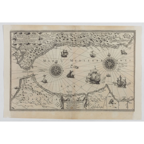
Pascaerte Van't Westelyckste der Middelandsche Zee. . .
An eye-catching chart of the western part of the Mediterranean Sea.Pieter Goos (ca. 1616-1675) was one of the most important cartographer, engraver, publisher and print seller of Amsterdam. His widow continued business at her husband's death. She re-issued the Nieuwe Groote Zee-Spiegel in 1676.In very decorative original colors. The compass rose and cartouche heightened with gold.The map is in a strictly contemporary coloring and of the highest level.
$3.750
Paulus_Swaen
Nieuwe en Nette Afteekening van het Eyland Corsica en het Eyland Elba vertoonende alle desselfs Havenen, Steeden en Rivieren . . .
Highly decorative large sea chart of Corsica, Sardinia and Elba, including multiple sailing ships, compass roses, cartouche, coat of arms, rhumb lines, topographical details, soundings, etc.Inset map of "Eyland Zlba of Ilva int Groot". Includes rhumb lines, topographical details, soundings, and a host of other details.
$4.000
Paulus_Swaen
Universe Europae Maritime Eiusque Navigationis Descriptio. Generale Pascaerte van Europa . . .
This general chart of north-western Europe and the surrounding coastal waters is from the rare pilot-guide De Spiegel der Zeevaerdt , printed by Christopher Plantin in Leyden.FIRST PLATE AND FIRST STATE, which appeared in the first 3 editions, before Latin names of some seas and inscriptions in the scale bars were added. (editions 4-12). EXTREMELY RARE.The map's title is given in both Latin and Dutch, with the latter attributing it to Waghenaer and nothing a privilege of ten years. The date 1583...
$19.000
Paulus_Swaen
Mappe-Monde pour connoitre les progres & les conquestes..
Unusual double hemisphere map with California as an Island. Dutch text describes the expeditions and colonial possessions of the Dutch East India Company. The map originated in about 1670. Chatelain acquired the plate; he added decorative elements, including sailing ships, the Dutch crest, and a figure representing Europa seated inside a native fort.Zacharie Chatelain (d.1723) was the father of Henri Abraham (1684-1743) and Zacharie Junior (1690-1754).They worked as a partnership publishing the ...
$800
Paulus_Swaen
Nieuwe Paskaert van de Custen Zee Loango en Angoy van C. de Lopo Gonzalves tot R. de Zaire os Congo vertoonende alle desselfs gelegenteden.
Sea-chart of the coast of Gabon, Loango, Angoy and Angola to Zaire (Congo) River. In lower right side title and two coastal profiles. In upper left corner inset charts of Cabo de Lopo Gonzalves and Mouth of the Congo River. With a latitude scale, compass rose and system of rhumb lines, soundings, anchorage's, etc. East to the top.The Dutch firm and printing house van Keulen was one of the most important and leading publishers for sea charts during the ending 17th century. Their firm was leading ...
$500
Paulus_Swaen
Nieuwe Wassende Graadige Pas-kaart van de Kust van Guinea en Brasilia.
Rare two-sheet sea chart of the coasts of Brazil, West Africa and South Africa, published by Johannes Van Keulen (the younger), circa 1720.The chart shows the western coast of Africa but the information provided in the map for Inland territories is wide. The South American coast of Brazil, the latter with a large, decorative, dedication cartouche inland, and Guyana. In the left-hand part a large dedicational cartouche to Abraham Anias, with the signature of Johannes van Keulen.Abraham Anias (169...
$2.250
Paulus_Swaen
Pas-Caart van Hispangien vertoonde de Custen van Granade…
An eye-catching chart of Spain and Portugal, including a large part of Brittany and the southwestern coast of France, including Isle de Reé , Isle Saint Martin ...Pieter Goos (ca. 1616-1675) was one of the most important cartographers, engraver, publisher and print seller of Amsterdam. His widow continued business at her husband's death. She re-issued 'Nieuwe Groote Zee-Spiegel in 1676.The map is in a strictly contemporary coloring and of the highest level.The map is in a strictly contemporary ...
$1.000