ID: 468
Open
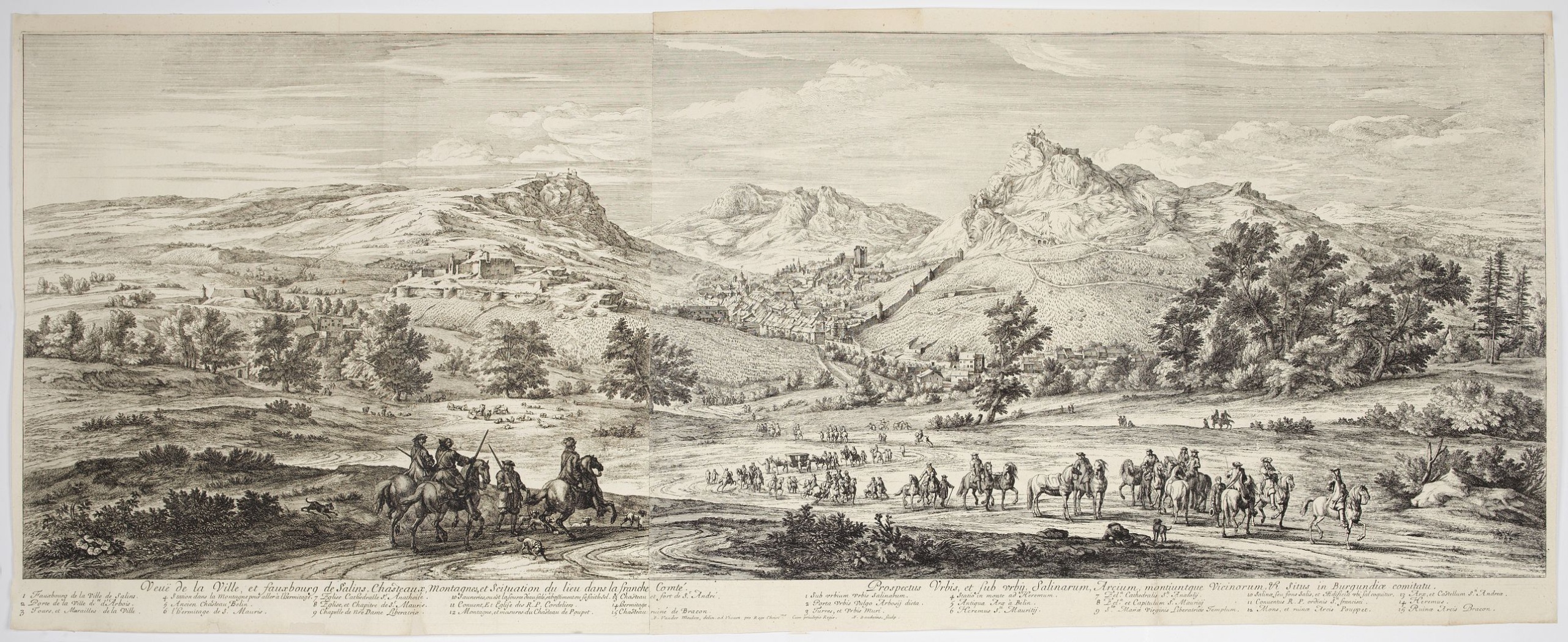
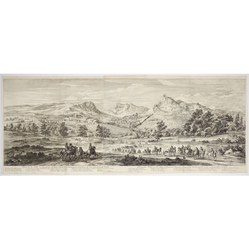
Veue de la ville, et fauxbourg de Salins…
BuyNow for €700
- Maker :
- MEULEN, Adam Frans van der.
- Place :
- Paris
- Date :
- 1680
- Color :
- Uncoloured
- Height mm.:
- 470
- Width mm.:
- 1315
- Condition :
- Two sheets joined. Size of the plate with key : 535 x 1335 mm. Many vertical folds expertly reinforced and repaired. Upper margin cut to neatline with reinstalled margin. Good and dark impression.
- Bibliography :
- -
- Seller's ref. :
- 47332
This item is offered by Librairie_Loeb-Larocque
See other Items from this seller- Postage
-
France
€15 to France
- Select Country
- Zip/Post Code
- Quantity
€700
Description
Showing the town of Salins, a commune with salt works (Salines) in the Jura department in the region of Bourgogne-Franche-Comté in eastern France. With a key (1-15) in Latin and French to the most remarkable sights. Etching by A. F. Bauduins (Adrien François Baudouin) after Adam Frans van der Meulen (1632-1690) who was a Flemish Baroque painter specialising in battle scenes. He was active first in Brussels, where he was a pupil of Pieter Snayers, and from the 1660s onwards in Paris.
His paintings during the campaigns of Flanders in 1667 so delighted Louis that from that date van der Meulen was ordered to accompany him in all his expeditions. In 1673 he was received into the Académie royale de peinture et de sculpture, attained the grade of councillor in 1681, and died full of honors in Paris in 1690.
![[The strange sheep-like creatures that carried the silver .]](/uploads/cache/40481-500x500.jpg)
[The strange sheep-like creatures that carried the silver .]
When the Spanish discovered the silver mines of Potosí, they organised the transport of the rich ore westward by llama trains across the Altiplano and down to Arica on the coast, where it would be transported by ship to Panama. These strange creatures would sit down when angered or overburdened and, neither beatings nor kind words would make the animals get up again. If any of them ran away, they had to be shot to recover their valuable cargo.In 1631, Johann Ludwig Gottfried inherited Theodor D...
€80
Maker : GOTTFRIED, J.L. / DE BRY.
Place : Frankfurt, M.Merian, 1633
Date : 1633
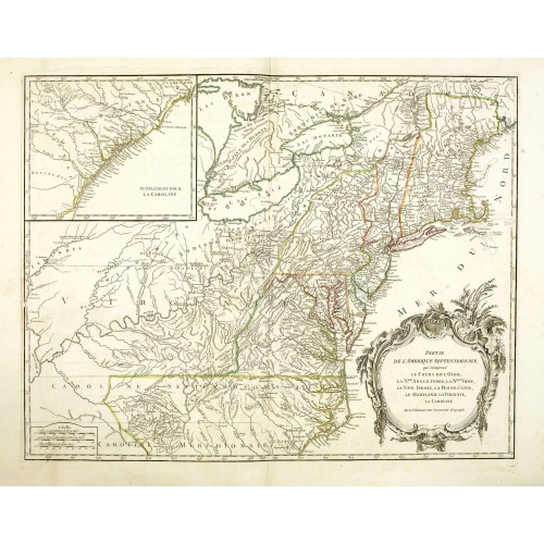
Partie De L'Amerique Septentrionale... Le Cours De L'Ohio, La N.lle Angleterre, a Nlle York, le New Jersey , La Pensyvanie, Le Maryland, Le Virginie, La Carolina...1755
From the Atlas Universel , a detailed map extending the length of the east coast from Penobscot Bay to Cape Fear and, in an inset, from Cape Fear to Fort St.Georges.This state with a dotted border of Treaty of Paris, 1763, with Virginie and Caroline Sept. Et Merid. Extended west to Mississippi. New-Hemp-Shire" and Prov. De Sagadahock" now added.The Atlas Universel of Gilles and Didier Robert de Vaugondy was first published in 1755. The maps were detailed, precisely engraved and not given to the ...
€800
Maker : DE VAUGONDY, R. de
Place : Paris
Date : 1768
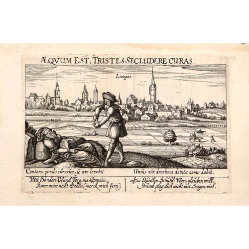
Aeqvum est, tristes secludere curas (Lianges.)
A very nice view of the city Lianges. With a verse in two languages underneath the picture.The poet and topographer from Comothau, Daniel Meisner (1585-1625), started his first publication entitled Thesaurus Philo-Politicus in Frankfurt in 1623, initially in parts, each one containing about fifty plans. The work was engraved circa 1623-1650, and printed 1678, and was published by Eberhard Kieser. In 1678 the collection of copperplates was sold to Paul Fü, who continued the printing under the t...
€60
Maker : MEISNER, D.
Place : Frankfurt
Date : 1623-1678
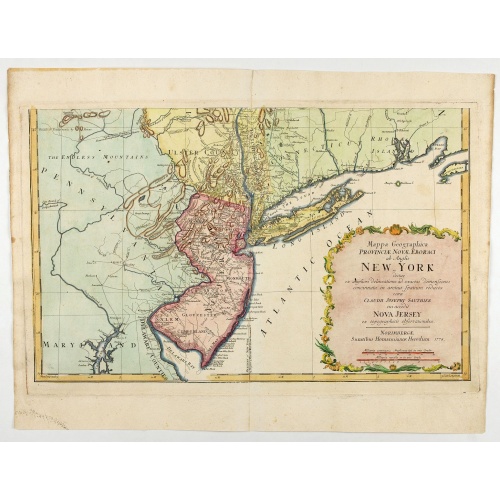
Mappa geographica Provinciæ Nova Eboraci ab Anglis New-York . . .
Lower part of the two sheets map of Homann Heirs' edition of Sauthier's celebrated map of New York and New Jersey, made during the Revolutionary War. Appears in Homann's Atlas geographicvs maior. 1759-[1784].
€750
Maker : HOMANN HEIRS.
Place : Nuremburg
Date : 1778
Postage & Shipping
-
Item Location
Terms and conditions - Item Location
- 75013, Ile-de-France, France
- Ships To
- United States, United Kingdom, Albania, Argentina, Armenia, Australia, Austria, Bahamas, Belgium, Bermuda, Bosnia and Herzegowina, Brazil, Bulgaria, Canada, Chile, China, Costa Rica, Denmark, Dominica, Egypt, El Salvador, Finland, France, Germany, Greece, Guatemala, Hong Kong, Hungary, Iceland, India, Italy, Japan, Korea (South), Kuwait, Liechtenstein, Lithuania, Luxembourg, Madagascar, Mexico, Monaco, Morocco, Netherlands, Netherlands Antilles, New Zealand, Norway, Paraguay, Peru, Philippines, Poland, Portugal, Qatar, Reunion, Romania, San Marino, Saudi Arabia, Seychelles, Singapore, Slovenia, South Africa, Spain, Sri Lanka, Suriname, Sweden, Switzerland, Taiwan, Thailand, Tunisia, Turkey, United Arab Emirates, Uruguay, Vietnam
- Pick-ups
- Buyer can pick-up
This item is owned and offered by the seller Librairie_Loeb-Larocque - All items are available for immediate sale, offered subject to prior sale.
Invoices are created by the seller by using our shopping cart or be prepared by the seller the day following the order and are emailed to you.
Items offeres by different sellers are invoiced separately.
Shipping fees are extra. The buyer is responsible for all applicable taxes, including any VAT, customs clearance, import duties, or equivalent costs arriving at the customer's home border. Payment is due on receipt of the invoice. The item(s) are shipped as soon as possible after receipt of your payment.
Before buying please read the complete Terms Conditions of Sale.
- Payment Methods
- Visa, Mastercard, Bank Transfer, American Express, iDEAL, PayPal, Google Pay
- Returns Accepted
- No
Post Message
Feel free to ask the seller a question. Please note that the seller could be located in an area with a different time zone. Our seller will do their best to respond within 24 hours.Post your message below.
Sign in to ask the seller a question.
-500x500.jpg)