
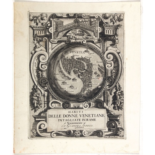
Habiti delle Donne Venetiane . . .
Title page of the book Habiti delle Donne Venetiane" (Dress of Venetian Women) which consists of twenty numbered plates of ornately dressed women. This very decorative title page shows in to Rialto Bridge and in the center a bird's-eye plan of Venice.Giacomo Franco (1556-1620) was born and grew in Venice, where he used to work. He was the son of painter Giovanni-Battista Franco (1510-1561), with whom he began his artistic training at the age of eleven. He worked as a painter, engraver, woodcutte...
€950
Maker : FRANCO, G.
Place : Venice
Date : ca. 1591

La Piovra Russa. Carta Serio-Comica Pel 1878.
Very rare political caricature map by Grossi of the nations of Europe, published in Bologna in the supplement of the newspaper "Le Perroquet / Al papagallo, N° 15, Anno VI.Known as the Octopus Map ; the brooding presence of the Russian Empire depicted as a massive octopus, whose tentacles stretch out towards Europe. In this map, the Octopus has Turkey, Persia and Poland but has been wounded by Crimea and is being fought off by Germany.This map, by Grossi, followed the style created by Frederick...
€1.850
Maker : GROSSI, A.
Place : Bologne
Date : 14 avril 1878
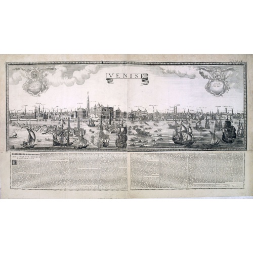
Venise. 1700
Extremely rare panoramic broad sheet panoramic town-view of Venice with underneath in letter press a description of the town's history.The view measures more than 1 meter. The foreground is animated with a great variety of sailing vessels.The printer's address is dated 1699, but the tile has the date 1700. Most likely, Jaillot published the view to celebrate the turn of the century!
€20.000
Maker : JAILLOT, H.
Place : Paris
Date : 1699
![Venetia. [Venice ]](/uploads/cache/45176-500x500.jpg)
Venetia. [Venice ]
Very rare view of Venice published in the first edition of "Viaggio da Venetia, a Costantinopoli. Per Mare, e per Terra, & infieme quello di Terra Santa. Da Gioseppe Rosaccio con brevita descritto".Several of the maps and plans resemble those in G. F. Camocio's "Isole famose", in particular the maps of the individual Greek islands, among which are Corfu, Crete, Cyprus, together with a map of Palestine and a view of Jerusalem.It is possible that many of the plates may originate from 1590-1597, wh...
€420
Maker : ROSACCIO, Giuseppe
Place : Venice, Giacomo Franco, 1598
Date : 1598
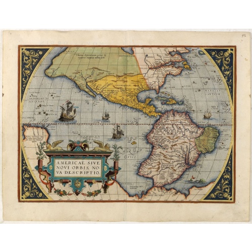
Americae Sive Novi Orbis, Nova Descriptio.
This is the second copperplate of Ortelius'.
$5.500
Maker : ORTELIUS, A.
Place : Antwerp
Date : 1579
![Groeninga MDLXXIII. [Groningen]](/uploads/cache/27192-500x500.jpg)
Groeninga MDLXXIII. [Groningen]
RECTO: A panoramic view of the city of Groningen dated 1573.VERSO: a woodcut of a cow, a bull and their calf.Taken from Sebastian Munster's encyclopedic work, the "Cosmographia Universalis". The Cosmographia by Sebastian Münster had numerous editions in different languages including Latin, French (translated by François de Belleforest), Italian, English, and even Czech. The last German edition was published in 1628, long after his death. The Cosmographia was one of the most successful and popu...
$60
Maker : MUNSTER, S.
Place : Basle, ca. 1564
Date : 1564
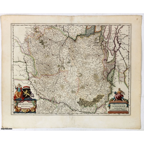
Brabantia Ducatus.
A very decorative map by Willem Blaeu with west is at the top. On the lower left a magnificent cartouche with a sitting female figure carrying a globe and compasses and the coat of arms of Brabant. The map encloses the area between the rivers Rhine, Meuse and Scheldt, with Namur (Namen) as the most southern town.
$400
Maker : BLAEU, W.
Place : Amsterdam, 1645
Date : 1645
Regno de' Paesi-Bassi compresa la Olanda . . . / La Svizzera . . .
Two rare and detailed maps of The Netherland (210 x 230mm. ) and Switzerland (140 x 230mm.) According to the title cartouche, prepared by J.A.Buchon and A de La Sage for l'Atlante Storico, Letterario, Biografico, Archeologico. . . with attributions by Giambatista Albrizzi.Lower left a color-key, giving good detail and information. We were not able to find references to the publisher, engraver or author of this map. Uncommon and in very good condition.
$60
Maker : TASSO, G.
Place : Venice, 1840
Date : 1840
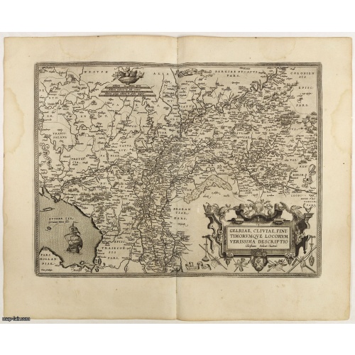
Gelriae, Cliviae, Finitimorumque Locorum Verissima..
East to the top. Fine map of Geldria and Limburg, prepared by Christian s'Grooten. Very fine title cartouche lower right with painter's utensils around the cartouche.Dare to go in Black. All early maps were printed in black and white, and many were kept that way for a long time. A black and white map in an early and strong impression is a rarity nowadays, being so many examples recently colored up!
$250
Maker : ORTELIUS, A.
Place : Antwerp
Date : 1598
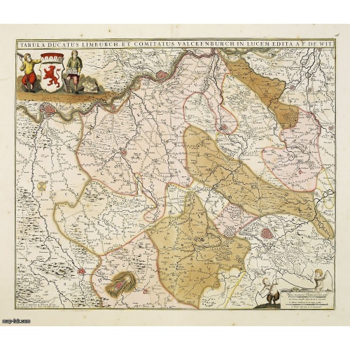
Tabula ducatus Limburch et comitatus Valckenburch. . .
The map describes the southern part of Limburg and reaches into Belgium (Liége, Verviers) and Germany. With two very decorative cartouches.
$350
Maker : DE WIT, F.
Place : Amsterdam
Date : 1690
A new mape of Ye XVII Provinces of Low Germanie.
Showing all 17 Provinces of the Netherlands before the split between Spain and the Protestant Provinces under the House of Orange.The map was first published. At the same time, the war of independence was still being fought against Philip II. With columns of figures on either side and surmounted by eight city prospects. A famous and most decorative item.A fourth state published by Thomas Basset and Richard Chiswell. The date has been removed and Speed's name has been added to the title cartouche...
$2.300
Maker : SPEED, J.
Place : London, 1676
Date : 1626
-500x500.jpg)
Holland & Belgium.
An attractive steel engraved map of Holland and Belgium. Map flanked by France and Prussia. Duchy of Luxembourg included. Many place names and physical features shown. 4 mileage scales given.The Arrowsmith family members were among the most respected and influential cartographers of the nineteenth century. Taken from 'The London Atlas of Universal Geography…' John Arrowsmith (1790-1873) joined his uncle, Aaron Arrowsmith in mapmaking in London in 1810. Upon the death of his uncle in 1823, the ...
$110
Maker : ARROWSMITH, John
Place : London, 1839
Date : 1839
Quarta pars Brabantiae cujus caput Sylvaducis.
The coat of arms of Brabant and 's-Hertogenbosch do appear on the map. But the municipal arms in the columns on right and left-hand side have not yet been filled in. The map was prepared by Willibrordus van der Burgt.Considered one of the most decorative maps published by the publishing house of Blaeu.
$750
Maker : BLAEU, W.
Place : Amsterdam
Date : 1645
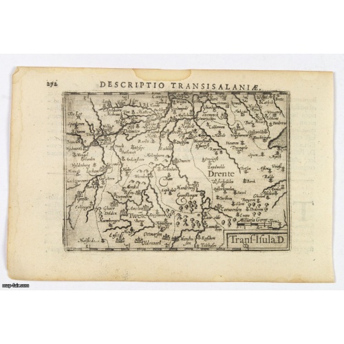
Descriptio Transisalaniae.
An original early 17th century copper engraved miniature antique map of the eastern Dutch region of Overijssel by Petrus Bertius. The title is displayed in a simple strapwork cartouche with the further title in bold letters above the map. Zwolle the capital city is engraved, along with Lochem, Zutphen, Apeldoorn, Deventer, Hengelo and Enschede. From the Bertius atlas Tabularum geographicarum contractarum. Bertius (1565-1629) was a Flemish cartographer, theologian, historian and geographer. Altho...
$100
Maker : LANGENES, B. / BERTIUS, P.
Place : Amsterdam
Date : 1606
Partie septentrionale des Pays-Bas comprenant .. des provinces unies. . .
Finely and crisply engraved map of Netherlands.Venetian edition of Giles Didier Robert De Vaugondy's map from Atlas Universel printed in 1776-84.Ornamental title cartouche in the upper right corner, including a large vessel in the North Sea.
$450
Maker : SANTINI, P. / REMONDINI, M.
Place : Venice, 1776 - 1784
Date : 1784
Transisalania provincia vulgo Over-Yssel auctore N.ten Have
Detailed map prepared by Nico ten Have.
$300
Maker : DE WIT, F.
Place : Amsterdam
Date : 1690
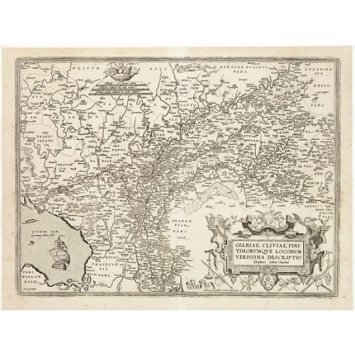
Gelriae, Cliviae, Finitimorumque Locorum Verissima Descriptio.
From the very rare Galle edition of the Ortelius Atlas, published after 1612. Fine map of Geldria and Limburg, prepared by Christian s'Grooten. Very fine title cartouche lower right with artist brushes and palettes as well as an owl gazing in a round mirror.East to the top.
$1.250
Maker : ORTELIUS, A. / GALLE, TH.
Place : Antwerp
Date : after 1612
Les Provinces Unies des Pays Bas, suivant les nouvelles observations. . .
With decorative title cartouche upper left corner.This example is unusual in having the additional separately engraved decorative framework border around the map, the resultant visual effect being particularly striking. The frame border was prepared with a blank center so that the map could be over-printed on that area.These separately engraved border frames appear much more uncommon than the standard edition without border frames. From Le Nouveau Theatre du Monde, ou la Geographie Royale.
$250
Maker : AA, P. van der
Place : Amsterdam
Date : 1728
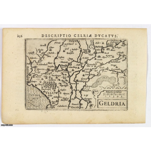
Geldria.
An original early 17th century copper engraved miniature antique map of the Dutch province of Gelderland by Petrus Bertius, that was published in Amsterdam at the beginning of the seventeenth century. Shows extensive river systems, hills, towns and cities, sea hatching in the Zyder Zee and a strapwork title. Cities include: Arnhem, Nijmegen, Zutphen, Harderwijk. North is orientated to the left. From the Bertius atlas Tabularum geographicarum contractarum. Bertius (1565-1629) was a Flemish cartog...
$100
Maker : LANGENES, B. / BERTIUS, P.
Place : Amsterdam, 1606
Date : 1606
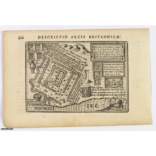
Descriptio Arcis Britannicae.
An original early 17th century copper engraved miniature antique map of the Roman remains in the sand dunes near Katwijk aan Zee in south Holland by Petrus Bertius. In Roman times, Katwijk was a place of strategic importance. It was located at the Roman Empire's northern border, at the mouth of the Rhine river, which in Roman times was larger in this area than it is today. There was a good deal of traffic along the Rhine. Katwijk was also a jumping-off point for the voyage to Britain. The map i...
$100
Maker : LANGENES, B. / BERTIUS, P.
Place : Amsterdam
Date : 1606