
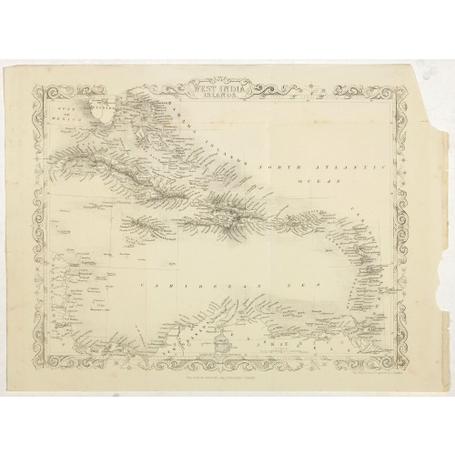
West India Islands.
Map of the West Indies, published by "The London Printing and Publishing Company". Drawn and engraved by John Rapkin.
€75
Maker : RAPKIN, J.
Place : London
Date : 1854
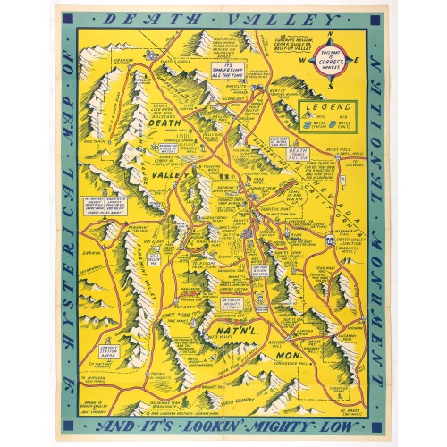
A Hysterical Map Of Death Valley National Monument -- And It's Looking Mighty Low
First edition Humorous map of Death Valley. "Drawn In Broken English by Jolly Lindgren," this comic pictorial map is full of puns and comic vignettes related to Death Valley. The Lindgren Brothers issued a number of other silly whimsical maps of national parks and other parts of the West.
$500
Maker : LINDGREN, J.
Place : Spokane, Wash., Lindgren Brothers,
Date : 1948
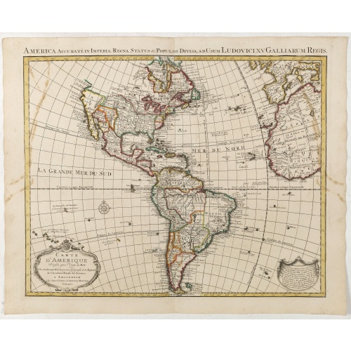
Carte d'Amerique dressée par l'usage du Roy..
Fine map prepared by G.d'Isle depicting North and south America, the west coast taken north to Cap Mendocin and Cap Blanc with a note Entrée decouverte par Martin d'Aguilar .The re-engraved Amsterdam edition, with the lettering within the title cartouche copied from the issue of the first edition with the florid lettering for d'Amerique. Dated 1739.
€700
Maker : COVENS, J. / MORTIER, C.
Place : Amsterdam
Date : 1739
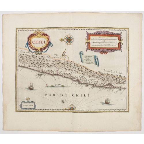
Chili.
Willem Blaeu's very decorative map of Chili with two large and beautiful cartouches, a compass and ships. From early on Willem Jansz. Blaeu aimed of publishing an atlas to compete with the Hondius-Janssonius Atlas. By 1630, he had published at least 17 folio size maps. Blaeu was able to realize his plan soon after he had acquired the copper plates of the atlas maps by Jodocus Hondius. The "Appendix followed in 1630.In 1635 he finally realized a "international edition" of a world atlas, the "The...
$900
Maker : BLAEU, W.
Place : Amsterdam, 1644
Date : 1644
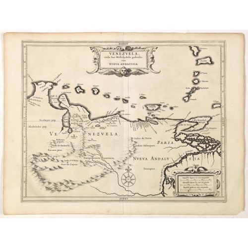
Venezuela, atque Occidentalis Pars Novæ Andalusiae.
Coastline of Venezuela with little interior development. Including Aruba, Bonaire, Curaçao, etc. Scarce map prepared by Hessel Gerritsz (1581-1632), former apprentice of Willem Blaeu, and Blaeu’s predecessor as chief cartographer of the Dutch East India Company. Gerritsz enjoys a very high reputation for his critical approach towards his sources.Most of Gerritsz’ work exists only in manuscript, and these maps published by de Laet, are among the only printed Gerritsz maps available to the co...
$600
Maker : LAET, DE J. / GERITSZ, H.
Place : Leiden, Elzevier
Date : 1630
![[Map of the Monterey Peninsula.]](/uploads/cache/48349-500x500.jpg)
[Map of the Monterey Peninsula.]
A lovely example of Jo Mora's Del Monte Properties Company' California's Fun' playground tourist map of the Monterey Peninsular, published in San Francisco in 1927. The rare first state and among the rarest maps by Jo Mora.A lively map full of interesting, fun illustrations of the region. The map borders are surrounded by many small illustrations of modern and historical Monterey. These include animals, historical figures, native Indians, missionaries, cowboys, singing & dancing, the 'gold rush'...
€900
Maker : ROBERTSON, A.M.
Place : San Francisco
Date : 1927
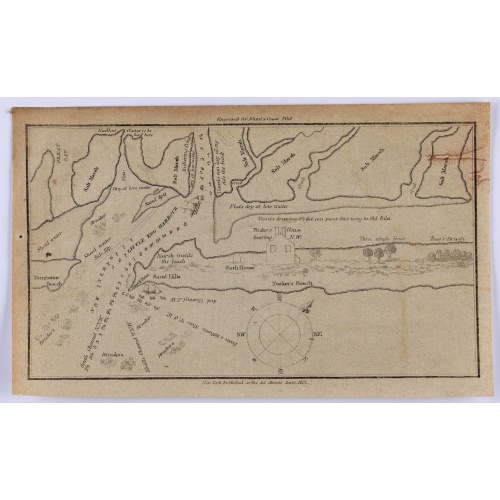
Little Egg Harbour.
A small sea chart showing Little Egg Harbour east of Tucker's Island. This map was published in the “American Coast Pilot”, a detailed guide to harbors, capes and headlands on the east coasts of North and South America. It includes information on winds, currents, tides as well as latitudes and longitudes. The American Coast Pilot was published between 1796 and 1861, until it was replaced by the US Coast Survey.Edmund March Blunt (1770–1862) was an American navigator, author, and publisher ...
$50
Maker : BLUNT, E.
Place : New York, 1817
Date : 1817
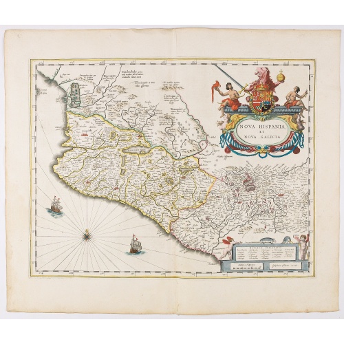
Nova Hispania et Nova Galicia.
Map of New Spain and New Galicia shows the city of Mexico situated by a large lake, as well as the location of many silver and gold mines. The map's elaborate cartouche is surmounted by the Spanish Royal coat of arms. Based on Ortelius map of 1579 which became the basis for many of the seventeenth century maps of the area. From early on Willem Jansz. Blaeu aimed of publishing an atlas to compete with the Hondius-Jansson Atlas. By 1630, he had published at least 17 folio size maps. Blaeu was ab...
€850
Maker : BLAEU, W.
Place : Amsterdam
Date : 1644
-500x500.jpg)
TOMBEAU DU DUC DE BREZE, DANS LA CATHEDRALE DE ROUEN. Dessiné d'après nature par Chapuy. Lith. par Monthelier. Fig. par Bayot.
Original lithography of the tomb of the duke of Brézé, in the cathedral of Rouen. Lithographed by Jules Monthelier (1801-1883) and Adolphe-Jean-Baptist Bayot (Alessandria 1810 - 1866) after a design by Chapuy and printed in Paris by Lemercier, Bernard Cie.
€50
Maker : CHAPUY
Place : Paris
Date : 1844
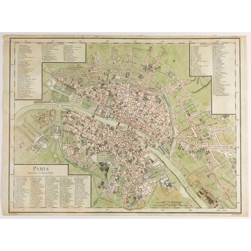
Paris Superficie 5,280,000 Toises.
FIRST EDITION of this finely engraved plan of Paris by P. F. Tardieu and prepared by DuBuisson. This detailed plan of Paris includes la Place Louis XV, la Bastille, but does not have the city walls. The first edition was included in " l'Atlas nouveau" of E. Mentelle. The second state (after 1792) has the text "Plan routier de la ville de Paris…", in the righthand lettered key, added.
€600
Maker : TARDIEU, P. F.
Place : Paris
Date : 1779-1782
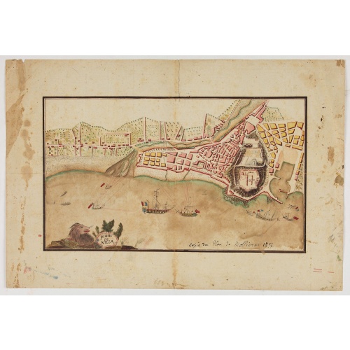
Piano di Nizza.
Rare 1797 manuscript map of Nice, with the French navy attacking from the sea. Unknown author, Italian, but map attributed to an original, probably broadsheet map by Mollieras (?). Good plan of the layout of Nice and the port and coast as was in 1797. Ships are perhaps a trifle naive. This attack is not covered by any other antique maps or prints.The sheet is watermarked with the initials JH & Z, for Jan Honig and Zoonen, a firm of papermakers operating in Zaandijk, north of Amsterdam operating ...
€900
Maker : ANONYMOUS
Place : Italy
Date : after 1797
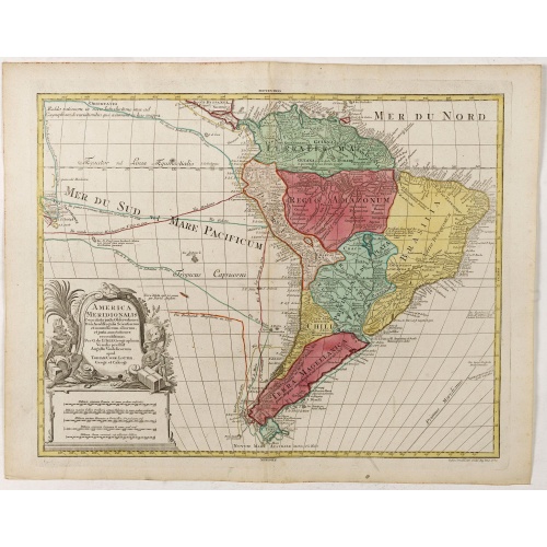
America Meridionalis.
The title cartouche lower left surrounded by native Indians and an Elephant.A rather accurate depiction and descriptions of South America. Brazil is slightly enlarged and bears mainly names of the costal zone. The inland was rather unknown at the time and regarded as both pagan and dangerous area like the Amazon.Argentina with Cape Horn and the Falkland Islands are merely deformed. The map was published by Matthäus Seutter's son in law Tobias Conrad Lotter, who continued the cartographical work...
€700
Maker : LOTTER, T.C.
Place : Augsburg
Date : ca. 1760
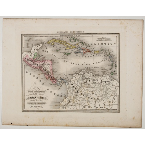
Le Indie Ocidentali ( Antille maggiori e minori, ecc) L'America Centrale . . .
Uncommon map of Central America and the Antilles prepared by Francesco Costantino Marmocchi. Above the map "Geografia Commerciale". From "Il Globo Atlante di carte Geografiche compilate da F.C. Marmocchi per servire di corredo al suu corso di geografia commerciale", with the maps engraved by engraved by Gius. Cattaneo, Campo Antico, C. Poggiali, G. Bonatti, and Ces. Magrini.Marmocchi (Poggibonsi, 1805-Geneva, 1858) was known as a geographer and cartographer. He emigrated to Rome, and later to Co...
€75
Maker : MARMOCCHI, F.C.
Place : Genova, Paolo Rivara fu Giacomo
Date : 1858
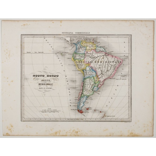
Nuovo Mondo parte Meridionale.
Uncommon map of South America prepared by Francesco Costantino Marmocchi. Above the map "Geografia Commerciale". From "Il Globo Atlante di carte Geografiche compilate da F.C. Marmocchi per servire di corredo al suu corso di geografia commerciale", with the maps engraved by engraved by Gius. Cattaneo, Campo Antico, C. Poggiali, G. Bonatti, and Ces. Magrini.Marmocchi (Poggibonsi, 1805-Geneva, 1858) was known as a geographer and cartographer. He emigrated to Rome, and later to Corsica, later settle...
€75
Maker : MARMOCCHI, F.C.
Place : Genova, Paolo Rivara fu Giacomo
Date : 1858
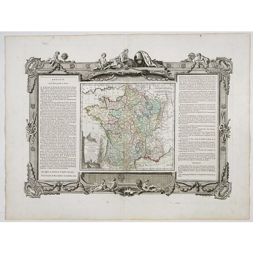
La France Divisée en ses quarante gouvernemens . . .
Map of France surrounded by a decorative frame.
€80
Maker : DESNOS, S.
Place : Paris, 1770
Date : 1770
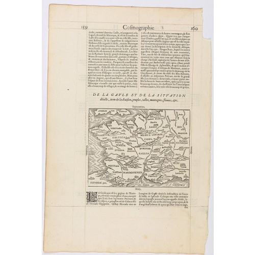
Page from La Cosmographie Universelle with map of France. (Page 160)
Text page with woodblock map of ancient France (122 x 163 mm.) In 1575 Sebastian Münster's Cosmographia was translated into French and published in Paris by François de Belle-Forest.
€75
Maker : DE BELLE-FOREST, F.
Place : Paris
Date : 1575
-500x500.jpg)
INTERIEUR DE L'EGLISE SAINT OUEN A ROUEN. Dessiné d'après nature par Chapuy. Lith. Par Arnout. Fig par Bayot.
Original lithograph of the inside of Saint Ouen chruch, situated in Rouen. Lithographed by Arnout and Adolphe-Jean-Baptist Bayot (Alessandria 1810 - 1866) after a design by Chapuy and printed in Paris by Lemercier, Bernard Cie.
€50
Maker : CHAPUY
Place : Paris
Date : 1844
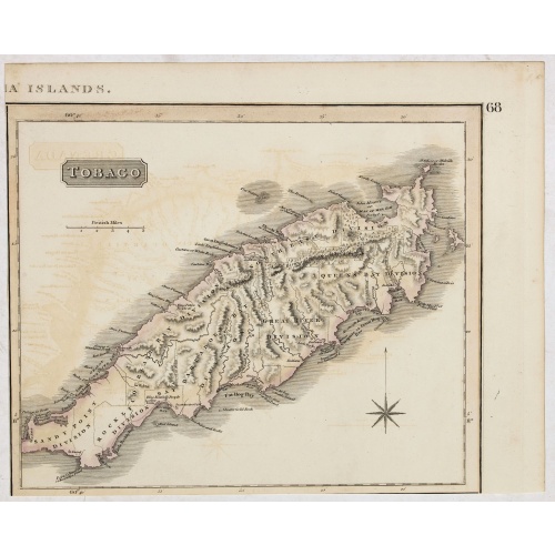
Tobago.
A delightfully detailed map of the West Indian island Tobago by John Thomson. The map displays excellent detail concerning roads, rivers, towns, bays, harbors, and other interesting topographical details.Thomson (1777-c1840) was a Scottish cartographer from Edinburgh, celebrated for his 1817 New General Atlas, published by himself in Edinburgh, John Cumming in Dublin, and Baldwin, Cradock, and Joy in London.
$50
Maker : THOMSON, J.
Place : Edenburgh
Date : 1821
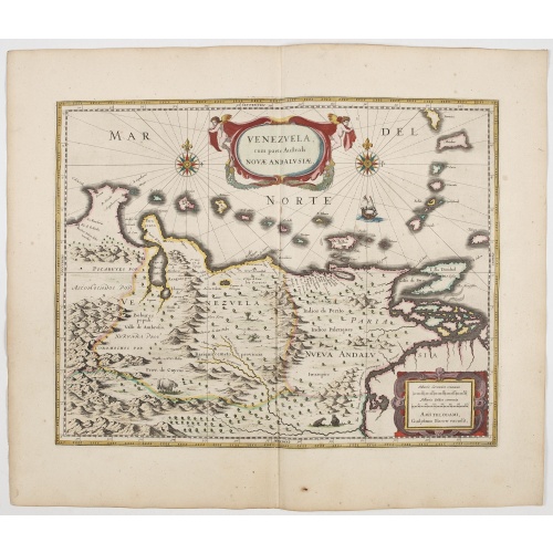
Venezuela cum parte Australi Novae Andalusiae.
A finely engraved, decorative map of Venezuela. The islands of Trinidad and Tobago, Margarita, Aruba and Curaçao are shown. Local animals are depicted, sheep, birds, monkeys.With a decorative title cartouche held aloft by a pair of winged cherubs and a handsome pair of compass roses, galleon etc. From early on Willem Jansz. Blaeu aimed of publishing an atlas to compete with the Hondius-Janssonius Atlas. By 1630, he had published at least 17 folio size maps. Blaeu was able to realize his plan s...
€800
Maker : BLAEU, W.
Place : Amsterdam
Date : 1644
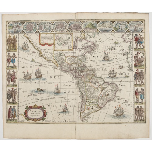
Americae Nova Tabula.
An inset shows Greenland and Iceland. Decorative elements include ships, sea monsters, and vignettes of native Americans within South America. In addition, the map is bordered by a series of nine maps and birds-eye views at the top (including Cusco, Havana, and Mexico City) and ten ethnographic views of various Native Americans.The delineation of the coast and the nomenclature on both the Pacific and Atlantic coasts are basically Spanish in origin and follow the maps of Ortelius and Wytfliet. To...
€6.500
Maker : BLAEU, W.
Place : Amsterdam
Date : 1644