
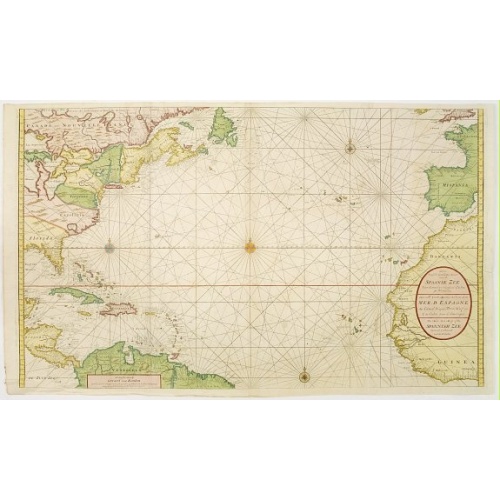
Nieuwe Wassende Graade Zee Kaart over de Spaanse Zee Vant Kanaal tot 't Eyland Cuba in Westindia. . .
¤ Engraved by I.van Anse. A very representative example of a Dutch chart of the Atlantic, showing the north-east coast of America, the coasts of Africa and Europe and South America, including Florida and the West Indies. Gerard issued ca. 40 charts of this exceptionally large format. Collections of these large-size charts were issued in the shining sea-torch and as separate atlases.Title in Dutch, French and English. North America from Labrador to West Florida, including New Foundland, the Gulf...
$3.000
Maker : VAN KEULEN, G.
Place : Amsterdam
Date : 1728
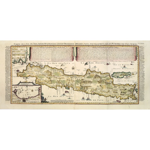
Carte de l'Ile de Java. . .
An inset plan of Batavia and clearly indicated rice fields, mountains, forests, towns in profile, and even elephants, suggesting the wealth of detail found on this map. Modeled on Hadrien Reland's important Dutch map of a few years earlier, the superb topographical detail is complemented by drapery style cartouche and side panels which provide a full French text description of the island, its topography, history, flora, fauna and inhabitants. Above the map are two drapery style title banners wri...
$1.750
Maker : CHATELAIN, H.
Place : Amsterdam
Date : 1720
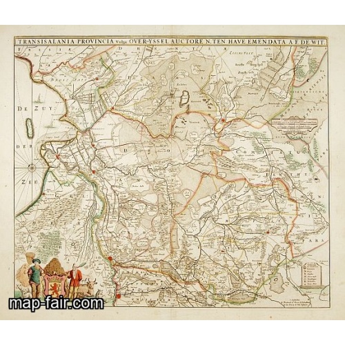
Transisalania provincia vulgo Over-Yssel auctore N.ten Have
Detailed map prepared by Nico ten Have.
$300
Maker : DE WIT, F.
Place : Amsterdam
Date : 1690
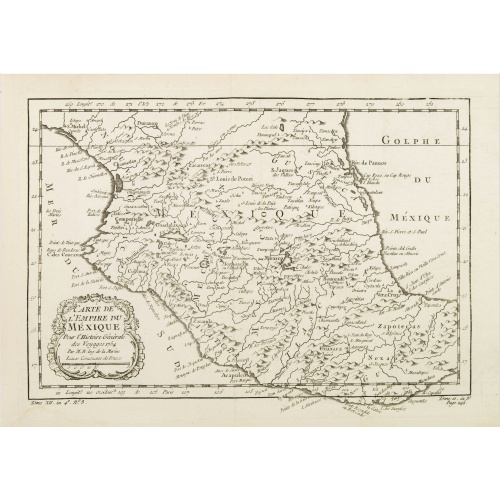
Carte de L'Empire du Mexico.
A good engraved map of Mexico, with rococo title cartouche lower left. From l'Histoire générale des voyages .
$80
Maker : BELLIN, J.N.
Place : Paris
Date : 1754
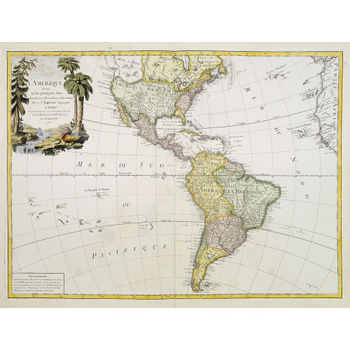
L'Amerique divisée en ses principaux Etats..
Uncommon map published by Lattré. This map is most notable for its depiction of "Mer de L'Ouest" or "Sea of the West". A great sea, easily the size of the Mediterranean, to flow from the then-known Strait of Juan de Fuca. Showing an opening to the ocean from this great sea at roughly in North California or Oregon and Quivira somewhere in Idaho. Fattening Alaska and appropriately leaving blank the unknown parts of Northern America. Listing Indian nations, towns such as Santa Fe.
$900
Maker : JANVIER,Sr.
Place : Paris
Date : 1760
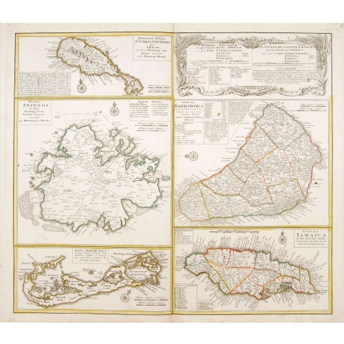
Dominia Anglorum in praecipuis Insulis Americae ut sunt Insula S. Christopheri, Antegoa, Iamaica, Barbados nec non Insula Bermudes vel Sommers . . .
Four maps of the islands of West Indies (St. Christoph "Delineatio Insulae St, Christophori alias I. Kitts", Antigua "Insula Antegoa", Barbados "Insula Barbadoes" and Iamaica "Insula Iamaica") and a map of Bermudas ("Insulae Bermudes") showing British possessions in the Caribbean. At the upper right of the sheet text in German relating to the areas depicted.A second edition with Bermudes. The first edition uses the name Bermudos.
$500
Maker : HOMANN HEIRS.
Place : Nuremberg
Date : 1740
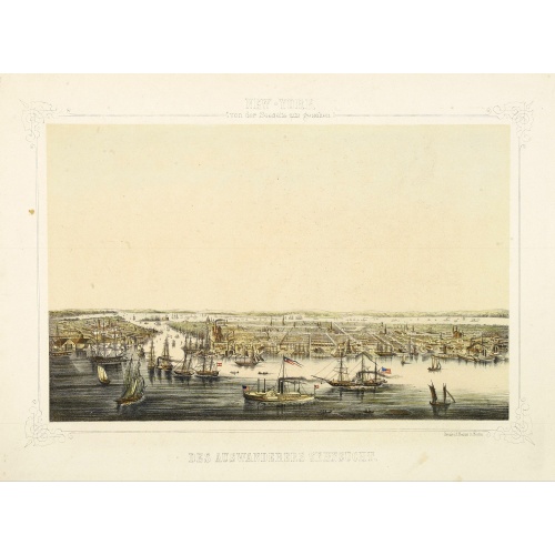
New York von der Seeseite aus gesehen.
Very decorate view of New-York. J.Hesse was known as a portrait painter and publisher of lithographs. A long panorama of the shoreline from the sea, with sailing vessels and American steamships in the busy port.
€700
Maker : HESSE, J.
Place : Berlin
Date : c. 1850

Die Vereinigten Staaten von Nord Amerika..
Uncommon map of the east coast of North America, including the Great Lakes area. To the right inset map of New Foundland. After the map by William Faden of 1783. With color-key.
€500
Maker : MARIANUS, J.
Place : Germany, 1790
Date : 1790
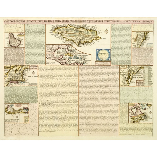
Carte qui contient..Iles & Terres..L'Amerique..Jamaique..
Eight maps on one sheet. From Chatelain's Atlas Historique et Méthodique . Including maps of Bermuda, Jamaica, New England with Long Island, Carolina, Chesapeake and Delaware Bay, Nova Scotia and a map of the Caribbean.
€500
Maker : CHATELAIN, H.
Place : Amsterdam
Date : 1728
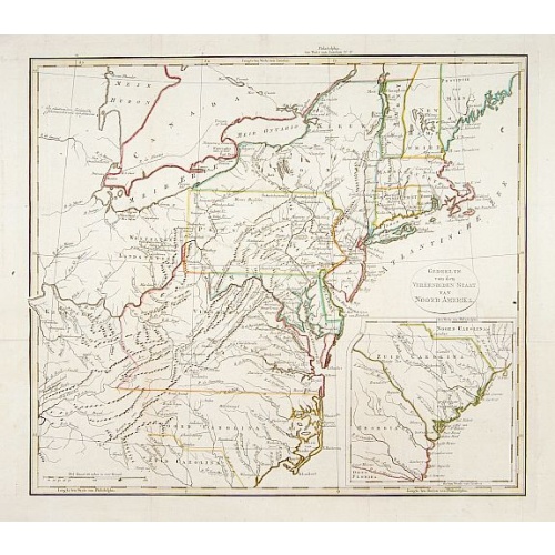
Gedeelte van den Vereenigden Staat van Noord Amerika.
A rare an detailed map of the eastern part of the United States of America. After Isaac Weld's map from his Travels through the States of North America 1799. Barbara Backus McCorkle does mention English, French and German editions, but not this Dutch text edition. (See map 800.4 for a German text variant)Lower right hand corner inset map of South Carolina.
€750
Maker : ANONYMOUS
Place : Netherlands c. 1820
Date : 1820
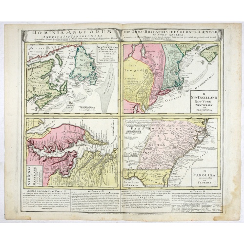
Dominia Anglorum in America Septentrionali.
Four maps on one sheet (New Found land/ New England/ Virginia and Carolina/Florida) based on J.B.Homann's map, showing British possessions in North America. The upper left shows territory in Newfoundland and around the Bay of St. Lawrence, with portions of the ‘lost’ colony of New Scotland. The Grand Banks are prominently noted as well. The map immediately to the right shows claims in New York and New England, with large areas in Pennsylvania noted as belonging to the Iroquois. The lower lef...
€750
Maker : HOMANN HEIRS.
Place : Nuremberg 1740
Date : 1740
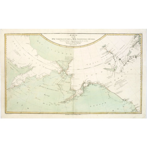
Karte von den N.W. Amerikanischen und N.OE. Asiatischen Kusten nach den Untersuchungen des Kapit. Cook...
A detailed large-scale map showing the Bering Strait, Kamchatka, Alaska and much of North America. While the Russian coastline is shown with reasonable accuracy. Showing tracks of Captain Cook. Prepared by Heinrich Roberts.A German language variant of Cook’s map of his explorations along the northwest coast of America and the northeast coast of Asia. Based upon original work by Cook’s cartographer Henry Roberts. Vancouver Island is missing. Shows several lakes west of Hudson Bay in what is...
€900
Maker : SCHRAEMBL, F.A.
Place : Vienna
Date : 1788
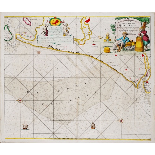
Nieuwe Paskaert van de Kust van HOLLANDT - Tussen Texel en de Maes.
Nieuwe Paskaert van de Kust van Hollandt Tussen Texel en de Maes. A very attractive sea chart off the coast of Holland by Johannes van Keulen with a pair of decorative cartouches, ships sailing off the coast, rhumb lines, compass rose etc. Van Keulen was the founder of the successful van Keulen firm that published charts, pilot guides and sea-atlases for over 2 centuries. In 1680, he published his immensely popular 'Zee Atlas ofte Water Werelt'.
€500
Maker : van Keulen, J.
Place : Amsterdam
Date : ca 1685
![[Lot of 7 Flower prints] Talauma mutabilis. flower Talauma mutabilis from 'FLORA MALESIANA' Arckenhausen del. / Hutz Lith.](/uploads/cache/85382-500x500.jpg)
[Lot of 7 Flower prints] Talauma mutabilis. flower Talauma mutabilis from 'FLORA MALESIANA' Arckenhausen del. / Hutz Lith.
The flower Talauma mutabilis from 'FLORA MALESIANA'. Talauma mutabilis by Karl Ludwig von Blume (9 June 1796, Braunschweig – 3 February 1862, Leiden) was a German-Dutch botanist. (3454)Lot of 7 flower prints.- Talauma mutabilis - Sobralia Macrantha- Détails de la liane femelle du Chili- Liane femelle du Chili- Détails de la lianne màle du Chili- Dianthus sinensis heddewigii- Dianthus sinensis laciniatus
€300
Maker : BLUME, Carl Ludwig. von
Place : Germany
Date : 1829
-500x500.jpg)
Nuovo Mondo parte Settentrionale.
Uncommon map of North America prepared by Francesco Costantino Marmocchi. Above the map "Geografia Commerciale". From "Il Globo Atlante di carte Geografiche compilate da F.C. Marmocchi per servire di corredo al suu corso di geografia commerciale", with the maps engraved by engraved by Gius. Cattaneo, Campo Antico, C. Poggiali, G. Bonatti, and Ces. Magrini.Marmocchi (Poggibonsi, 1805-Geneva, 1858) was known as a geographer and cartographer. He emigrated to Rome, and later to Corsica, later settle...
€50
Maker : MARMOCCHI, F.C.
Place : Genova, Paolo Rivara fu Giacomo
Date : 1858
![[Printed on silk] Nieuw Wassende Graaden Paskaart Vertoonende alle de bekende Zeekusten en Landen op den geheelen Aard Boodem of Werelt door Gerard van Keulen. . .](/uploads/cache/31640-500x500.jpg)
[Printed on silk] Nieuw Wassende Graaden Paskaart Vertoonende alle de bekende Zeekusten en Landen op den geheelen Aard Boodem of Werelt door Gerard van Keulen. . .
A very scarce and beautiful chart on Mercator's projection printed on silk. The map is printed on silk. With the name of Gerard van Keulen and the privilege. The map shows great interior detail, including a well-formed depiction of the Great Lakes and Mississippi River. Fort de Creveceur is shown near the Illinois River. The east coast of Siberia has been drawn after Nicolas Witsen's 1687 map of Tartary. A Great Companies Land has been added off the northwest coast of America. California is an i...
$20.000
Maker : VAN KEULEN, G.
Place : Amsterdam
Date : 1728
![(Chatelain "Atlas Historique" in 7 volumes.]](/uploads/cache/47053X-500x500.jpg)
(Chatelain "Atlas Historique" in 7 volumes.]
Henri Abraham Chatelain, whose Atlas Historique was one of the most expansive encyclopedias of the age. First published in 1705, Chatelain's Atlas Historique was part of an immense seven-volume encyclopedia. Although the main focus of the text was geography, the work also included a wealth of historical, political, and genealogical information. The text was compiled by Nicholas Gueudeville and Garillon with a supplement by H.P. de Limiers and the maps were engraved by Chatelain, primarily after...
€40.000
Maker : CHATELAIN, H.
Place : Amsterdam: Chez Zacharie Châtelain
Date : 1732 - 1739
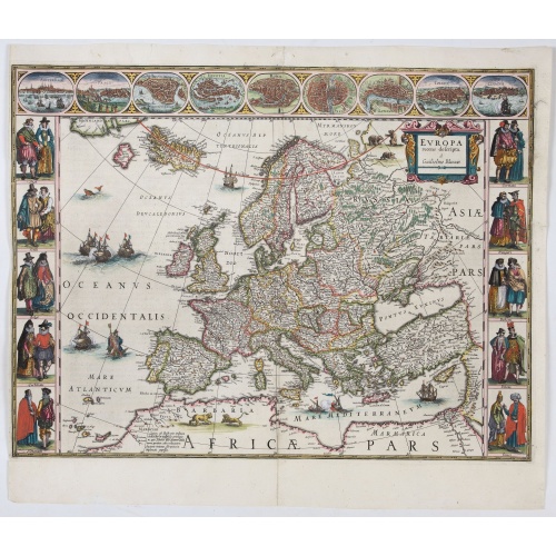
Europa recens descripta à Guilielmo Blaeuw.
On either side columns depicting the manner of dress in the major countries of Europe, surmounted by nine city views and plans.For European mapmakers their own continent contained few mysteries or secrets by the seventeenth century. However, the mythical island of Frisland still appears between Iceland and Greenland. The map is decorated with ships and a sea monster on the sea, bears on northern Russia, and lions on North Africa.
€3.250
Maker : BLAEU, W.
Place : Amsterdam
Date : 1644
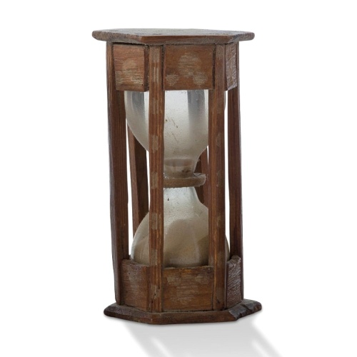
A ship's hour glass.
Maritime hourglass with blown glass bulbs, orange sand, junction ring covered with cord, the circular ebony frame with six turned baluster columns.The invention of the hourglass is attributed to an 8th-century monk in Chartres, France, with the marine sandglass appearing as early as the 14th century. In earlier examples, the bulbs were connected with a material such as putty or hardened wax, bound in leather, linen or string. From about 1720, the two bulbs were welded together over a brass bead ...
$1.750
Maker : ANONYMOUS
Place : The Netherlands or Germany
Date : ca. 1750
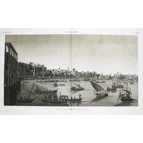
Le Kaire (Cairo). Vue de la place Ezbekyeh, côté du sud
A very fine view of Cairo.
€500
Maker : DUTERTRE / BEAUGEAN.
Place : Paris
Date : ca 1780